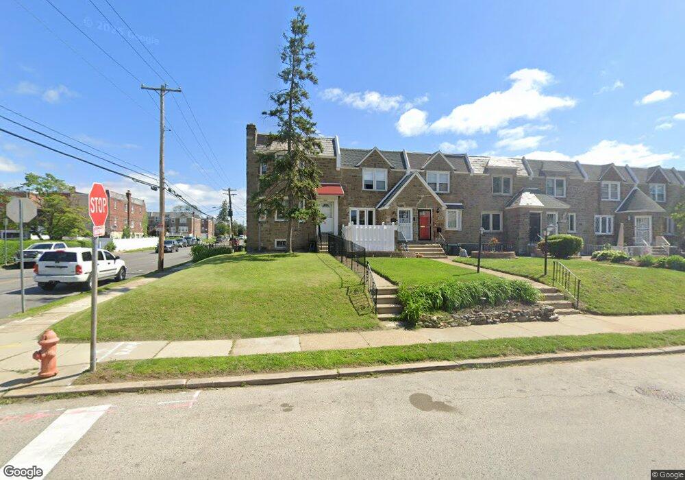
8279 Forrest Ave Philadelphia, PA 19150
Cedarbrook NeighborhoodEstimated Value: $239,000 - $303,000
3
Beds
1
Bath
1,486
Sq Ft
$182/Sq Ft
Est. Value
About This Home
This home is located at 8279 Forrest Ave, Philadelphia, PA 19150 and is currently estimated at $270,453, approximately $182 per square foot. 8279 Forrest Ave is a home located in Philadelphia County with nearby schools including Franklin S Edmonds School, Martin Luther King High School, and St. Raymond Of Penafort Catholic School.
Ownership History
Date
Name
Owned For
Owner Type
Purchase Details
Closed on
Oct 26, 2005
Sold by
Harris Theodore L and Harris Diane E
Bought by
Yost Alysia C
Current Estimated Value
Home Financials for this Owner
Home Financials are based on the most recent Mortgage that was taken out on this home.
Original Mortgage
$85,200
Outstanding Balance
$46,139
Interest Rate
5.85%
Mortgage Type
Fannie Mae Freddie Mac
Estimated Equity
$224,314
Purchase Details
Closed on
Jul 27, 1994
Sold by
Maiden Frank Jay and Mahoney Ella
Bought by
Harris Theodore L and Harris Diane E
Create a Home Valuation Report for This Property
The Home Valuation Report is an in-depth analysis detailing your home's value as well as a comparison with similar homes in the area
Home Values in the Area
Average Home Value in this Area
Purchase History
| Date | Buyer | Sale Price | Title Company |
|---|---|---|---|
| Yost Alysia C | $116,000 | None Available | |
| Harris Theodore L | $56,000 | -- |
Source: Public Records
Mortgage History
| Date | Status | Borrower | Loan Amount |
|---|---|---|---|
| Open | Yost Alysia C | $85,200 |
Source: Public Records
Tax History Compared to Growth
Tax History
| Year | Tax Paid | Tax Assessment Tax Assessment Total Assessment is a certain percentage of the fair market value that is determined by local assessors to be the total taxable value of land and additions on the property. | Land | Improvement |
|---|---|---|---|---|
| 2025 | $2,868 | $248,000 | $49,600 | $198,400 |
| 2024 | $2,868 | $248,000 | $49,600 | $198,400 |
| 2023 | $2,868 | $204,900 | $40,980 | $163,920 |
| 2022 | $1,397 | $159,900 | $40,980 | $118,920 |
| 2021 | $2,027 | $0 | $0 | $0 |
| 2020 | $2,027 | $0 | $0 | $0 |
| 2019 | $2,117 | $0 | $0 | $0 |
| 2018 | $2,079 | $0 | $0 | $0 |
| 2017 | $2,079 | $0 | $0 | $0 |
| 2016 | $1,659 | $0 | $0 | $0 |
| 2015 | $1,588 | $0 | $0 | $0 |
| 2014 | -- | $148,500 | $31,575 | $116,925 |
| 2012 | -- | $18,208 | $2,241 | $15,967 |
Source: Public Records
Map
Nearby Homes
- 8221 Forrest Ave
- 8218 Forrest Ave
- 8307 Thouron Ave
- 8326 Fayette St
- 8305 Temple Rd
- 8400 Fayette St
- 8239 Michener Ave
- 1204 E Mount Airy Ave
- 8502 Temple Rd
- 8004 Gilbert St
- 1300 E Gorgas Ln
- 8048 Michener Ave
- 8433 Provident St
- 8446 Bayard St
- 8016 Michener Ave
- 8613 Thouron Ave
- 7968 Fayette St
- 8038 Lowber Ave
- 8309 Lynnewood Rd
- 1038 E Mount Pleasant Ave
- 8281 Forrest Ave
- 8277 Forrest Ave
- 8275 Forrest Ave
- 8273 Forrest Ave
- 8271 Forrest Ave
- 8301 Forrest Ave
- 8269 Forrest Ave
- 8303 Forrest Ave
- 8267 Forrest Ave
- 8280 Williams Ave
- 8278 Williams Ave
- 8305 Forrest Ave
- 8276 Williams Ave
- 8265 Forrest Ave
- 8274 Williams Ave
- 8272 Williams Ave
- 8307 Forrest Ave
- 8263 Forrest Ave
- 8270 Williams Ave
- 8300 Williams Ave