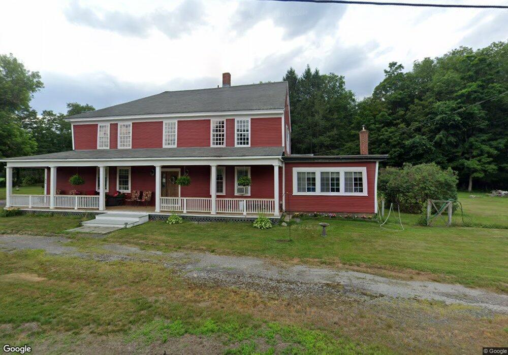
828 Brattleboro Rd Bernardston, MA 01337
Estimated Value: $521,379 - $1,416,000
5
Beds
4
Baths
6,786
Sq Ft
$115/Sq Ft
Est. Value
About This Home
This home is located at 828 Brattleboro Rd, Bernardston, MA 01337 and is currently estimated at $777,345, approximately $114 per square foot. 828 Brattleboro Rd is a home located in Franklin County with nearby schools including Pioneer Valley Regional.
Ownership History
Date
Name
Owned For
Owner Type
Purchase Details
Closed on
Jul 21, 1993
Sold by
Phelps Michael A
Bought by
Johnson Kenneth C and Johnson Annette P
Current Estimated Value
Home Financials for this Owner
Home Financials are based on the most recent Mortgage that was taken out on this home.
Original Mortgage
$42,167
Interest Rate
7.43%
Mortgage Type
Purchase Money Mortgage
Create a Home Valuation Report for This Property
The Home Valuation Report is an in-depth analysis detailing your home's value as well as a comparison with similar homes in the area
Home Values in the Area
Average Home Value in this Area
Purchase History
| Date | Buyer | Sale Price | Title Company |
|---|---|---|---|
| Johnson Kenneth C | $5,000 | -- | |
| Johnson Kenneth C | $5,000 | -- |
Source: Public Records
Mortgage History
| Date | Status | Borrower | Loan Amount |
|---|---|---|---|
| Open | Johnson Kenneth C | $110,000 | |
| Closed | Johnson Kenneth C | $42,167 | |
| Closed | Johnson Kenneth C | $5,000 |
Source: Public Records
Tax History Compared to Growth
Tax History
| Year | Tax Paid | Tax Assessment Tax Assessment Total Assessment is a certain percentage of the fair market value that is determined by local assessors to be the total taxable value of land and additions on the property. | Land | Improvement |
|---|---|---|---|---|
| 2025 | $6,352 | $445,100 | $37,500 | $407,600 |
| 2024 | $6,740 | $412,500 | $37,500 | $375,000 |
| 2023 | $6,639 | $415,200 | $44,000 | $371,200 |
| 2022 | $6,496 | $377,700 | $40,000 | $337,700 |
| 2021 | $5,970 | $321,500 | $34,000 | $287,500 |
| 2020 | $6,005 | $323,000 | $34,000 | $289,000 |
| 2019 | $5,847 | $297,700 | $34,000 | $263,700 |
| 2018 | $5,425 | $265,000 | $34,500 | $230,500 |
| 2017 | $5,242 | $265,000 | $34,500 | $230,500 |
| 2016 | $5,157 | $265,000 | $34,500 | $230,500 |
| 2015 | $4,885 | $262,900 | $40,600 | $222,300 |
Source: Public Records
Map
Nearby Homes
- 775 Brattleboro Rd
- 704 Brattleboro Rd
- 56 Brattleboro Rd
- Lot 9 Fox Hill Rd (Off)
- 430 Huckle Hill Rd
- 430 Hucklehill Rd
- 539 Fox Hill Rd
- 180 Bald Mountain Rd
- 1 Northfield Rd
- 75 South St Unit 3
- 23 Industrial Dr
- 59 River St
- Lot 12 Central Park Estates
- Lot 14 Central Park Estates
- Lot 18 Central Park Estates
- Lot 15 Central Park Estates
- 47 Cross St
- 319 Greenfield Rd
- 2069 Fort Bridgman Rd
- 83 Eden Trail Branch
- 827 Brattleboro Rd
- 824 Brattleboro Rd
- 823 Brattleboro Rd
- 31 Keets Brook Rd
- 844 Brattleboro Rd
- 818 Brattleboro Rd
- 808 Brattleboro Rd
- 811 Brattleboro Rd
- 800 Brattleboro Rd
- 805 Brattleboro Rd
- 30 Keets Brook Rd
- 30 Keets Brook Rd
- 33 Keets Brook Rd
- 790 Brattleboro Rd
- 787 Brattleboro Rd
- 780 Brattleboro Rd
- 888 Brattleboro Rd
- 55 Keets Brook Rd
- 764 Brattleboro Rd
- 895 Brattleboro Rd