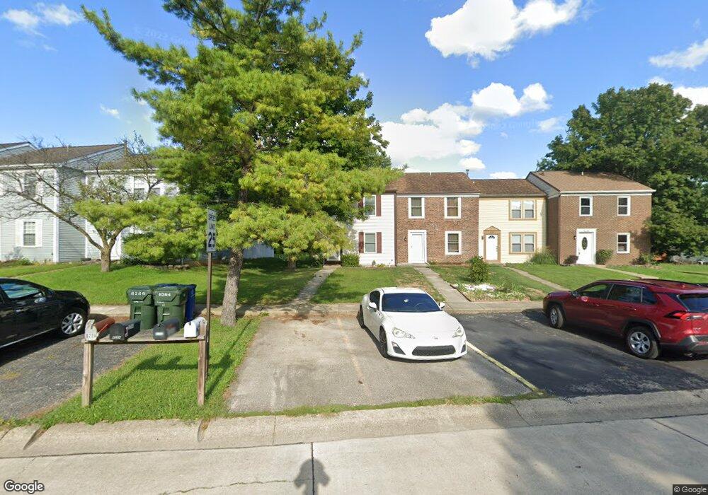
8286 Lariat Ct Powell, OH 43065
Western Hills NeighborhoodEstimated Value: $222,000 - $268,000
2
Beds
3
Baths
1,200
Sq Ft
$203/Sq Ft
Est. Value
About This Home
This home is located at 8286 Lariat Ct, Powell, OH 43065 and is currently estimated at $243,562, approximately $202 per square foot. 8286 Lariat Ct is a home located in Franklin County with nearby schools including Liberty Elementary School, McCord Middle School, and Worthington Kilbourne High School.
Ownership History
Date
Name
Owned For
Owner Type
Purchase Details
Closed on
Jan 19, 2018
Sold by
Black Lynette M and Black Thomas J
Bought by
Shadd Sarah M
Current Estimated Value
Purchase Details
Closed on
Jun 16, 2010
Sold by
Ohler Andrew James and Ohler Patricia L
Bought by
Black Lynette M and Shadd Sarah M
Purchase Details
Closed on
Jul 26, 1989
Bought by
Miller John D
Purchase Details
Closed on
Jan 12, 1989
Create a Home Valuation Report for This Property
The Home Valuation Report is an in-depth analysis detailing your home's value as well as a comparison with similar homes in the area
Home Values in the Area
Average Home Value in this Area
Purchase History
| Date | Buyer | Sale Price | Title Company |
|---|---|---|---|
| Shadd Sarah M | -- | None Available | |
| Black Lynette M | $60,000 | Talon Group | |
| Miller John D | $48,900 | -- | |
| -- | $89,700 | -- |
Source: Public Records
Tax History Compared to Growth
Tax History
| Year | Tax Paid | Tax Assessment Tax Assessment Total Assessment is a certain percentage of the fair market value that is determined by local assessors to be the total taxable value of land and additions on the property. | Land | Improvement |
|---|---|---|---|---|
| 2024 | $3,308 | $52,850 | $17,500 | $35,350 |
| 2023 | $3,166 | $52,850 | $17,500 | $35,350 |
| 2022 | $4,072 | $36,860 | $8,190 | $28,670 |
| 2021 | $2,573 | $36,860 | $8,190 | $28,670 |
| 2020 | $2,424 | $36,860 | $8,190 | $28,670 |
| 2019 | $2,385 | $32,730 | $7,460 | $25,270 |
| 2018 | $1,155 | $32,730 | $7,460 | $25,270 |
| 2017 | $2,036 | $32,730 | $7,460 | $25,270 |
| 2016 | $1,934 | $27,240 | $7,320 | $19,920 |
| 2015 | $967 | $27,240 | $7,320 | $19,920 |
| 2014 | $1,934 | $27,240 | $7,320 | $19,920 |
| 2013 | $962 | $27,230 | $7,315 | $19,915 |
Source: Public Records
Map
Nearby Homes
- 1908 Lost Valley Rd
- 8345 Smoky Row Rd Unit 8345
- 8205 Longhorn Rd
- 7898 Sarahurst Dr
- 7907 Sarahurst Dr
- 1986 Sutter Pkwy
- 1539 Clubview Blvd S
- 1960 Barnard Dr
- 2208 Otter Ln
- 2074 Hard Rd
- 7734 Henry David Ct
- 1625 Shelley Ct
- 8741 Jamey Ct
- 8669 Ripton Dr
- 7680 Foxboro Ln
- 8208 Copperfield Dr
- 1828 Gardenstone Dr
- 1890 Gallo Dr
- 1592 Newcomer Rd
- 2475 Slateshire Dr
- 8284 Lariat Ct
- 8290 Lariat Ct
- 8282 Lariat Ct
- 8294 Lariat Ct
- 8280 Lariat Ct
- 8298 Lariat Ct
- 8302 Lariat Ct
- 8310 Lariat Ct
- 8270 Lariat Ct
- 8312 Lariat Ct
- 1946 Plains Blvd
- 1940 Plains Blvd
- 8295 High Ridge Dr
- 8314 Lariat Ct
- 8279 Lariat Ct
- 8316 Lariat Ct
- 8283 Lariat Ct
- 8311 Highridge Dr
- 8287 Lariat Ct
- 8295 Lariat Ct
