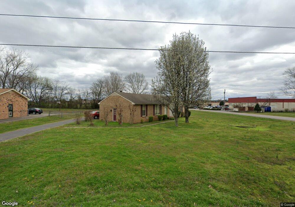
829 General Forrest Dr Smyrna, TN 37167
Estimated Value: $284,074 - $373,000
--
Bed
2
Baths
1,568
Sq Ft
$210/Sq Ft
Est. Value
About This Home
This home is located at 829 General Forrest Dr, Smyrna, TN 37167 and is currently estimated at $330,019, approximately $210 per square foot. 829 General Forrest Dr is a home located in Rutherford County with nearby schools including Rocky Fork Elementary School, Stewarts Creek Middle School, and Stewarts Creek High School.
Ownership History
Date
Name
Owned For
Owner Type
Purchase Details
Closed on
Feb 27, 2008
Sold by
Sharon Rickabaugh
Bought by
Rickabaugh Roger E
Current Estimated Value
Home Financials for this Owner
Home Financials are based on the most recent Mortgage that was taken out on this home.
Original Mortgage
$127,382
Outstanding Balance
$78,887
Interest Rate
5.63%
Estimated Equity
$251,132
Purchase Details
Closed on
May 24, 1999
Sold by
Joel Rowlett
Bought by
Sharon Rickabaugh
Home Financials for this Owner
Home Financials are based on the most recent Mortgage that was taken out on this home.
Original Mortgage
$75,562
Interest Rate
6.9%
Purchase Details
Closed on
Oct 4, 1993
Sold by
Housing & Urban Dev Secty
Bought by
Rowlett Joel E
Create a Home Valuation Report for This Property
The Home Valuation Report is an in-depth analysis detailing your home's value as well as a comparison with similar homes in the area
Home Values in the Area
Average Home Value in this Area
Purchase History
| Date | Buyer | Sale Price | Title Company |
|---|---|---|---|
| Rickabaugh Roger E | -- | -- | |
| Sharon Rickabaugh | $89,900 | -- | |
| Rowlett Joel E | $62,001 | -- |
Source: Public Records
Mortgage History
| Date | Status | Borrower | Loan Amount |
|---|---|---|---|
| Open | Rowlett Joel E | $127,382 | |
| Previous Owner | Rowlett Joel E | $75,562 |
Source: Public Records
Tax History Compared to Growth
Tax History
| Year | Tax Paid | Tax Assessment Tax Assessment Total Assessment is a certain percentage of the fair market value that is determined by local assessors to be the total taxable value of land and additions on the property. | Land | Improvement |
|---|---|---|---|---|
| 2025 | $1,456 | $60,600 | $13,750 | $46,850 |
| 2024 | $1,456 | $60,600 | $13,750 | $46,850 |
| 2023 | $1,456 | $60,600 | $13,750 | $46,850 |
| 2022 | $1,298 | $60,600 | $13,750 | $46,850 |
| 2021 | $1,234 | $42,250 | $8,325 | $33,925 |
| 2020 | $1,234 | $42,250 | $8,325 | $33,925 |
| 2019 | $1,234 | $42,250 | $8,325 | $33,925 |
| 2018 | $1,183 | $42,250 | $0 | $0 |
| 2017 | $1,089 | $30,550 | $0 | $0 |
| 2016 | $1,089 | $30,550 | $0 | $0 |
| 2015 | $1,089 | $30,550 | $0 | $0 |
| 2014 | $760 | $30,550 | $0 | $0 |
| 2013 | -- | $24,950 | $0 | $0 |
Source: Public Records
Map
Nearby Homes
- 527 Hawk Cove
- 838 Seven Oaks Blvd
- 607 General Barksdale Dr
- 2090 Caladonia Way
- 620 General Barksdale Dr
- 3057 Burnt Pine Dr
- 3039 Burnt Pine Dr
- 1036 Harold Lee Dr
- 2028 Caladonia Way
- 510 Lydia Ashley Ln
- 490 Lydia Ashley Ln
- 4074 Utica St
- 809 Stewart Valley Dr
- 712 Stewart Valley Dr
- 595 Glenwood Ave
- 305 Wildwood Dr
- 932 Ca Veat Cir
- 647 Legacy Dr
- 920 Sky Valley Trail
- 368 Sarava Ln
- 827 General Forrest Dr
- 831 General Forrest Dr
- 104 General Forrest Ct
- 104 General Forrest Ct
- 833 General Forrest Dr
- 823 General Forrest Dr
- 106 General Forrest Ct
- 101 Sam Davis Dr
- 835 General Forrest Dr
- 109 General Forrest Ct
- 830 General Forrest Dr
- 103 Sam Davis Dr
- 821 General Forrest Dr
- 108 General Forrest Ct
- 837 General Forrest Dr
- 107 Sam Davis Dr
- 111 General Forrest Ct
- 819 General Forrest Dr
- 816 General Forrest Dr
- 523 Hawk Cove