Estimated Value: $744,000 - $786,698
4
Beds
3
Baths
2,331
Sq Ft
$328/Sq Ft
Est. Value
About This Home
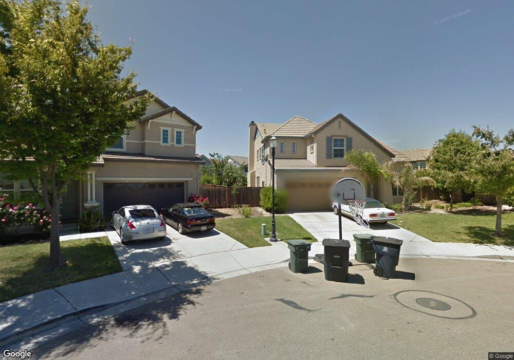
This home is located at 829 Mason Ct Unit 1B, Tracy, CA 95377 and is currently estimated at $764,175, approximately $327 per square foot. 829 Mason Ct Unit 1B is a home located in San Joaquin County with nearby schools including George Kelly Elementary School, John C. Kimball High School, and Tracy Independent Study Charter School.
Ownership History
Date
Name
Owned For
Owner Type
Purchase Details
Closed on
Apr 24, 2002
Sold by
Standard Pacific Corp
Bought by
Vakalahi Salesi and Vakalahi Maureen
Current Estimated Value
Home Financials for this Owner
Home Financials are based on the most recent Mortgage that was taken out on this home.
Original Mortgage
$250,014
Interest Rate
5.96%
Mortgage Type
Stand Alone First
Create a Home Valuation Report for This Property
The Home Valuation Report is an in-depth analysis detailing your home's value as well as a comparison with similar homes in the area
Home Values in the Area
Average Home Value in this Area
Purchase History
| Date | Buyer | Sale Price | Title Company |
|---|---|---|---|
| Vakalahi Salesi | $357,500 | First Amer Title Co |
Source: Public Records
Mortgage History
| Date | Status | Borrower | Loan Amount |
|---|---|---|---|
| Previous Owner | Vakalahi Salesi | $250,014 | |
| Closed | Vakalahi Salesi | $71,433 |
Source: Public Records
Tax History
| Year | Tax Paid | Tax Assessment Tax Assessment Total Assessment is a certain percentage of the fair market value that is determined by local assessors to be the total taxable value of land and additions on the property. | Land | Improvement |
|---|---|---|---|---|
| 2025 | $8,779 | $547,921 | $154,959 | $392,962 |
| 2024 | $8,243 | $537,178 | $151,921 | $385,257 |
| 2023 | $8,086 | $526,646 | $148,943 | $377,703 |
| 2022 | $7,916 | $516,321 | $146,023 | $370,298 |
| 2021 | $7,801 | $506,198 | $143,160 | $363,038 |
| 2020 | $7,713 | $501,009 | $141,693 | $359,316 |
| 2019 | $7,569 | $491,186 | $138,915 | $352,271 |
| 2018 | $7,404 | $481,556 | $136,192 | $345,364 |
| 2017 | $7,112 | $472,115 | $133,522 | $338,593 |
| 2016 | $7,063 | $462,861 | $130,905 | $331,956 |
| 2014 | $6,408 | $418,000 | $118,000 | $300,000 |
Source: Public Records
Map
Nearby Homes
- 2689 Jackson Ave
- 1214 Dover Ln
- 2921 Compton Place
- 1294 Dover Ln
- 2685 Remy Javier St
- 2431 Garrett Ct
- 2902 Campbell Ln
- 2488 Gaines Ln
- 2432 Tennis Ln
- 3030 W Byron Rd
- 2431 Ogden Sannazor Ct
- 2219 Yellowstone Ave
- 1233 Plaza Ct
- 2306 Sabrina Way
- 2325 Alamo Ct
- 2403 Clemente Ln
- 230 Steven Bridges Ln
- 2132 Tennis Ln
- 8300 W 11th St
- 573 Veneto Ct
- 849 Mason Ct
- 819 Mason Ct Unit 1B
- 830 Kennedy Place Unit 1B
- 820 Kennedy Place Unit 1B
- 2949 Jackson Ave
- 840 Kennedy Place
- 2939 Jackson Ave Unit 1B
- 2959 Jackson Ave
- 850 Kennedy Place
- 2929 Jackson Ave
- 869 Mason Ct
- 2969 Jackson Ave
- 860 Kennedy Place
- 828 Mason Ct
- 2919 Jackson Ave
- 879 Mason Ct
- 848 Mason Ct
- 870 Kennedy Place
- 868 Mason Ct
- 2909 Jackson Ave
Your Personal Tour Guide
Ask me questions while you tour the home.