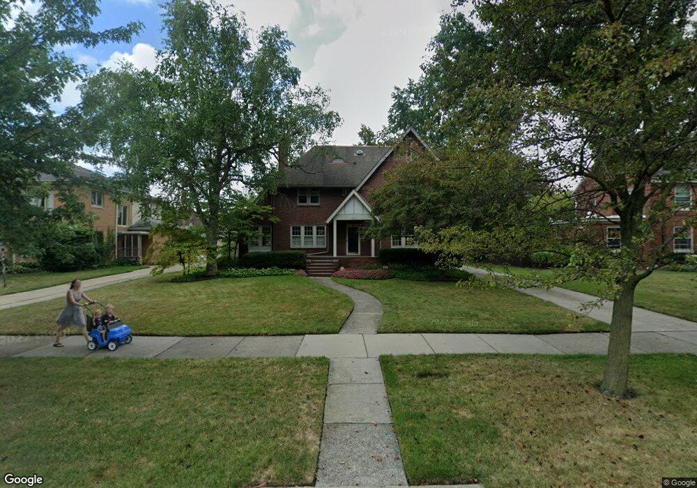
829 Pemberton Rd Grosse Pointe Park, MI 48230
Estimated Value: $499,781 - $555,000
4
Beds
3
Baths
2,269
Sq Ft
$230/Sq Ft
Est. Value
About This Home
This home is located at 829 Pemberton Rd, Grosse Pointe Park, MI 48230 and is currently estimated at $522,695, approximately $230 per square foot. 829 Pemberton Rd is a home located in Wayne County with nearby schools including Pierce Middle School, Grosse Pointe South High School, and Detroit Merit Charter Academy.
Ownership History
Date
Name
Owned For
Owner Type
Purchase Details
Closed on
Apr 30, 2015
Sold by
Beer Margaret and Beer Joseph
Bought by
Beer Margaret C
Current Estimated Value
Home Financials for this Owner
Home Financials are based on the most recent Mortgage that was taken out on this home.
Original Mortgage
$15,000
Interest Rate
3.86%
Mortgage Type
Credit Line Revolving
Create a Home Valuation Report for This Property
The Home Valuation Report is an in-depth analysis detailing your home's value as well as a comparison with similar homes in the area
Home Values in the Area
Average Home Value in this Area
Purchase History
| Date | Buyer | Sale Price | Title Company |
|---|---|---|---|
| Beer Margaret C | -- | Multiple |
Source: Public Records
Mortgage History
| Date | Status | Borrower | Loan Amount |
|---|---|---|---|
| Closed | Beer Margaret C | $15,000 |
Source: Public Records
Tax History Compared to Growth
Tax History
| Year | Tax Paid | Tax Assessment Tax Assessment Total Assessment is a certain percentage of the fair market value that is determined by local assessors to be the total taxable value of land and additions on the property. | Land | Improvement |
|---|---|---|---|---|
| 2025 | $3,622 | $255,400 | $0 | $0 |
| 2024 | $3,622 | $237,900 | $0 | $0 |
| 2023 | $3,459 | $209,200 | $0 | $0 |
| 2022 | $3,286 | $192,700 | $0 | $0 |
| 2021 | $6,480 | $188,900 | $0 | $0 |
| 2020 | $6,805 | $186,300 | $0 | $0 |
| 2019 | $6,668 | $166,900 | $0 | $0 |
| 2018 | $3,133 | $145,100 | $0 | $0 |
| 2017 | $7,200 | $109,700 | $0 | $0 |
| 2016 | $6,641 | $139,300 | $0 | $0 |
| 2015 | $11,726 | $132,200 | $0 | $0 |
| 2013 | $11,360 | $115,600 | $0 | $0 |
| 2012 | $3,179 | $121,500 | $42,500 | $79,000 |
Source: Public Records
Map
Nearby Homes
- 847 Barrington Rd
- 709 Ashland St
- 504 Alter Rd
- 784 Barrington Rd
- 877 Manistique St
- 908 Manistique St
- 709 Lakepointe St
- 976 Lakepointe St
- 487 Philip St
- 709 Middlesex Rd
- 429 Manistique St
- 875 Balfour St
- 54 Pointe Park Place Unit 208
- 74 Pointe Park Place Unit 311
- 14536 E Jefferson Ave
- 888 Marlborough St
- 458 Marlborough St
- 614 Pemberton Rd
- 605 Lakewood St
- 1032 Beaconsfield Ave
- 837 Pemberton Rd
- 821 Pemberton Rd
- 840 Barrington Rd
- 830 Barrington Rd
- 843 Pemberton Rd
- 844 Barrington Rd
- 813 Pemberton Rd
- 826 Barrington Rd
- 852 Barrington Rd
- 828 Pemberton Rd
- 822 Barrington Rd
- 836 Pemberton Rd
- 809 Pemberton Rd
- 851 Pemberton Rd
- 820 Pemberton Rd
- 856 Barrington Rd
- 842 Pemberton Rd
- 812 Pemberton Rd
- 816 Barrington Rd
- 841 Lakepointe St