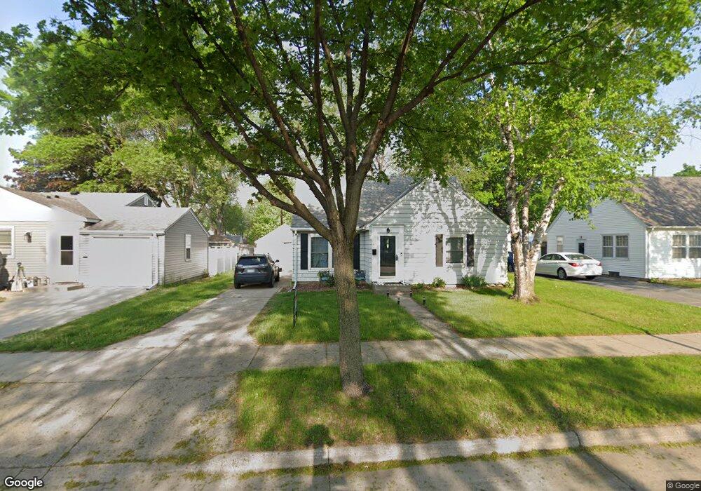
829 Range St Unit Lower North North Mankato, MN 56003
Estimated Value: $229,000 - $249,181
4
Beds
2
Baths
1,243
Sq Ft
$190/Sq Ft
Est. Value
About This Home
This home is located at 829 Range St Unit Lower North, North Mankato, MN 56003 and is currently estimated at $235,795, approximately $189 per square foot. 829 Range St Unit Lower North is a home located in Nicollet County with nearby schools including Monroe Elementary School, Dakota Meadows Middle School, and Mankato West Senior High School.
Ownership History
Date
Name
Owned For
Owner Type
Purchase Details
Closed on
May 22, 2024
Sold by
Ortiz Ortiz Franco Franco and Macias Kimberlynn
Bought by
Farley Samuel
Current Estimated Value
Home Financials for this Owner
Home Financials are based on the most recent Mortgage that was taken out on this home.
Original Mortgage
$188,400
Outstanding Balance
$185,758
Interest Rate
6.88%
Mortgage Type
New Conventional
Estimated Equity
$50,037
Purchase Details
Closed on
Jun 30, 2020
Sold by
Shea Lisa
Bought by
Ortiz Franco Alexis
Home Financials for this Owner
Home Financials are based on the most recent Mortgage that was taken out on this home.
Original Mortgage
$122,000
Interest Rate
3.1%
Mortgage Type
New Conventional
Purchase Details
Closed on
Jan 9, 2015
Sold by
Wollum Brian Brian
Bought by
Shea Lisa Lisa
Home Financials for this Owner
Home Financials are based on the most recent Mortgage that was taken out on this home.
Original Mortgage
$129,700
Interest Rate
3.73%
Create a Home Valuation Report for This Property
The Home Valuation Report is an in-depth analysis detailing your home's value as well as a comparison with similar homes in the area
Home Values in the Area
Average Home Value in this Area
Purchase History
| Date | Buyer | Sale Price | Title Company |
|---|---|---|---|
| Farley Samuel | $252,000 | -- | |
| Ortiz Franco Alexis | $162,000 | North American Title | |
| Shea Lisa Lisa | $129,900 | -- |
Source: Public Records
Mortgage History
| Date | Status | Borrower | Loan Amount |
|---|---|---|---|
| Open | Farley Samuel | $188,400 | |
| Previous Owner | Ortiz Franco Alexis | $122,000 | |
| Previous Owner | Shea Lisa Lisa | $129,700 |
Source: Public Records
Tax History Compared to Growth
Tax History
| Year | Tax Paid | Tax Assessment Tax Assessment Total Assessment is a certain percentage of the fair market value that is determined by local assessors to be the total taxable value of land and additions on the property. | Land | Improvement |
|---|---|---|---|---|
| 2025 | $2,252 | $201,100 | $47,500 | $153,600 |
| 2024 | $2,146 | $201,100 | $47,500 | $153,600 |
| 2023 | $1,942 | $183,400 | $47,500 | $135,900 |
| 2022 | $1,678 | $168,200 | $47,500 | $120,700 |
| 2021 | $1,672 | $137,000 | $35,300 | $101,700 |
| 2020 | $1,514 | $132,900 | $35,300 | $97,600 |
| 2019 | $1,460 | $124,700 | $35,300 | $89,400 |
| 2018 | $1,418 | $120,600 | $35,300 | $85,300 |
| 2017 | -- | $115,700 | $0 | $0 |
| 2016 | $1,218 | $0 | $0 | $0 |
| 2015 | -- | $0 | $0 | $0 |
| 2011 | -- | $0 | $0 | $0 |
Source: Public Records
Map
Nearby Homes
- 725 725 Wall St
- 954 954 Range St
- 420 Mc Kinley Ave
- 420 Mckinley Ave
- 245 W Wheeler Ave
- 512 Page Ave
- 538 538 Belgrade Ave
- 415 415 Sherman St
- 415 Sherman St
- 726 Garfield Ave
- 126 Cross St
- 719 Page Ave
- 541 541 Nicollet Ave
- 546 546 Ave S
- 206 206 E Elm St
- 217 E Spring St
- 712 N Broad St
- 0 Outlot A Block 1 Unit 7031909
- 0 Tbd Belvista Dr
- 712 712 N Broad St
- 829 Range St
- 833 Range St
- 825 Range St
- 835 Range St
- 823 Range St
- 315 Tyler Ave
- 315 Tyler Ave Unit 315 Tyler Avenue
- 312 Harrison Ave
- 317 Tyler Ave
- 316 Harrison Ave
- 844 Range St
- 844 844 Range St
- 842 Range St
- 838 Range St
- 321 Tyler Ave
- 320 Harrison Ave
- 828 Range St
- 903 Range St
- 235 Tyler Ave
- 327 Tyler Ave