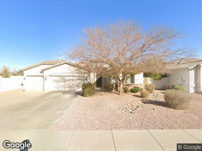
8294 W Bloomfield Rd Peoria, AZ 85381
Estimated Value: $494,724 - $590,000
--
Bed
3
Baths
2,476
Sq Ft
$225/Sq Ft
Est. Value
About This Home
This home is located at 8294 W Bloomfield Rd, Peoria, AZ 85381 and is currently estimated at $556,931, approximately $224 per square foot. 8294 W Bloomfield Rd is a home located in Maricopa County with nearby schools including Oasis Elementary School and Centennial High School.
Ownership History
Date
Name
Owned For
Owner Type
Purchase Details
Closed on
Apr 18, 2003
Sold by
Beebe Tamara
Bought by
Beebe Dennis W
Current Estimated Value
Home Financials for this Owner
Home Financials are based on the most recent Mortgage that was taken out on this home.
Original Mortgage
$142,500
Interest Rate
5.84%
Purchase Details
Closed on
Aug 1, 1998
Sold by
Beem James L
Bought by
Treude Cheri Kae
Create a Home Valuation Report for This Property
The Home Valuation Report is an in-depth analysis detailing your home's value as well as a comparison with similar homes in the area
Home Values in the Area
Average Home Value in this Area
Purchase History
| Date | Buyer | Sale Price | Title Company |
|---|---|---|---|
| Beebe Dennis W | -- | Fidelity National Title | |
| Beebe Dennis W | $242,536 | Fidelity National Title | |
| Becker Homes Inc | -- | Fidelity National Title | |
| Treude Cheri Kae | -- | -- |
Source: Public Records
Mortgage History
| Date | Status | Borrower | Loan Amount |
|---|---|---|---|
| Closed | Beebe Dennis W | $142,500 |
Source: Public Records
Tax History Compared to Growth
Tax History
| Year | Tax Paid | Tax Assessment Tax Assessment Total Assessment is a certain percentage of the fair market value that is determined by local assessors to be the total taxable value of land and additions on the property. | Land | Improvement |
|---|---|---|---|---|
| 2025 | $2,178 | $28,768 | -- | -- |
| 2024 | $2,206 | $27,398 | -- | -- |
| 2023 | $2,206 | $40,070 | $8,010 | $32,060 |
| 2022 | $2,160 | $31,620 | $6,320 | $25,300 |
| 2021 | $2,359 | $29,510 | $5,900 | $23,610 |
| 2020 | $2,381 | $27,030 | $5,400 | $21,630 |
| 2019 | $2,305 | $26,350 | $5,270 | $21,080 |
| 2018 | $2,211 | $25,350 | $5,070 | $20,280 |
| 2017 | $2,214 | $23,020 | $4,600 | $18,420 |
| 2016 | $2,190 | $22,460 | $4,490 | $17,970 |
| 2015 | $2,046 | $22,360 | $4,470 | $17,890 |
Source: Public Records
Map
Nearby Homes
- 8256 W Bloomfield Rd
- 8219 W Corrine Dr
- 12529 N 83rd Ln
- 8210 W Wethersfield Rd
- 7583 W Gelding Dr
- 8021 W Charter Oak Rd
- 12512 N 85th Ave
- 8020 W Windrose Dr
- 8234 W Sweetwater Ave
- 8117 W Dreyfus Dr
- 8420 W Cherry Hills Dr
- 8137 W Wood Dr
- 8614 W Shaw Butte Dr
- 8622 W Shaw Butte Dr
- 11811 N 80th Ave Unit 58
- 13320 N 82nd Dr
- 8111 W Wacker Rd Unit 62
- 8111 W Wacker Rd Unit 106
- 7995 W Kirby St Unit 38A
- 8436 W Pershing Ave
- 8294 W Bloomfield Rd
- 8286 W Bloomfield Rd
- 8233 W Columbine Dr
- 12454 N 82nd Ln
- 8276 W Bloomfield Rd
- 8227 W Columbine Dr
- 8239 W Columbine Dr
- 8287 W Bloomfield Rd
- 12442 N 82nd Ln
- 8221 W Columbine Dr
- 8277 W Bloomfield Rd
- 8266 W Bloomfield Rd
- 12430 N 82nd Ln
- 8267 W Bloomfield Rd
- 12522 N 82nd Dr
- 8232 W Columbine Dr
- 8226 W Columbine Dr
- 12418 N 82nd Ln
- 8288 W Charter Oak Rd
- 8257 W Bloomfield Rd