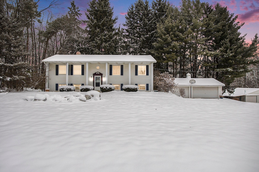

8295 D Dr S Ceresco, MI 49033
Estimated payment $2,017/month
Highlights
- Private Waterfront
- Home fronts a pond
- Wooded Lot
- Indoor Spa
- Deck
- Wood Flooring
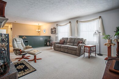
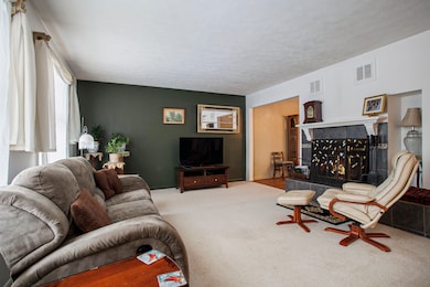
About This Home
Are you on the hunt for peaceful and private living? Maybe something with several acres and enough barn and or garage space for your storage or hobbies, maybe even both? Weve got the place for you! 8295 D Drive S has so much to offer any buyer looking for some space to spread their wings and have some fun. This home boasts 4 bedrooms with 2 1/2 baths, 2 family rooms, a screened in 3 seasons room, a 3 car detached garage, a pole barn big enough to tackle almost any form of storage or be fine tuned to host any hobby you can think of. This parcel is incredible and filled with endless opportunity! You'll be pleased with the flow and openness of this home and all that it has to offer. When all the chores are finished you can picture yourself kicked back anjoying the peacefulness of your three seasons room, or relaxing in the hot tub as you unwind, surrounded by nature. Easy does it, as they say. Call Mike at 269-209-3501or Peggy at 269-209-5939 today for your personal showing!
Home Details
Home Type
- Single Family
Est. Annual Taxes
- $3,746
Year Built
- Built in 1978
Lot Details
- 4.55 Acre Lot
- Lot Dimensions are 660x300x659x285
- Home fronts a pond
- Private Waterfront
- 150 Feet of Waterfront
- Shrub
- Wooded Lot
- Garden
- Property is zoned MDA, MDA
Parking
- 3 Car Detached Garage
- Front Facing Garage
- Garage Door Opener
Home Design
- Shingle Roof
- Composition Roof
- Vinyl Siding
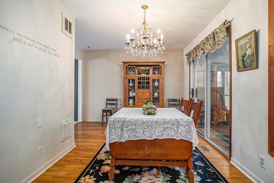
Interior Spaces
- 2,246 Sq Ft Home
- 2-Story Property
- Ceiling Fan
- Wood Burning Fireplace
- Insulated Windows
- Window Treatments
- Garden Windows
- Window Screens
- Family Room
- Living Room with Fireplace
- Dining Area
- Sun or Florida Room
- Indoor Spa
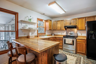
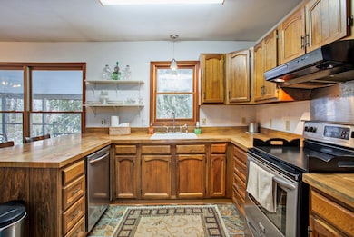
Kitchen
- Oven
- Range
- Freezer
- Dishwasher
- Snack Bar or Counter
Flooring
- Wood
- Carpet
- Ceramic Tile
Bedrooms and Bathrooms
- 4 Bedrooms | 3 Main Level Bedrooms
Laundry
- Laundry Room
- Laundry on lower level
- Dryer
- Washer
- Sink Near Laundry
Finished Basement
- Walk-Out Basement
- Basement Fills Entire Space Under The House
Outdoor Features
- Water Access
- Deck
- Screened Patio
- Pole Barn
Location
- Mineral Rights Excluded
Utilities
- Forced Air Heating and Cooling System
- Heating System Uses Oil
- Well
- Electric Water Heater
- Water Softener Leased
- Septic Tank
- Septic System
Community Details
- No Home Owners Association
Map
Home Values in the Area
Average Home Value in this Area
Tax History
| Year | Tax Paid | Tax Assessment Tax Assessment Total Assessment is a certain percentage of the fair market value that is determined by local assessors to be the total taxable value of land and additions on the property. | Land | Improvement |
|---|---|---|---|---|
| 2025 | $3,625 | $125,700 | $0 | $0 |
| 2024 | $2,317 | $116,300 | $0 | $0 |
| 2023 | $2,933 | $107,700 | $0 | $0 |
| 2022 | $2,933 | $101,100 | $0 | $0 |
| 2021 | $2,923 | $94,400 | $0 | $0 |
| 2020 | $2,888 | $86,800 | $0 | $0 |
| 2019 | $0 | $83,400 | $0 | $0 |
| 2018 | $0 | $84,500 | $15,700 | $68,800 |
| 2017 | $0 | $84,700 | $0 | $0 |
| 2016 | $0 | $83,200 | $0 | $0 |
| 2015 | -- | $83,100 | $0 | $0 |
| 2014 | -- | $83,800 | $0 | $0 |
Property History
| Date | Event | Price | List to Sale | Price per Sq Ft |
|---|---|---|---|---|
| 12/09/2025 12/09/25 | Pending | -- | -- | -- |
| 12/06/2025 12/06/25 | For Sale | $325,000 | -- | $145 / Sq Ft |
Purchase History
| Date | Type | Sale Price | Title Company |
|---|---|---|---|
| Quit Claim Deed | -- | Chicago Title | |
| Warranty Deed | $180,000 | Chicago Title Insurance Co | |
| Warranty Deed | $142,000 | -- | |
| Warranty Deed | $129,500 | -- |
Mortgage History
| Date | Status | Loan Amount | Loan Type |
|---|---|---|---|
| Open | $149,600 | New Conventional | |
| Previous Owner | $180,000 | Purchase Money Mortgage |
Source: MichRIC
MLS Number: 25060988
APN: 17-091-036-01
Disclaimer: Certain information contained herein is derived from information provided by parties other than Homes.com. All information provided is deemed reliable, but is not guaranteed to be accurate and should be independently verified.
![]() Information is deemed reliable but not guaranteed.
Information is deemed reliable but not guaranteed.
Copyright 2025 MichRIC, LLC. All rights reserved.
- 10660 D Dr S
- 12460 Beadle Lake Rd
- 9304 I Dr S
- 14 Blue Stone Ridge
- 11349 6 Mile Rd
- 10047 11 Mile Rd
- 6185 Willow Run Dr
- V/L 10 Mile Rd
- 11506 11 Mile Rd
- 11445 F Dr S
- 13028 Harper Crossing
- 6660 B Dr N
- 8934 5 Mile Rd
- 6703 Oak Grove Rd
- 5555 Capital Ave SW
- 13233 6 1 2 Mile Rd
- 1375 Woodland Beach
- VL Beadle Lake Rd
- 2851 Kistler Rd
- 4850 H Dr S
