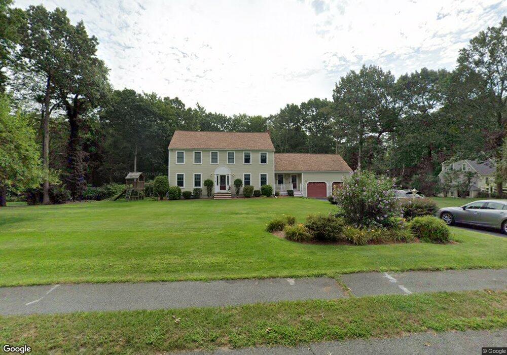
83 Birchbark Dr Hanson, MA 02341
Estimated Value: $838,416 - $1,002,000
4
Beds
3
Baths
3,184
Sq Ft
$278/Sq Ft
Est. Value
About This Home
This home is located at 83 Birchbark Dr, Hanson, MA 02341 and is currently estimated at $885,604, approximately $278 per square foot. 83 Birchbark Dr is a home located in Plymouth County with nearby schools including St Bridget School.
Ownership History
Date
Name
Owned For
Owner Type
Purchase Details
Closed on
Oct 20, 2009
Sold by
Mara Rt and Mara John A
Bought by
Collins Christopher J and Collins Susan
Current Estimated Value
Home Financials for this Owner
Home Financials are based on the most recent Mortgage that was taken out on this home.
Original Mortgage
$417,000
Outstanding Balance
$273,127
Interest Rate
5.14%
Mortgage Type
Purchase Money Mortgage
Estimated Equity
$612,477
Create a Home Valuation Report for This Property
The Home Valuation Report is an in-depth analysis detailing your home's value as well as a comparison with similar homes in the area
Home Values in the Area
Average Home Value in this Area
Purchase History
| Date | Buyer | Sale Price | Title Company |
|---|---|---|---|
| Collins Christopher J | $528,345 | -- |
Source: Public Records
Mortgage History
| Date | Status | Borrower | Loan Amount |
|---|---|---|---|
| Open | Collins Christopher J | $417,000 | |
| Previous Owner | Collins Christopher J | $80,000 | |
| Previous Owner | Collins Christopher J | $70,000 |
Source: Public Records
Tax History Compared to Growth
Tax History
| Year | Tax Paid | Tax Assessment Tax Assessment Total Assessment is a certain percentage of the fair market value that is determined by local assessors to be the total taxable value of land and additions on the property. | Land | Improvement |
|---|---|---|---|---|
| 2025 | $10,182 | $761,000 | $191,800 | $569,200 |
| 2024 | $9,994 | $746,900 | $186,300 | $560,600 |
| 2023 | $9,678 | $682,500 | $186,300 | $496,200 |
| 2022 | $9,369 | $620,900 | $169,300 | $451,600 |
| 2021 | $8,551 | $566,300 | $162,800 | $403,500 |
| 2020 | $8,441 | $552,800 | $157,300 | $395,500 |
| 2019 | $8,001 | $515,200 | $154,300 | $360,900 |
| 2018 | $7,850 | $495,900 | $148,400 | $347,500 |
| 2017 | $7,629 | $477,400 | $141,300 | $336,100 |
| 2016 | $7,436 | $449,300 | $141,300 | $308,000 |
| 2015 | $7,035 | $441,900 | $141,300 | $300,600 |
Source: Public Records
Map
Nearby Homes
- 417 Birchbark Dr
- 842 Whitman St
- 1057 Whitman St
- 33 Tavern Way
- 168 Spring St
- 22 Howland Trail Unit 34
- 5 Hayford Trail Unit 11
- 7 Hayford Trail Unit 12
- 12 Hayford Trail Unit 17
- 13 Hayford Trail Unit 15
- 131 Holly Ridge Dr
- 55 Plymouth St Unit A5
- Lot 5 Princeton Way
- 214 Winter St
- 35 Dana St
- 57 Liberty St
- 248 E Washington St
- 684 South Ave
- 418 E Washington St
- 23 Reed Place
- 97 Birchbark Dr
- 65 Birchbark Dr
- 104 Forest Trail
- 111 Birchbark Dr
- 94 Forest Trail
- 70 Birchbark Dr
- 86 Birchbark Dr
- 47 Birchbark Dr
- 122 Forest Trail
- 480 Birchbark Dr
- 104 Birchbark Dr
- 78 Forest Trail
- 127 Birchbark Dr
- 136 Forest Trail
- 103 Forest Trail
- 120 Birchbark Dr
- 31 Birchbark Dr
- 91 Forest Trail
- 123 Forest Trail
- 156 Forest Trail