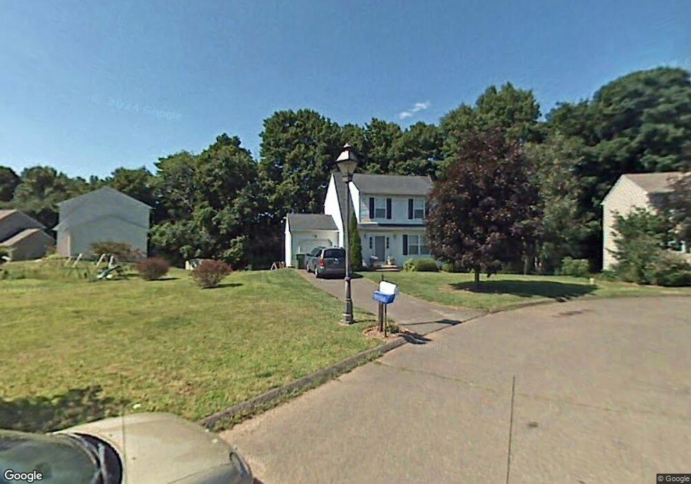
83 Brookside Cir Windsor, CT 06095
West Windsor NeighborhoodEstimated Value: $360,502 - $390,000
3
Beds
3
Baths
1,316
Sq Ft
$285/Sq Ft
Est. Value
About This Home
This home is located at 83 Brookside Cir, Windsor, CT 06095 and is currently estimated at $375,376, approximately $285 per square foot. 83 Brookside Cir is a home located in Hartford County with nearby schools including Poquonock Elementary School, Clover Street School, and Sage Park Middle School.
Ownership History
Date
Name
Owned For
Owner Type
Purchase Details
Closed on
Dec 21, 1999
Sold by
Carlon Herbert and Carlon Lisa
Bought by
Aitkin Benjamin and Aitkin Kimberly
Current Estimated Value
Purchase Details
Closed on
Mar 27, 1997
Sold by
Somerset Development
Bought by
Golder Lisa and Golder Herbert
Create a Home Valuation Report for This Property
The Home Valuation Report is an in-depth analysis detailing your home's value as well as a comparison with similar homes in the area
Home Values in the Area
Average Home Value in this Area
Purchase History
| Date | Buyer | Sale Price | Title Company |
|---|---|---|---|
| Aitkin Benjamin | $132,000 | -- | |
| Golder Lisa | $128,900 | -- |
Source: Public Records
Mortgage History
| Date | Status | Borrower | Loan Amount |
|---|---|---|---|
| Open | Golder Lisa | $132,000 | |
| Closed | Golder Lisa | $22,000 |
Source: Public Records
Tax History Compared to Growth
Tax History
| Year | Tax Paid | Tax Assessment Tax Assessment Total Assessment is a certain percentage of the fair market value that is determined by local assessors to be the total taxable value of land and additions on the property. | Land | Improvement |
|---|---|---|---|---|
| 2025 | $5,728 | $201,320 | $54,040 | $147,280 |
| 2024 | $6,104 | $201,320 | $54,040 | $147,280 |
| 2023 | $4,426 | $131,740 | $42,700 | $89,040 |
| 2022 | $4,383 | $131,740 | $42,700 | $89,040 |
| 2021 | $4,383 | $131,740 | $42,700 | $89,040 |
| 2020 | $4,362 | $131,740 | $42,700 | $89,040 |
| 2019 | $4,266 | $131,740 | $42,700 | $89,040 |
| 2018 | $4,296 | $130,340 | $42,700 | $87,640 |
| 2017 | $4,230 | $130,340 | $42,700 | $87,640 |
| 2016 | $4,108 | $130,340 | $42,700 | $87,640 |
| 2015 | $4,030 | $130,340 | $42,700 | $87,640 |
| 2014 | $3,971 | $130,340 | $42,700 | $87,640 |
Source: Public Records
Map
Nearby Homes
- 19 Rainbow Creek
- 2080 Poquonock Ave
- 33 Old Village Cir
- 10 Oxcart Dr
- 52 Wyndemere Ln
- 129 Hollow Brook Rd
- 26 Hickory Dr
- 16 Landing Cir
- 41 Chestnut Dr
- 45 Timothy Terrace
- 35 George Rd
- 308 Prospect Hill Rd
- 10 Cleary Ln
- 80 Southwest Ave
- 999 Stone Rd
- 21 Derek Ln
- 552 Stone Rd
- 404 Elmwood Dr
- 1 Deanne Lynn Cir
- 404 Woodland St
- 32 Rainbow Creek
- 87 Brookside Cir
- 20 Rainbow Creek
- 36 Rainbow Creek
- 80 Brookside Cir
- 88 Brookside Cir
- 84 Brookside Cir
- 39 Rainbow Creek
- 40 Stevens Mill Rd
- 35 Rainbow Creek
- 23 Rainbow Creek
- 31 Rainbow Creek
- 27 Rainbow Creek
- 11 Rainbow Creek
- 15 Rainbow Creek
- 185 Rainbow Rd
- 187 Rainbow Rd
- 27 Stevens Mill Rd
- 179 Rainbow Rd
- 215 Rainbow Rd