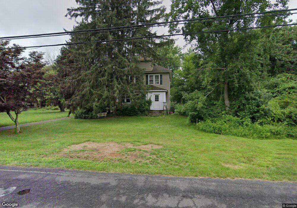
83 Lanes Pond Rd Howell, NJ 07731
Southard NeighborhoodEstimated Value: $629,000 - $765,000
2
Beds
2
Baths
1,720
Sq Ft
$393/Sq Ft
Est. Value
About This Home
This home is located at 83 Lanes Pond Rd, Howell, NJ 07731 and is currently estimated at $675,122, approximately $392 per square foot. 83 Lanes Pond Rd is a home located in Monmouth County with nearby schools including Ramtown School, Greenville School, and Howell Township Middle School South.
Ownership History
Date
Name
Owned For
Owner Type
Purchase Details
Closed on
Dec 30, 2019
Sold by
Wallace Matthew A and Estate Of Pennie Levine
Bought by
Levine Howard
Current Estimated Value
Purchase Details
Closed on
Apr 9, 2012
Sold by
Levine Max
Bought by
Levine Pennie
Purchase Details
Closed on
Mar 29, 2005
Sold by
Levine Max
Bought by
Levine Max
Purchase Details
Closed on
Jan 25, 2005
Sold by
Levine Max
Bought by
Levine Max and Levine Pennie
Create a Home Valuation Report for This Property
The Home Valuation Report is an in-depth analysis detailing your home's value as well as a comparison with similar homes in the area
Home Values in the Area
Average Home Value in this Area
Purchase History
| Date | Buyer | Sale Price | Title Company |
|---|---|---|---|
| Levine Howard | -- | None Available | |
| Levine Pennie | -- | None Available | |
| Levine Max | -- | -- | |
| Levine Max | -- | -- |
Source: Public Records
Tax History Compared to Growth
Tax History
| Year | Tax Paid | Tax Assessment Tax Assessment Total Assessment is a certain percentage of the fair market value that is determined by local assessors to be the total taxable value of land and additions on the property. | Land | Improvement |
|---|---|---|---|---|
| 2025 | $7,949 | $496,500 | $310,400 | $186,100 |
| 2024 | $7,850 | $447,100 | $264,400 | $182,700 |
| 2023 | $7,850 | $421,800 | $243,300 | $178,500 |
| 2022 | $8,153 | $379,200 | $209,300 | $169,900 |
| 2021 | $8,153 | $360,400 | $209,300 | $151,100 |
| 2020 | $8,329 | $358,700 | $209,300 | $149,400 |
| 2019 | $8,492 | $358,900 | $208,400 | $150,500 |
| 2018 | $4,788 | $392,100 | $248,600 | $143,500 |
| 2017 | $9,095 | $377,700 | $238,600 | $139,100 |
| 2016 | $8,784 | $361,200 | $225,600 | $135,600 |
| 2015 | $8,789 | $357,700 | $225,600 | $132,100 |
| 2014 | $9,151 | $345,600 | $240,600 | $105,000 |
Source: Public Records
Map
Nearby Homes
- 460 Alexander Ave
- 6 Taft St
- 3 Larrabee Blvd
- 0 Larrabee Blvd Unit 22533292
- 0 Larrabee Blvd Unit 22533293
- 31 Rappleyea Rd
- 0 Alexander Ave
- 1042 Maxim Southard Rd
- 222 Lanes Pond Rd
- 0 Maxim Southard Rd Unit 22531504
- 5 Porter Rd
- 26 Vienna Rd
- 601 Appolo Rd
- 0 Appolo Rd
- 402 Twin Oaks Dr
- 34 Jason Ct
- 269 Alexander Ave
- 270 Alexander Ave
- 176 Downing St Unit 1
- 184 Downing St
- 67 Lanes Pond Rd
- 111 Lanes Pond Rd
- 52 Lanes Pond Rd
- 63 Miller Rd
- 1146 Lakewood Farmingdale Rd
- 69 Miller Rd
- 37 Miller Rd
- 1149 Lakewood Farmingdale Rd
- 1128 Lakewood Farmingdale Rd
- 1139 Lakewood Farmingdale Rd
- 19 Miller Rd
- 1135 Lakewood Farmingdale Rd
- 135 Lanes Pond Rd
- 1112 Lakewood Farmingdale Rd
- 143 Lanes Pond Rd
- 475 Alexander Ave
- 1117 Lakewood Farmingdale Rd
- 463 Alexander Ave
- 1106 Lakewood Farmingdale Rd
- 441 Alexander Ave