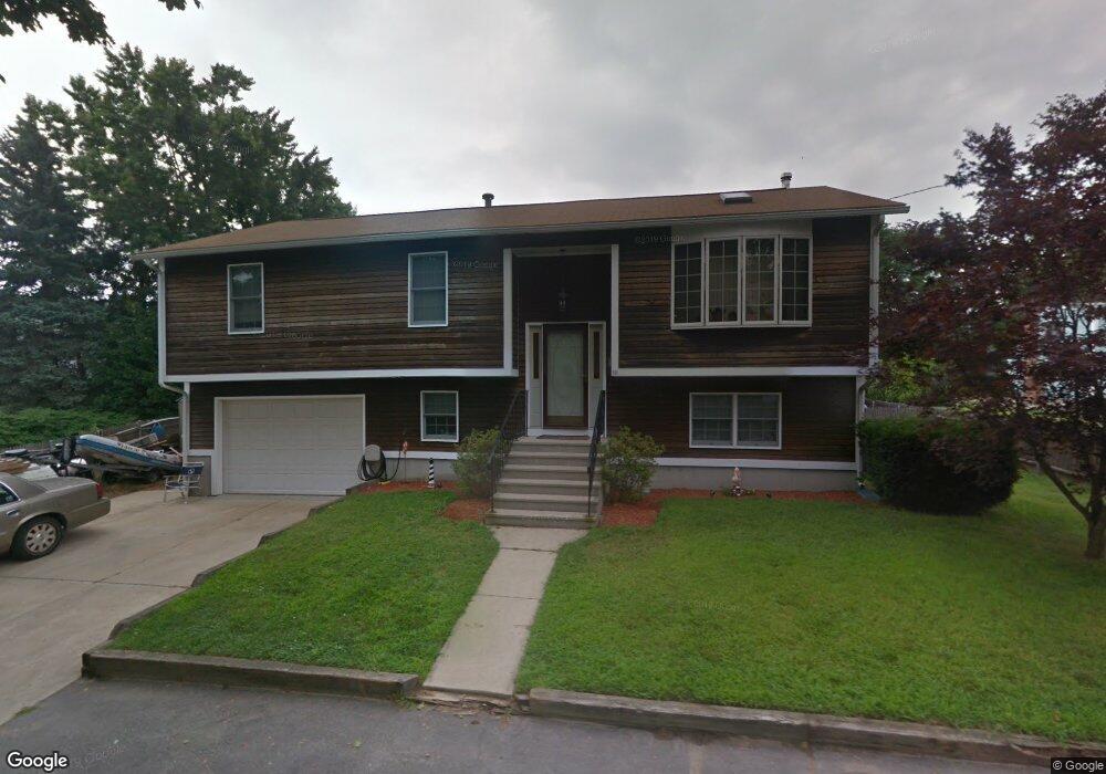
83 Locust St Riverside, RI 02915
Riverside NeighborhoodEstimated Value: $474,000 - $619,000
3
Beds
2
Baths
1,850
Sq Ft
$278/Sq Ft
Est. Value
About This Home
This home is located at 83 Locust St, Riverside, RI 02915 and is currently estimated at $515,027, approximately $278 per square foot. 83 Locust St is a home located in Providence County with nearby schools including East Providence High School, St Mary Academy-Bay View, and St Luke Elementary School.
Ownership History
Date
Name
Owned For
Owner Type
Purchase Details
Closed on
Mar 30, 2018
Sold by
Reynolds Nathan S
Bought by
Miller-Capriccio Nicole and Caprriccio Anthony L
Current Estimated Value
Home Financials for this Owner
Home Financials are based on the most recent Mortgage that was taken out on this home.
Original Mortgage
$214,900
Outstanding Balance
$184,152
Interest Rate
4.38%
Mortgage Type
New Conventional
Estimated Equity
$330,875
Create a Home Valuation Report for This Property
The Home Valuation Report is an in-depth analysis detailing your home's value as well as a comparison with similar homes in the area
Home Values in the Area
Average Home Value in this Area
Purchase History
| Date | Buyer | Sale Price | Title Company |
|---|---|---|---|
| Miller-Capriccio Nicole | $389,900 | -- | |
| Miller-Capriccio Nicole | $389,900 | -- |
Source: Public Records
Mortgage History
| Date | Status | Borrower | Loan Amount |
|---|---|---|---|
| Open | Miller-Capriccio Nicole | $214,900 | |
| Closed | Miller-Capriccio Nicole | $214,900 |
Source: Public Records
Tax History
| Year | Tax Paid | Tax Assessment Tax Assessment Total Assessment is a certain percentage of the fair market value that is determined by local assessors to be the total taxable value of land and additions on the property. | Land | Improvement |
|---|---|---|---|---|
| 2025 | $5,872 | $449,300 | $98,200 | $351,100 |
| 2024 | $5,221 | $340,600 | $81,900 | $258,700 |
| 2023 | $5,027 | $340,600 | $81,900 | $258,700 |
| 2022 | $5,406 | $247,300 | $54,300 | $193,000 |
| 2021 | $5,317 | $247,300 | $53,300 | $194,000 |
| 2020 | $5,092 | $247,300 | $53,300 | $194,000 |
| 2019 | $4,951 | $247,300 | $53,300 | $194,000 |
| 2018 | $4,738 | $207,100 | $53,500 | $153,600 |
| 2017 | $4,633 | $207,100 | $53,500 | $153,600 |
| 2016 | $4,610 | $207,100 | $53,500 | $153,600 |
| 2015 | $4,771 | $207,900 | $54,500 | $153,400 |
| 2014 | $4,771 | $207,900 | $54,500 | $153,400 |
Source: Public Records
Map
Nearby Homes
- 129 Shore Rd
- 72 Stowe Ave
- 33 Pine St Unit 35
- 28 Jefferson Ave
- 41 White Ave
- 103 Burnside Ave
- 25 Arnold St
- 151 Willett Ave Unit 2
- 43 Bullocks Point Ave Unit 4A
- 33 Bullocks Point Ave Unit 5C
- 25 Bullocks Point Ave Unit 5C
- 10 Booth Ave
- 14 Winthrop St
- 15 Claire St
- 0 Carousel Dr
- 6 Fuller Ave
- 25 Winslow St
- 14 Benedict St
- 916 Bullocks Pt Ave
- 85 Hilton Ave
- 104 North St
- 96 North St
- 78 Locust St Unit 80
- 106 North St
- 111 Narragansett Ave
- 113 Narragansett Ave
- 97 Narragansett Ave
- 74 Locust St
- 82 North St
- 85 Middle St
- 103 Middle St
- 81 Shore Rd
- 77 Middle St
- 65 Locust St
- 109 Middle St
- 96 Narragansett Ave
- 70 North St
- 65 Shore Rd
- 87 Narragansett Ave
- 70 Locust St
Your Personal Tour Guide
Ask me questions while you tour the home.