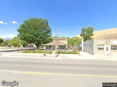
83 N Connor Ave Stockton, UT 84071
Estimated Value: $401,000 - $517,000
--
Bed
--
Bath
3,426
Sq Ft
$128/Sq Ft
Est. Value
About This Home
This home is located at 83 N Connor Ave, Stockton, UT 84071 and is currently estimated at $437,747, approximately $127 per square foot. 83 N Connor Ave is a home with nearby schools including Settlement Canyon Elementary School and Dugway.
Ownership History
Date
Name
Owned For
Owner Type
Purchase Details
Closed on
Sep 4, 2024
Sold by
Allred Kim and Allred Dana
Bought by
Allred Living Trust and Allred
Current Estimated Value
Purchase Details
Closed on
Nov 29, 2005
Sold by
Sagers Margene O
Bought by
Sagers Margene O and Margene O Sagers Trust
Purchase Details
Closed on
Aug 31, 2005
Sold by
Anderson Miriam J and Allred Darlene J
Bought by
Sagers Margene O
Home Financials for this Owner
Home Financials are based on the most recent Mortgage that was taken out on this home.
Original Mortgage
$76,000
Interest Rate
5.7%
Mortgage Type
New Conventional
Purchase Details
Closed on
Dec 12, 2003
Sold by
Johnson Ernest James and Allred Darlen J
Bought by
Allred Darlen J
Create a Home Valuation Report for This Property
The Home Valuation Report is an in-depth analysis detailing your home's value as well as a comparison with similar homes in the area
Home Values in the Area
Average Home Value in this Area
Purchase History
| Date | Buyer | Sale Price | Title Company |
|---|---|---|---|
| Allred Living Trust | -- | Meridian Title | |
| Sagers Margene O | -- | None Available | |
| Sagers Margene O | -- | None Available |
Source: Public Records
Mortgage History
| Date | Status | Borrower | Loan Amount |
|---|---|---|---|
| Previous Owner | Sagers Margene O | $76,000 |
Source: Public Records
Tax History Compared to Growth
Tax History
| Year | Tax Paid | Tax Assessment Tax Assessment Total Assessment is a certain percentage of the fair market value that is determined by local assessors to be the total taxable value of land and additions on the property. | Land | Improvement |
|---|---|---|---|---|
| 2024 | $3,907 | $287,961 | $47,988 | $239,973 |
| 2023 | $3,907 | $269,830 | $47,988 | $221,842 |
| 2022 | $2,891 | $233,603 | $42,983 | $190,620 |
| 2021 | $2,641 | $177,766 | $42,983 | $134,783 |
| 2020 | $2,612 | $294,216 | $2,200 | $292,016 |
| 2019 | $2,056 | $245,547 | $2,200 | $243,347 |
| 2018 | $1,849 | $204,989 | $2,200 | $202,789 |
| 2017 | $1,349 | $171,191 | $2,200 | $168,991 |
| 2016 | $1,102 | $94,155 | $1,210 | $92,945 |
| 2015 | $1,102 | $74,510 | $0 | $0 |
| 2014 | -- | $60,883 | $0 | $0 |
Source: Public Records
Map
Nearby Homes
- 93 N Sherman St
- 60 S Johnson St
- 25 W Pearson
- 282 S Sheridan St
- 305 S Sheridan St
- 609 E 900 S
- 0 E Bald Mountain Rd
- 0 Utah 36
- 1843 W Big Sky Dr
- 2258 W Deer Run Dr Unit 174
- 2521 W Ridgeline Rd
- 3017 W Ridgeline Rd
- 3214 W Ridgeline Rd
- 1054 S 1050 W
- 1081 S 900 W
- 799 3 O'Clock Dr
- 1018 S 810 W
- 1082 Southland Dr
- 765 1 O'Clock Dr
- 615 W 1080 S
- 83 N Connor Ave
- 91 N Connor Ave
- 94 N Connor Ave
- 25 E Clark St
- 49 N Connor Ave
- 113 N Connor Ave
- 98 N Sherman St
- 42 N Sherman St
- 64 N Connor Ave
- 50 N Sherman St
- 52 N Connor Ave
- 43 N Connor Ave
- 116 N Connor Ave
- 65 N Sherman St
- 129 N Connor Ave
- 26 E Clark St
- 42 N Connor Ave
- 37 E Clark St
- 128 N Connor Ave
- 97 N Sheridan Ave