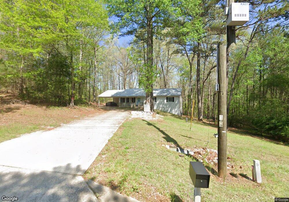
83 Selfridge Rd McDonough, GA 30252
Estimated Value: $251,000 - $289,000
3
Beds
2
Baths
1,530
Sq Ft
$175/Sq Ft
Est. Value
About This Home
This home is located at 83 Selfridge Rd, McDonough, GA 30252 and is currently estimated at $267,244, approximately $174 per square foot. 83 Selfridge Rd is a home located in Henry County with nearby schools including East Lake Elementary School, Union Grove Middle School, and Union Grove High School.
Ownership History
Date
Name
Owned For
Owner Type
Purchase Details
Closed on
May 1, 2023
Sold by
Babb Stephanie
Bought by
Latour James
Current Estimated Value
Purchase Details
Closed on
Sep 20, 2021
Sold by
Latour James
Bought by
Latour James and Babb Stephanie
Home Financials for this Owner
Home Financials are based on the most recent Mortgage that was taken out on this home.
Original Mortgage
$150,400
Interest Rate
2.8%
Mortgage Type
New Conventional
Create a Home Valuation Report for This Property
The Home Valuation Report is an in-depth analysis detailing your home's value as well as a comparison with similar homes in the area
Home Values in the Area
Average Home Value in this Area
Purchase History
| Date | Buyer | Sale Price | Title Company |
|---|---|---|---|
| Latour James | -- | -- | |
| Latour James | -- | -- | |
| Latour James | $188,000 | -- |
Source: Public Records
Mortgage History
| Date | Status | Borrower | Loan Amount |
|---|---|---|---|
| Previous Owner | Latour James | $150,400 |
Source: Public Records
Tax History Compared to Growth
Tax History
| Year | Tax Paid | Tax Assessment Tax Assessment Total Assessment is a certain percentage of the fair market value that is determined by local assessors to be the total taxable value of land and additions on the property. | Land | Improvement |
|---|---|---|---|---|
| 2025 | $3,340 | $112,320 | $14,240 | $98,080 |
| 2024 | $3,340 | $106,960 | $13,360 | $93,600 |
| 2023 | $2,543 | $97,760 | $13,480 | $84,280 |
| 2022 | $2,515 | $75,200 | $11,806 | $63,394 |
| 2021 | $2,564 | $65,800 | $10,680 | $55,120 |
| 2020 | $2,417 | $61,960 | $10,040 | $51,920 |
| 2019 | $2,164 | $55,360 | $9,520 | $45,840 |
| 2018 | $2,157 | $55,200 | $8,800 | $46,400 |
| 2016 | $1,800 | $45,880 | $6,840 | $39,040 |
| 2015 | $1,503 | $37,000 | $7,840 | $29,160 |
| 2014 | $1,314 | $31,840 | $7,840 | $24,000 |
Source: Public Records
Map
Nearby Homes
- 0 Highway 155 N Unit 10380875
- 316 Moab Ct
- Henry II Plan at Grandview at Millers Mill
- Isabella V Plan at Grandview at Millers Mill
- Meridian II Plan at Grandview at Millers Mill
- Rosemary II Plan at Grandview at Millers Mill
- Clarity Plan at Grandview at Millers Mill
- Stonefield Plan at Grandview at Millers Mill
- Rainier Plan at Grandview at Millers Mill
- 1104 Driftwood Ct
- 621 Sidney Ct
- 617 Sidney Ct
- 613 Sidney Ct
- 1205 Mill Creek Ln
- 609 Sidney Ct
- 605 Sidney Ct
- 187 Buffalo Trace
- 425 Sheridan Dr
- 825 Rapid Ct
- 176 Northmill Pkwy
- 93 Selfridge Rd
- 0 Highway 155 N Unit 10549557
- 0 Highway 155 N Unit 7557730
- 0 Highway 155 N Unit 7229333
- 0 Highway 155 N Unit 7201062
- 0 Highway 155 N Unit 7113517
- 0 Highway 155 N Unit 7035014
- 0 Highway 155 N Unit 7585508
- 0 Highway 155 N Unit 8605981
- 0 Highway 155 N Unit 10350094
- 0 Highway 155 N Unit 7339714
- 0 Highway 155 N Unit 8412689
- 0 Highway 155 N Unit 20165670
- 0 Highway 155 N Unit 20145387
- 0 Highway 155 N Unit 20120250
- 0 Highway 155 N Unit 8957120
- 97 Selfridge Rd
- 97 Selfridge Rd Unit /39
- 0 Highway 155
- 0 Selfridge Rd Unit 2604973