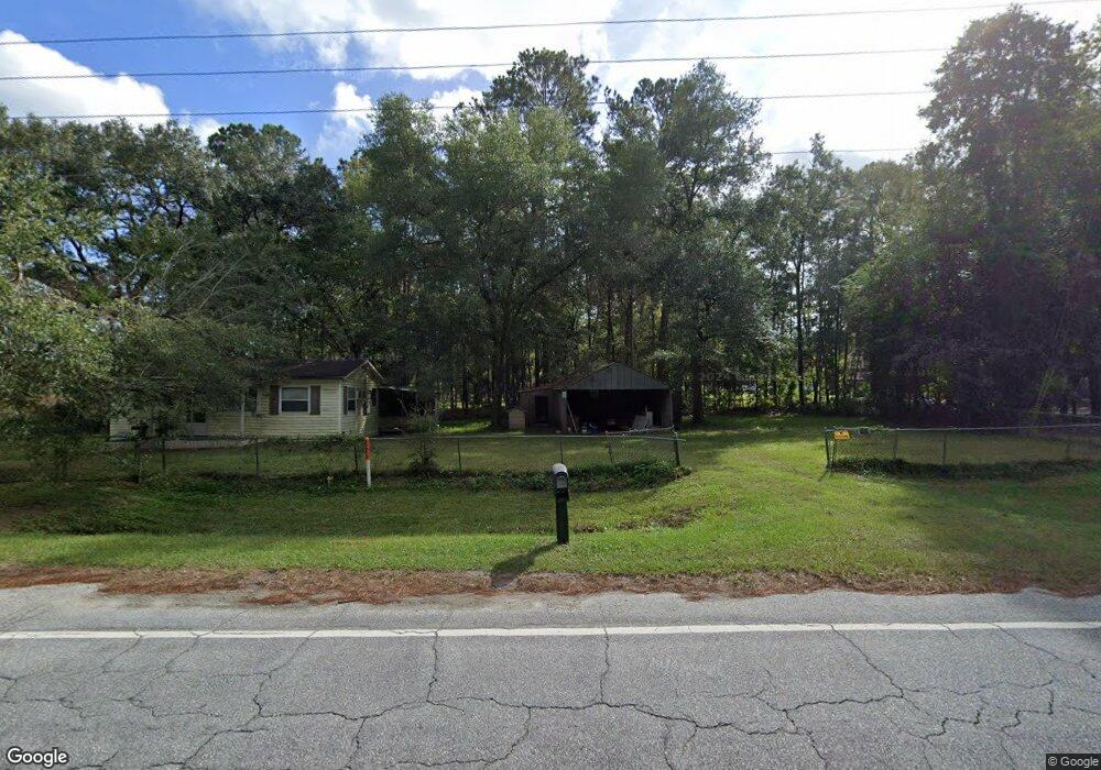
830 Dover Bluff Rd Waverly, GA 31565
Estimated Value: $452,000 - $595,000
3
Beds
2
Baths
2,898
Sq Ft
$176/Sq Ft
Est. Value
About This Home
This home is located at 830 Dover Bluff Rd, Waverly, GA 31565 and is currently estimated at $510,020, approximately $175 per square foot. 830 Dover Bluff Rd is a home with nearby schools including Woodbine Elementary School, Camden Middle School, and Camden County High School.
Ownership History
Date
Name
Owned For
Owner Type
Purchase Details
Closed on
Aug 19, 2013
Sold by
Bloodworth Farming Propert
Bought by
Smith Richard L
Current Estimated Value
Purchase Details
Closed on
Dec 1, 2012
Sold by
Bloodworth I Stewart
Bought by
Bloodworth Farming Properties
Purchase Details
Closed on
Dec 8, 2011
Bought by
Bloodworth Stewart I
Purchase Details
Closed on
Dec 6, 2011
Sold by
Fdic
Purchase Details
Closed on
Aug 31, 2006
Sold by
Not Provided
Bought by
Bank Security Bank Of Bibb Cou
Create a Home Valuation Report for This Property
The Home Valuation Report is an in-depth analysis detailing your home's value as well as a comparison with similar homes in the area
Home Values in the Area
Average Home Value in this Area
Purchase History
| Date | Buyer | Sale Price | Title Company |
|---|---|---|---|
| Smith Richard L | $24,750 | -- | |
| Bloodworth Farming Properties | -- | -- | |
| Bloodworth Stewart I | $12,210 | -- | |
| -- | -- | -- | |
| Bank Security Bank Of Bibb Cou | $135,000 | -- |
Source: Public Records
Tax History Compared to Growth
Tax History
| Year | Tax Paid | Tax Assessment Tax Assessment Total Assessment is a certain percentage of the fair market value that is determined by local assessors to be the total taxable value of land and additions on the property. | Land | Improvement |
|---|---|---|---|---|
| 2024 | $3,004 | $160,756 | $5,534 | $155,222 |
| 2023 | $2,879 | $147,433 | $4,297 | $143,136 |
| 2022 | $2,834 | $139,151 | $4,297 | $134,854 |
| 2021 | $2,996 | $108,280 | $4,297 | $103,983 |
| 2020 | $3,081 | $96,836 | $4,297 | $92,539 |
| 2019 | $3,105 | $96,836 | $4,297 | $92,539 |
| 2018 | $2,911 | $96,836 | $4,297 | $92,539 |
| 2017 | $1,686 | $54,791 | $4,297 | $50,494 |
| 2016 | $222 | $7,257 | $7,257 | $0 |
| 2015 | $122 | $4,107 | $4,108 | $0 |
| 2014 | $79 | $4,349 | $4,349 | $0 |
Source: Public Records
Map
Nearby Homes
- 51 Bluffs Landing
- 321 Harbour Island Cir
- 0 Timmons Dr Unit 10431847
- 73 Fairwinds Dr
- V/L 276 Harbour Island Cir
- Spring Valley II Plan at The Estates of Sanctuary Cove
- Pinehurst II Plan at The Estates of Sanctuary Cove
- Southport III Plan at The Estates of Sanctuary Cove
- Charleston II Plan at The Estates of Sanctuary Cove
- 681 Harbour Island Cir
- 35 Fairwinds Dr
- 197 Little Satilla Trail
- 352 Harbour Island Cir
- 424 Harbour Island Cir
- 0 Dover Bluff Rd Unit 10276950
- 0 Dover Bluff Rd Unit 1645843
- 0 Dover Bluff Rd Unit 11355244
- 96 E Lake Trail
- 390 Harbour Island Cir
- 0 Us Hwy 17 Unit 10488619
- 858 Dover Bluff Rd
- 800 Dover Bluff Rd
- 110 McVeigh Rd
- 772 Dover Bluff Rd
- 110 McVeigh Ct
- 30 McVeigh Rd
- 762 Dover Bluff Rd
- 0 McVeigh Ct Unit 3206431
- 0 McVeigh Ct
- 99 McVeigh Rd Unit 1,2,3
- 102 McVeigh Rd
- 726 Dover Bluff Rd
- 56 McVeigh Rd
- 138 McVeigh Rd
- 111 Ossabaw Way
- 101 Ossabaw Way
- 139 McVeigh Rd
- 150 McVeigh Rd
- 74 Shaddix Ln
- 89 Shaddix Ln