Estimated Value: $194,052 - $283,000
Studio
1
Bath
970
Sq Ft
$254/Sq Ft
Est. Value
About This Home
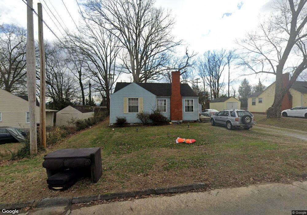
This home is located at 830 Long Rd, Alcoa, TN 37701 and is currently estimated at $246,513, approximately $254 per square foot. 830 Long Rd is a home located in Blount County with nearby schools including Alcoa Elementary School, Alcoa Middle School, and Alcoa High School.
Ownership History
Date
Name
Owned For
Owner Type
Purchase Details
Closed on
Nov 12, 2008
Sold by
Potter Leonard
Bought by
Potter Leonard
Current Estimated Value
Purchase Details
Closed on
Jul 30, 1998
Sold by
Furr Fred M
Bought by
Potter Leonard
Purchase Details
Closed on
Jun 22, 1992
Bought by
Furr Fred M Bldg E Suite 1
Purchase Details
Closed on
May 1, 1991
Bought by
Monday Robert W
Purchase Details
Closed on
Sep 1, 1947
Bought by
Monday William Eugene
Create a Home Valuation Report for This Property
The Home Valuation Report is an in-depth analysis detailing your home's value as well as a comparison with similar homes in the area
Home Values in the Area
Average Home Value in this Area
Purchase History
| Date | Buyer | Sale Price | Title Company |
|---|---|---|---|
| Potter Leonard | -- | -- | |
| Potter Leonard | $52,000 | -- | |
| Furr Fred M Bldg E Suite 1 | $677,000 | -- | |
| Monday Robert W | $350,000 | -- | |
| Monday William Eugene | -- | -- |
Source: Public Records
Tax History
| Year | Tax Paid | Tax Assessment Tax Assessment Total Assessment is a certain percentage of the fair market value that is determined by local assessors to be the total taxable value of land and additions on the property. | Land | Improvement |
|---|---|---|---|---|
| 2025 | -- | $38,225 | $10,125 | $28,100 |
| 2024 | -- | $38,225 | $10,125 | $28,100 |
| 2023 | $1,254 | $38,225 | $10,125 | $28,100 |
| 2022 | $1,010 | $21,300 | $5,625 | $15,675 |
| 2021 | $1,010 | $21,300 | $5,625 | $15,675 |
| 2020 | $1,010 | $21,300 | $5,625 | $15,675 |
| 2019 | $1,010 | $21,300 | $5,625 | $15,675 |
| 2018 | $777 | $17,550 | $5,325 | $12,225 |
| 2017 | $777 | $17,550 | $5,325 | $12,225 |
| 2016 | $777 | $17,550 | $5,325 | $12,225 |
| 2015 | $721 | $17,550 | $5,325 | $12,225 |
| 2014 | $768 | $17,550 | $5,325 | $12,225 |
| 2013 | $768 | $18,675 | $0 | $0 |
Source: Public Records
Map
Nearby Homes
- 1741 N Wright Rd
- 1539 Boyle St
- 1631 Springbrook Rd
- 1450 Dalton St
- 1413 Perkins St
- 869 Cedar St
- 1321 Nobel St Unit E
- 1119 Cherry St
- 1240 N Wright Rd
- 971 Maple St
- 0 N Wright Rd
- 922 Poplar St
- 966 Poplar St
- 1826 Peppertree Dr
- 1538 Tsuga Dr
- 2620 Marshall St
- 2638 Orton Dr
- 646 Kirkwell Dr
- 2405 Huckleberry Dr
- 3473 Russellwood Dr
Your Personal Tour Guide
Ask me questions while you tour the home.