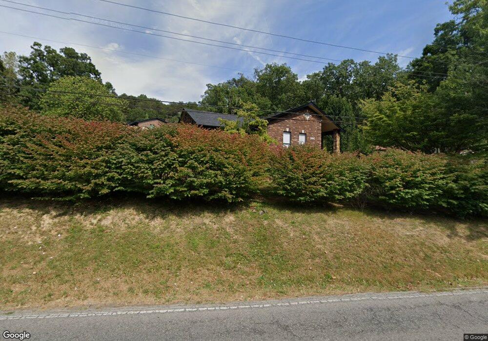
8305 Arnoldtown Rd Louisville, KY 40214
Valley Station NeighborhoodEstimated Value: $188,847 - $274,000
2
Beds
2
Baths
1,550
Sq Ft
$148/Sq Ft
Est. Value
About This Home
This home is located at 8305 Arnoldtown Rd, Louisville, KY 40214 and is currently estimated at $229,212, approximately $147 per square foot. 8305 Arnoldtown Rd is a home located in Jefferson County with nearby schools including Trunnell Elementary School, Stonestreet Elementary School, and Kenwood Elementary School.
Ownership History
Date
Name
Owned For
Owner Type
Purchase Details
Closed on
Jan 27, 2023
Sold by
Basham Samantha
Bought by
Meredith Steven A
Current Estimated Value
Purchase Details
Closed on
Nov 9, 2022
Sold by
Harold Snawder Living Trust
Bought by
Basham Samantha and Pursley Trey
Purchase Details
Closed on
Jan 11, 2019
Sold by
Snawder Harold F
Bought by
Harold Snawder Living Trust
Purchase Details
Closed on
Feb 9, 2018
Sold by
Snawder Harold F and Snawder Billie R
Bought by
Snawder Harold F
Create a Home Valuation Report for This Property
The Home Valuation Report is an in-depth analysis detailing your home's value as well as a comparison with similar homes in the area
Home Values in the Area
Average Home Value in this Area
Purchase History
| Date | Buyer | Sale Price | Title Company |
|---|---|---|---|
| Meredith Steven A | $120,000 | -- | |
| Basham Samantha | $100,000 | Rounsavall Title | |
| Harold Snawder Living Trust | -- | None Available | |
| Snawder Harold F | -- | None Available |
Source: Public Records
Tax History Compared to Growth
Tax History
| Year | Tax Paid | Tax Assessment Tax Assessment Total Assessment is a certain percentage of the fair market value that is determined by local assessors to be the total taxable value of land and additions on the property. | Land | Improvement |
|---|---|---|---|---|
| 2024 | $1,991 | $170,900 | $30,400 | $140,500 |
| 2023 | $2,047 | $170,900 | $30,400 | $140,500 |
| 2022 | $1,118 | $133,500 | $30,400 | $103,100 |
| 2021 | $1,200 | $133,500 | $30,400 | $103,100 |
| 2020 | $980 | $124,030 | $25,000 | $99,030 |
| 2019 | $961 | $124,030 | $25,000 | $99,030 |
| 2018 | $968 | $124,030 | $25,000 | $99,030 |
| 2017 | $907 | $124,030 | $25,000 | $99,030 |
| 2013 | $756 | $75,610 | $25,000 | $50,610 |
Source: Public Records
Map
Nearby Homes
- 2710 Windsor Forest Dr
- 8405 Arnoldtown Rd
- 2108 Churchdown Ln
- 9203 Lakeridge Dr
- 8800 W Manslick Rd
- 9209 Lakeridge Dr
- 9206 Lakeridge Dr
- 2707 Windsor Lakes Pkwy
- 1704 Star Rest Dr
- 2403 Windsor Forest Dr
- 9223 Hawthorne Pointe Dr Unit 9223
- 9231 Hawthorne Pointe Dr Unit 9231
- 8311 Pine Grove Ct
- 9233 Hawthorne Pointe Dr Unit 9233
- 9243 Hawthorne Pointe Dr
- 7912 3rd Street Rd
- 2506 Tavistock Ct
- 2407 Kings Cross Ct
- 9600 Britannia Ct
- 9613 Scarborough Ave
- 8303 Arnoldtown Rd
- 8307 Arnoldtown Rd
- 8219 Arnoldtown Rd
- 8311 Arnoldtown Rd
- 8215 Arnoldtown Rd
- 8301 Arnoldtown Rd
- 8300 Arnoldtown Rd
- 8313 Arnoldtown Rd
- 8304 Arnoldtown Rd
- 8216 Arnoldtown Rd
- 8211 Arnoldtown Rd
- 8306 Arnoldtown Rd
- 8315 Arnoldtown Rd
- 8214 Arnoldtown Rd
- 8310 Arnoldtown Rd
- 8314 Arnoldtown Rd
- 8207 Arnoldtown Rd
- 8319 Arnoldtown Rd
- 8210 Arnoldtown Rd
- 8316 Arnoldtown Rd