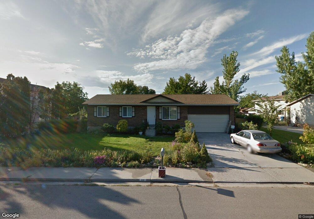
831 W 2300 N Provo, UT 84604
Riverside NeighborhoodEstimated Value: $452,938 - $530,000
4
Beds
2
Baths
1,824
Sq Ft
$264/Sq Ft
Est. Value
About This Home
This home is located at 831 W 2300 N, Provo, UT 84604 and is currently estimated at $480,985, approximately $263 per square foot. 831 W 2300 N is a home located in Utah County with nearby schools including Westridge Elementary School, Dixon Middle School, and Provo High School.
Ownership History
Date
Name
Owned For
Owner Type
Purchase Details
Closed on
Apr 29, 2009
Sold by
Chan Fuk Wing Thomas
Bought by
Chan Fuk Wing Thomas and Ho Li Kam
Current Estimated Value
Home Financials for this Owner
Home Financials are based on the most recent Mortgage that was taken out on this home.
Original Mortgage
$144,750
Outstanding Balance
$92,144
Interest Rate
4.99%
Mortgage Type
New Conventional
Estimated Equity
$388,841
Purchase Details
Closed on
Aug 30, 2000
Sold by
Mcclellan Family Lc
Bought by
Chan Fuk Wing Thomas and Ho Li Kam
Home Financials for this Owner
Home Financials are based on the most recent Mortgage that was taken out on this home.
Original Mortgage
$108,000
Interest Rate
8.2%
Create a Home Valuation Report for This Property
The Home Valuation Report is an in-depth analysis detailing your home's value as well as a comparison with similar homes in the area
Home Values in the Area
Average Home Value in this Area
Purchase History
| Date | Buyer | Sale Price | Title Company |
|---|---|---|---|
| Chan Fuk Wing Thomas | -- | Title West Title Company | |
| Chan Fuk Wing Thomas | -- | Title West Title Company | |
| Chan Fuk Wing Thomas | -- | Empire Land Title Company |
Source: Public Records
Mortgage History
| Date | Status | Borrower | Loan Amount |
|---|---|---|---|
| Open | Chan Fuk Wing Thomas | $144,750 | |
| Closed | Chan Fuk Wing Thomas | $108,000 |
Source: Public Records
Tax History Compared to Growth
Tax History
| Year | Tax Paid | Tax Assessment Tax Assessment Total Assessment is a certain percentage of the fair market value that is determined by local assessors to be the total taxable value of land and additions on the property. | Land | Improvement |
|---|---|---|---|---|
| 2025 | $2,296 | $246,510 | $168,400 | $279,800 |
| 2024 | $2,337 | $225,995 | $0 | $0 |
| 2023 | $2,337 | $226,820 | $0 | $0 |
| 2022 | $2,409 | $235,675 | $0 | $0 |
| 2021 | $1,843 | $314,600 | $106,900 | $207,700 |
| 2020 | $1,777 | $284,300 | $97,200 | $187,100 |
| 2019 | $1,615 | $268,700 | $90,200 | $178,500 |
| 2018 | $1,413 | $238,500 | $83,300 | $155,200 |
| 2017 | $1,352 | $125,345 | $0 | $0 |
| 2016 | $1,401 | $121,110 | $0 | $0 |
| 2015 | $1,364 | $119,185 | $0 | $0 |
| 2014 | $1,258 | $114,510 | $0 | $0 |
Source: Public Records
Map
Nearby Homes
- 819 W 2300 N
- 814 E 1740 S
- 1009 W 2000 N
- 696 E 1700 S
- 691 E 1600 S
- 1927 Columbia Ln
- 666 E 1600 S
- 720 E 1500 S
- 1763 Willowbrook Dr Unit 4D1
- 1685 Hickory Ln
- 1661 Willowbrook Dr
- 1633 Woodland Dr
- 1360 S Carterville Rd
- 920 W Columbia Ln
- 493 E 2000 S
- 444 1600 S Unit 1
- 1559 N Riverside Ave Unit 4
- 414 E 1834 S
- 1531 S 450 E
- 1237 S 1000 E