8314 Morningside Dr Manassas, VA 20112
South Manassas NeighborhoodEstimated Value: $775,216 - $813,000
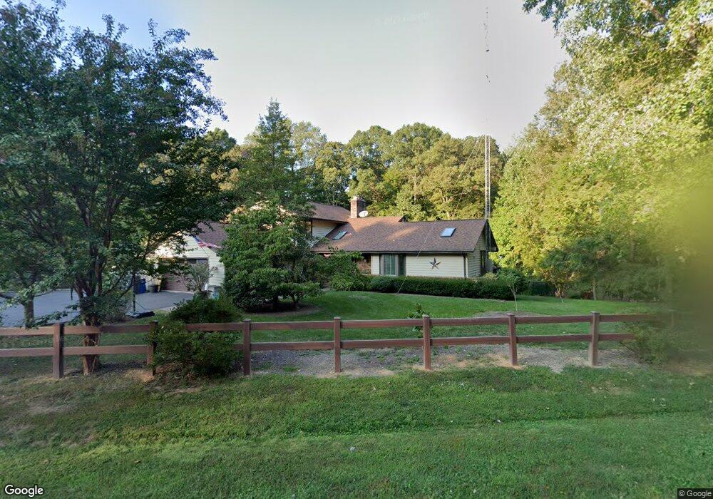
About This Home
This home is located at 8314 Morningside Dr, Manassas, VA 20112 and is currently estimated at $790,054, approximately $325 per square foot. 8314 Morningside Dr is a home located in Prince William County with nearby schools including Charles J. Colgan Senior High School, Thurgood Marshall Elementary School, and Louise A. Benton Middle School.
Ownership History
Purchase Details
Home Financials for this Owner
Home Financials are based on the most recent Mortgage that was taken out on this home.Home Values in the Area
Average Home Value in this Area
Purchase History
We collect this data history from publicly available records. To have your information removed, we recommend requesting removal directly through your county’s website.
| Date | Buyer | Sale Price | Title Company |
|---|---|---|---|
| Tarnovsky George V | $220,900 | -- |
Mortgage History
We collect this data history from publicly available records. To have your information removed, we recommend requesting removal directly through your county’s website.
| Date | Status | Borrower | Loan Amount |
|---|---|---|---|
| Open | Tarnovsky George V | $158,000 |
Tax History
| Year | Tax Paid | Tax Assessment Tax Assessment Total Assessment is a certain percentage of the fair market value that is determined by local assessors to be the total taxable value of land and additions on the property. | Land | Improvement |
|---|---|---|---|---|
| 2025 | $6,593 | $704,300 | $158,700 | $545,600 |
| 2024 | $6,593 | $662,900 | $149,400 | $513,500 |
| 2023 | $6,594 | $633,700 | $142,200 | $491,500 |
| 2022 | $6,523 | $578,700 | $129,000 | $449,700 |
| 2021 | $6,208 | $509,300 | $114,700 | $394,600 |
| 2020 | $7,544 | $486,700 | $109,700 | $377,000 |
| 2019 | $7,500 | $483,900 | $109,100 | $374,800 |
| 2018 | $5,476 | $453,500 | $105,300 | $348,200 |
| 2017 | $5,427 | $440,700 | $102,000 | $338,700 |
| 2016 | $5,245 | $429,800 | $98,700 | $331,100 |
| 2015 | $5,220 | $418,900 | $95,400 | $323,500 |
| 2014 | $5,220 | $418,600 | $94,300 | $324,300 |
Map
- 12216 Stoneybrook Dr
- 12203 Woodlark Ct
- 8324 Morningside Dr
- 8609 Short St
- 8201 Morningside Dr
- 8585 Short St
- 8544 Short St
- 11897 Waterside Dr
- 11993 Mente Rd
- 8701 Sinclair Mill Rd
- 12000 Mente Rd
- 11951 Mente Rd
- 11746 Margarite St
- 8028 Pinnacle Ridge Dr
- 11837 Lester Rd
- 8890 Evelyn Dr
- 8915 Helen St
- 8125 Pappas Dr
- 11594 Olympic Dr
- 8844 Mcgrath Rd
- 8312 Morningside Dr
- 8315 Morningside Dr
- 12218 Stoneybrook Dr
- 12213 Stoneybrook Dr
- 8317 Morningside Dr
- 12212 Woodlark Ct
- 12208 Woodlark Ct
- 12214 Stoneybrook Dr
- 8318 Morningside Dr
- 12211 Stoneybrook Dr
- 8311 Morningside Dr
- 8319 Morningside Dr
- 12206 Woodlark Ct
- 12212 Stoneybrook Dr
- 12209 Stoneybrook Dr
- 8306 Morningside Dr
- 8309 Morningside Dr
- 12204 Woodlark Ct
- 12209 Woodlark Ct
- 12205 Woodlark Ct
Ask me questions while you tour the home.