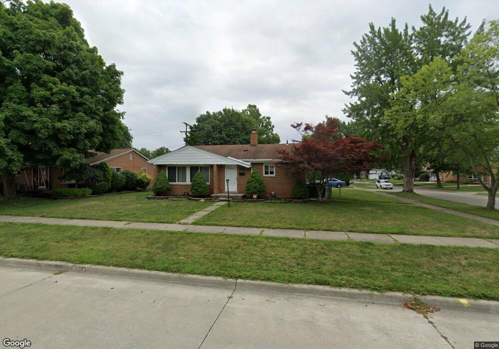
8314 Rae Dr Westland, MI 48185
Estimated Value: $267,040 - $282,000
3
Beds
6
Baths
1,178
Sq Ft
$233/Sq Ft
Est. Value
About This Home
This home is located at 8314 Rae Dr, Westland, MI 48185 and is currently estimated at $274,260, approximately $232 per square foot. 8314 Rae Dr is a home located in Wayne County with nearby schools including Hayes Elementary School, Cooper Upper Elementary School, and Emerson Middle School.
Ownership History
Date
Name
Owned For
Owner Type
Purchase Details
Closed on
Jan 2, 2023
Sold by
Turner Karey Lea
Bought by
Turner Justin and Turner Amanda
Current Estimated Value
Purchase Details
Closed on
Jun 17, 2009
Sold by
Tatrow Jessica
Bought by
Federal Home Loan Mortgage Corp
Purchase Details
Closed on
Nov 18, 2005
Sold by
Olweean Adam A and Olweean Karen M
Bought by
Tatrow Jessica
Create a Home Valuation Report for This Property
The Home Valuation Report is an in-depth analysis detailing your home's value as well as a comparison with similar homes in the area
Home Values in the Area
Average Home Value in this Area
Purchase History
| Date | Buyer | Sale Price | Title Company |
|---|---|---|---|
| Turner Justin | -- | None Listed On Document | |
| Federal Home Loan Mortgage Corp | $107,380 | None Available | |
| Tatrow Jessica | $168,000 | Multiple | |
| Tatrow Jessica | -- | Title One Inc |
Source: Public Records
Tax History Compared to Growth
Tax History
| Year | Tax Paid | Tax Assessment Tax Assessment Total Assessment is a certain percentage of the fair market value that is determined by local assessors to be the total taxable value of land and additions on the property. | Land | Improvement |
|---|---|---|---|---|
| 2025 | $2,610 | $127,800 | $0 | $0 |
| 2024 | $2,610 | $119,400 | $0 | $0 |
| 2023 | $2,782 | $108,300 | $0 | $0 |
| 2022 | $3,100 | $93,600 | $0 | $0 |
| 2021 | $2,580 | $89,400 | $0 | $0 |
| 2020 | $2,977 | $84,400 | $0 | $0 |
| 2019 | $2,978 | $81,900 | $0 | $0 |
| 2018 | $2,527 | $69,500 | $0 | $0 |
| 2017 | $1,931 | $64,600 | $0 | $0 |
| 2016 | $2,311 | $65,000 | $0 | $0 |
| 2015 | $4,681 | $60,020 | $0 | $0 |
| 2013 | $4,535 | $46,290 | $0 | $0 |
| 2012 | $2,068 | $46,440 | $0 | $0 |
Source: Public Records
Map
Nearby Homes
- 32451 Sandra Ln
- 33211 Anita Dr
- 32725 Joy Rd
- 32724 Hees St
- 32047 Anita Dr
- 33312 Lynx St
- 32327 Washington St
- 8332 Berwick Dr
- 33030 Cowan Rd
- 7946 Moonwood Place
- 8824 Nevada St
- 9243 Montana St
- 7436 Cochise St
- 7872 Ritz Ave
- 31640 Ann Arbor Trail
- 8219 Roselawn St
- 32611 Vermont St
- 9212 Idaho St
- 9253 Idaho St
- 9085 Melrose St
- 8328 Rae Dr
- 32674 Merritt Dr
- 32666 Merritt Dr
- 8342 Rae Dr
- 32681 Mackenzie Dr
- 32681 Merritt Dr
- 8315 Rae Dr
- 8329 Rae Dr Unit Bldg-Unit
- 8329 Rae Dr
- 32675 Merritt Dr
- 32671 Mackenzie Dr
- 32658 Merritt Dr
- 32669 Merritt Dr
- 32701 Merritt Dr
- 8343 Rae Dr
- 32663 Merritt Dr
- 32711 Merritt Dr
- 32663 Mackenzie Dr
- 32650 Merritt Dr
- 32730 Merritt Dr