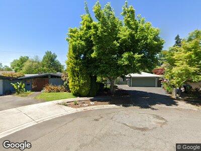
832 Delmar Place Eugene, OR 97401
Harlow NeighborhoodEstimated Value: $499,000 - $583,993
3
Beds
2
Baths
1,868
Sq Ft
$289/Sq Ft
Est. Value
About This Home
This home is located at 832 Delmar Place, Eugene, OR 97401 and is currently estimated at $538,998, approximately $288 per square foot. 832 Delmar Place is a home located in Lane County with nearby schools including Holt Elementary School, Monroe Middle School, and Sheldon High School.
Ownership History
Date
Name
Owned For
Owner Type
Purchase Details
Closed on
Apr 8, 2022
Sold by
Jones Dean F
Bought by
Dean F Jones Trust
Current Estimated Value
Purchase Details
Closed on
May 14, 2007
Sold by
Erickson David B
Bought by
Jones Dean F
Home Financials for this Owner
Home Financials are based on the most recent Mortgage that was taken out on this home.
Original Mortgage
$212,044
Interest Rate
6.17%
Mortgage Type
Purchase Money Mortgage
Create a Home Valuation Report for This Property
The Home Valuation Report is an in-depth analysis detailing your home's value as well as a comparison with similar homes in the area
Home Values in the Area
Average Home Value in this Area
Purchase History
| Date | Buyer | Sale Price | Title Company |
|---|---|---|---|
| Dean F Jones Trust | -- | None Listed On Document | |
| Jones Dean F | $223,215 | Cascade Title Co |
Source: Public Records
Mortgage History
| Date | Status | Borrower | Loan Amount |
|---|---|---|---|
| Previous Owner | Jones Dean F | $100,000 | |
| Previous Owner | Jones Dean F | $189,500 | |
| Previous Owner | Jones Dean F | $212,044 |
Source: Public Records
Tax History Compared to Growth
Tax History
| Year | Tax Paid | Tax Assessment Tax Assessment Total Assessment is a certain percentage of the fair market value that is determined by local assessors to be the total taxable value of land and additions on the property. | Land | Improvement |
|---|---|---|---|---|
| 2023 | $5,404 | $264,715 | $0 | $0 |
| 2022 | $5,062 | $257,005 | $0 | $0 |
| 2021 | $4,755 | $249,520 | $0 | $0 |
| 2020 | $4,772 | $242,253 | $0 | $0 |
| 2019 | $4,608 | $235,198 | $0 | $0 |
| 2018 | $4,338 | $221,697 | $0 | $0 |
| 2017 | $4,143 | $221,697 | $0 | $0 |
| 2016 | $3,937 | $215,240 | $0 | $0 |
| 2015 | $3,175 | $177,229 | $0 | $0 |
| 2014 | $3,080 | $172,067 | $0 | $0 |
Source: Public Records
Map
Nearby Homes
- 925 Ascot Dr
- 2840 Tomahawk Ln
- 488 Pinto Way
- 2795 Mallory Ln
- 950 Coburg Rd
- 3075 Dapple Way
- 471 Roan Dr
- 2878 Bailey Ln
- 3417 Harlow Rd
- 390 Hambletonian Dr
- 445 Hazel Ct
- 2620 Tandy Turn
- 310 Sunshine Acres Dr
- 2653 Sharon Way
- 3096 Sorrel Way
- 511 Honeysuckle Ln
- 2610 Cal Young Rd
- 905 Calvin St
- 127 Roan Dr
- 710 Arcadia Dr
- 832 Delmar Place
- 840 Ascot Dr
- 826 Delmar Place
- 870 Ascot Dr
- 2897 Tomahawk Ln
- 2899 Tomahawk Ln
- 2889 Tomahawk Ln
- 814 Delmar Place
- 2901 Tomahawk Ln
- 842 Delmar Place
- 894 Ascot Dr
- 853 Ascot Dr
- 768 Ascot Dr
- 2933 Tomahawk Ln
- 758 Santa Anita Ct
- 914 Ascot Dr
- 760 Santa Anita Ct
- 2881 Tomahawk Ln
- 2898 Tomahawk Ln
- 2894 Tomahawk Ln