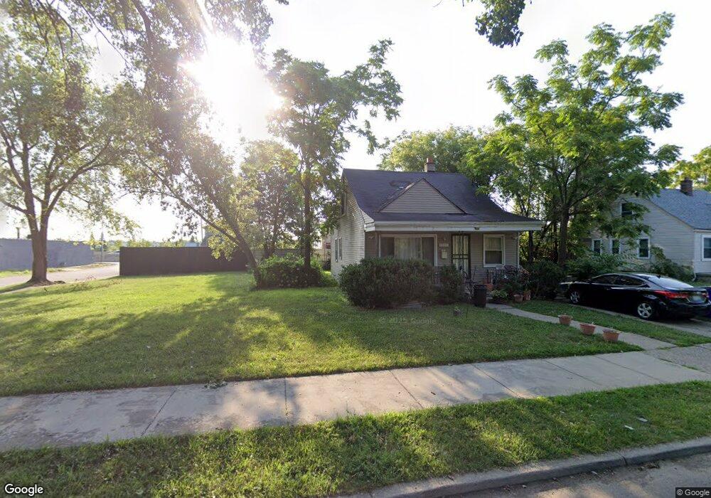
8324 Ashton Ave Detroit, MI 48228
Franklin Park NeighborhoodEstimated Value: $39,000 - $74,000
--
Bed
1
Bath
695
Sq Ft
$83/Sq Ft
Est. Value
About This Home
This home is located at 8324 Ashton Ave, Detroit, MI 48228 and is currently estimated at $57,667, approximately $82 per square foot. 8324 Ashton Ave is a home located in Wayne County with nearby schools including Bates Academy, Charles L. Spain Elementary-Middle School, and Edward 'Duke' Ellington Conservatory of Music and Art.
Ownership History
Date
Name
Owned For
Owner Type
Purchase Details
Closed on
Oct 20, 2014
Sold by
The City Of Detroit
Bought by
Latham Sanqustine
Current Estimated Value
Purchase Details
Closed on
Feb 7, 2013
Sold by
Wayne County Treasurer
Bought by
Planning & Development Dept City Of Detr
Purchase Details
Closed on
Jan 14, 2005
Sold by
Whitfield David A
Bought by
Whitfield David A
Home Financials for this Owner
Home Financials are based on the most recent Mortgage that was taken out on this home.
Original Mortgage
$76,000
Interest Rate
9.8%
Mortgage Type
Stand Alone Refi Refinance Of Original Loan
Create a Home Valuation Report for This Property
The Home Valuation Report is an in-depth analysis detailing your home's value as well as a comparison with similar homes in the area
Home Values in the Area
Average Home Value in this Area
Purchase History
| Date | Buyer | Sale Price | Title Company |
|---|---|---|---|
| Latham Sanqustine | $610 | None Available | |
| Planning & Development Dept City Of Detr | -- | None Available | |
| Whitfield David A | -- | Devon Title |
Source: Public Records
Mortgage History
| Date | Status | Borrower | Loan Amount |
|---|---|---|---|
| Previous Owner | Whitfield David A | $76,000 |
Source: Public Records
Tax History Compared to Growth
Tax History
| Year | Tax Paid | Tax Assessment Tax Assessment Total Assessment is a certain percentage of the fair market value that is determined by local assessors to be the total taxable value of land and additions on the property. | Land | Improvement |
|---|---|---|---|---|
| 2025 | $29 | $1,500 | $0 | $0 |
| 2024 | $29 | $500 | $0 | $0 |
| 2023 | $30 | $500 | $0 | $0 |
| 2022 | $35 | $500 | $0 | $0 |
| 2021 | $35 | $500 | $0 | $0 |
| 2020 | $35 | $500 | $0 | $0 |
| 2019 | $35 | $500 | $0 | $0 |
| 2018 | $29 | $500 | $0 | $0 |
| 2017 | $9 | $500 | $0 | $0 |
| 2016 | $198 | $2,800 | $0 | $0 |
| 2015 | $280 | $2,800 | $0 | $0 |
| 2013 | $1,392 | $13,921 | $0 | $0 |
| 2010 | -- | $20,409 | $1,179 | $19,230 |
Source: Public Records
Map
Nearby Homes
- 8441 Southfield Fwy
- 8428 Rosemont Ave
- 8209 Rosemont Ave
- 8051 Ashton Ave
- 8080 Penrod St
- 8671 Rosemont Ave
- 8451 Greenview Ave
- 8093 Greenview Ave
- 7834 Faust Ave
- 7795 Penrod St
- 8245 Brace St
- 8203 Brace St
- 20830 Joy Rd
- 8651 Brace St
- 9003 Archdale St
- 7800 Rutland St
- 8909 Penrod St
- 7691 Ashton Ave
- 7793 Clayburn St
- 9037 Longacre St
- 8312 Ashton Ave
- 8400 Ashton Ave
- 8306 Ashton Ave
- 8414 Ashton Ave
- 8300 Ashton Ave
- 8292 Ashton Ave
- 8424 Ashton Ave
- 8287 Southfield Fwy
- 8315 Ashton Ave
- 8284 Ashton Ave
- 8307 Ashton Ave
- 8299 Ashton Ave
- 8278 Ashton Ave
- 8291 Ashton Ave
- 8438 Ashton Ave
- 8323 Ashton Ave
- 8270 Ashton Ave
- 8429 Ashton Ave
- 8403 Ashton Ave
- 8413 Ashton Ave