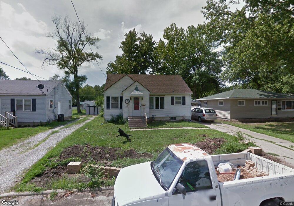
833 Allison Ave Ottumwa, IA 52501
Estimated Value: $116,000 - $125,000
3
Beds
1
Bath
1,251
Sq Ft
$96/Sq Ft
Est. Value
About This Home
This home is located at 833 Allison Ave, Ottumwa, IA 52501 and is currently estimated at $120,271, approximately $96 per square foot. 833 Allison Ave is a home located in Wapello County with nearby schools including Liberty Elementary School, Douma Elementary School, and Evans Middle School.
Ownership History
Date
Name
Owned For
Owner Type
Purchase Details
Closed on
Sep 30, 2021
Sold by
Arnett John N and Arnett Judy
Bought by
Arnett John N and Arnett Judy
Current Estimated Value
Purchase Details
Closed on
Mar 30, 2005
Sold by
Vande Noord Charles E
Bought by
Arnett John N
Home Financials for this Owner
Home Financials are based on the most recent Mortgage that was taken out on this home.
Original Mortgage
$59,236
Outstanding Balance
$30,902
Interest Rate
6.05%
Mortgage Type
Unknown
Estimated Equity
$89,369
Create a Home Valuation Report for This Property
The Home Valuation Report is an in-depth analysis detailing your home's value as well as a comparison with similar homes in the area
Home Values in the Area
Average Home Value in this Area
Purchase History
| Date | Buyer | Sale Price | Title Company |
|---|---|---|---|
| Arnett John N | -- | None Available | |
| Arnett John N | $65,000 | None Available |
Source: Public Records
Mortgage History
| Date | Status | Borrower | Loan Amount |
|---|---|---|---|
| Open | Arnett John N | $59,236 |
Source: Public Records
Tax History Compared to Growth
Tax History
| Year | Tax Paid | Tax Assessment Tax Assessment Total Assessment is a certain percentage of the fair market value that is determined by local assessors to be the total taxable value of land and additions on the property. | Land | Improvement |
|---|---|---|---|---|
| 2025 | $1,802 | $107,230 | $7,350 | $99,880 |
| 2024 | $1,802 | $101,760 | $7,350 | $94,410 |
| 2023 | $1,648 | $101,760 | $7,350 | $94,410 |
| 2022 | $1,644 | $81,280 | $7,350 | $73,930 |
| 2021 | $1,938 | $76,340 | $7,350 | $68,990 |
| 2020 | $1,568 | $73,190 | $7,350 | $65,840 |
| 2019 | $1,612 | $73,190 | $0 | $0 |
| 2018 | $1,558 | $73,190 | $0 | $0 |
| 2017 | $1,558 | $72,230 | $0 | $0 |
| 2016 | $1,486 | $71,487 | $0 | $0 |
| 2015 | $1,488 | $71,487 | $0 | $0 |
| 2014 | $1,488 | $71,487 | $0 | $0 |
Source: Public Records
Map
Nearby Homes
- 1507 Mowrey Ave
- 1322 Mowrey Ave
- 1409 Swanson Ave
- 1441 Casa Blanca Ln
- 1529 Swanson Ave
- 1903 Mowrey Ave
- 1021 Overman Ave
- 448 Mckinley Ave
- 745 Pocahontas Ln
- 439 Wildwood Dr
- 1508 Hamilton St
- 1005 Hamilton St
- 1401 W Finley Ave
- 1410 W Finley Ave
- 120 Shaul Ave
- 9450 150th Ave
- 1975 Greenwood Dr
- 117 Lynwood Ave
- 9 Kingsley Dr
- 138 Minnesota St
- 829 Allison Ave
- 837 Allison Ave
- 821 Allison Ave
- 732 Mckinley Ave
- 728 Mckinley Ave
- 817 Allison Ave
- 736 Mckinley Ave
- 1510 Mowrey Ave
- 832 Allison Ave
- 826 Allison Ave
- 815 Allison Ave
- 1504 Mowrey Ave
- 836 Allison Ave
- 720 Mckinley Ave
- 1436 Mowrey Ave
- 820 Allison Ave
- 716 Mckinley Ave
- 1522 Mowrey Ave
- 811 Allison Ave
- 1432 Mowrey Ave