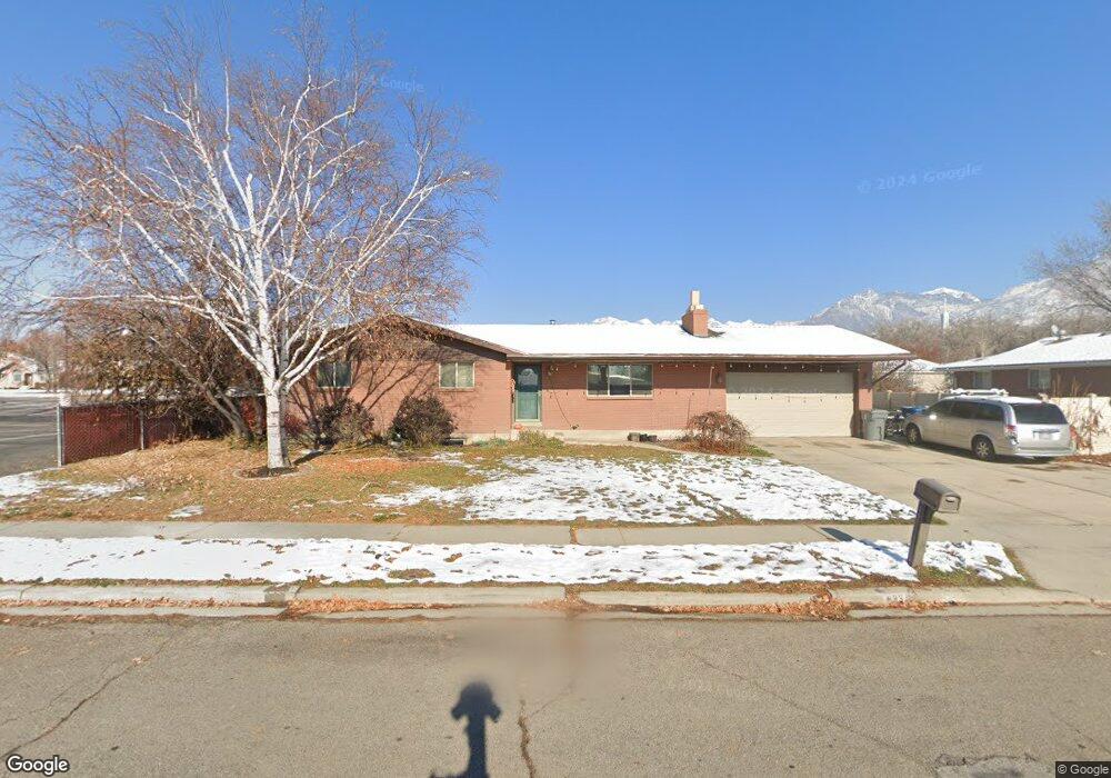
833 E 530 N American Fork, UT 84003
Estimated Value: $519,000 - $570,000
5
Beds
3
Baths
2,600
Sq Ft
$211/Sq Ft
Est. Value
About This Home
This home is located at 833 E 530 N, American Fork, UT 84003 and is currently estimated at $548,876, approximately $211 per square foot. 833 E 530 N is a home located in Utah County with nearby schools including Barratt Elementary School, American Fork Junior High School, and American Fork High School.
Ownership History
Date
Name
Owned For
Owner Type
Purchase Details
Closed on
Apr 23, 2007
Sold by
Anderson Brent
Bought by
Loughton Meredith R
Current Estimated Value
Home Financials for this Owner
Home Financials are based on the most recent Mortgage that was taken out on this home.
Original Mortgage
$26,450
Outstanding Balance
$3,464
Interest Rate
6.15%
Mortgage Type
Credit Line Revolving
Estimated Equity
$545,412
Purchase Details
Closed on
Apr 17, 2007
Sold by
Anderson Ginger
Bought by
Anderson Brent
Home Financials for this Owner
Home Financials are based on the most recent Mortgage that was taken out on this home.
Original Mortgage
$26,450
Outstanding Balance
$3,464
Interest Rate
6.15%
Mortgage Type
Credit Line Revolving
Estimated Equity
$545,412
Purchase Details
Closed on
Feb 9, 2006
Sold by
Goodwin William F and Goodwin Sharon R
Bought by
Anderson Brent and Anderson Ginger
Home Financials for this Owner
Home Financials are based on the most recent Mortgage that was taken out on this home.
Original Mortgage
$44,000
Interest Rate
6.15%
Mortgage Type
Stand Alone Second
Purchase Details
Closed on
May 27, 2003
Sold by
Goodwin William F and Goodwin Sharon R
Bought by
Goodwin Ii William F and Goodwin Sharon R
Purchase Details
Closed on
Apr 11, 2002
Sold by
Dudley Sharon Rae
Bought by
Goodwin Ii Williams S and Goodwin Sharon R
Home Financials for this Owner
Home Financials are based on the most recent Mortgage that was taken out on this home.
Original Mortgage
$126,300
Interest Rate
6.87%
Purchase Details
Closed on
Dec 3, 1997
Sold by
Dudley Kenneth W and Dudley Sharon Rae
Bought by
Dudley Sharon Rae
Home Financials for this Owner
Home Financials are based on the most recent Mortgage that was taken out on this home.
Original Mortgage
$60,000
Interest Rate
7.31%
Create a Home Valuation Report for This Property
The Home Valuation Report is an in-depth analysis detailing your home's value as well as a comparison with similar homes in the area
Home Values in the Area
Average Home Value in this Area
Purchase History
| Date | Buyer | Sale Price | Title Company |
|---|---|---|---|
| Loughton Meredith R | -- | Equity Title Orem Blvd | |
| Anderson Brent | -- | Equity Title Orem Blvd | |
| Anderson Brent | -- | Equity Title | |
| Goodwin Ii William F | -- | United Title Services | |
| Goodwin Ii Williams S | -- | United Title Service | |
| Dudley Sharon Rae | -- | -- |
Source: Public Records
Mortgage History
| Date | Status | Borrower | Loan Amount |
|---|---|---|---|
| Open | Loughton Meredith R | $26,450 | |
| Open | Loughton Meredith R | $212,000 | |
| Previous Owner | Anderson Brent | $44,000 | |
| Previous Owner | Anderson Brent | $176,050 | |
| Previous Owner | Goodwin Ii Williams S | $126,300 | |
| Previous Owner | Dudley Sharon Rae | $60,000 |
Source: Public Records
Tax History
| Year | Tax Paid | Tax Assessment Tax Assessment Total Assessment is a certain percentage of the fair market value that is determined by local assessors to be the total taxable value of land and additions on the property. | Land | Improvement |
|---|---|---|---|---|
| 2025 | $2,309 | $271,535 | -- | -- |
| 2024 | $2,309 | $256,520 | $0 | $0 |
| 2023 | $2,151 | $253,385 | $0 | $0 |
| 2022 | $2,300 | $267,355 | $0 | $0 |
| 2021 | $1,972 | $358,000 | $141,900 | $216,100 |
| 2020 | $1,845 | $325,000 | $126,700 | $198,300 |
| 2019 | $1,715 | $312,300 | $123,000 | $189,300 |
| 2018 | $1,632 | $284,300 | $112,200 | $172,100 |
| 2017 | $1,466 | $137,830 | $0 | $0 |
| 2016 | $1,387 | $121,165 | $0 | $0 |
| 2015 | $1,416 | $117,315 | $0 | $0 |
| 2014 | $1,346 | $110,055 | $0 | $0 |
Source: Public Records
Map
Nearby Homes
- 837 E 475 N
- 912 E Ellens St Unit 1
- 462 N 950 E Unit 5
- 470 N 950 E Unit LOT 6
- 357 N 950 E
- 1121 E 580 N
- 410 N 600 E
- 474 E 580 N
- 198 N 600 E
- 1045 N 930 E Unit 58
- 266 N 500 E
- 261 N 500 E
- 1058 N 930 E Unit 64
- 1077 N 950 E
- 1089 N 950 E
- 272 N 400 E
- 16 N 700 E Unit 21
- 610 N 300 E
- 1082 N 350 E
- 22 S 700 East St
Your Personal Tour Guide
Ask me questions while you tour the home.