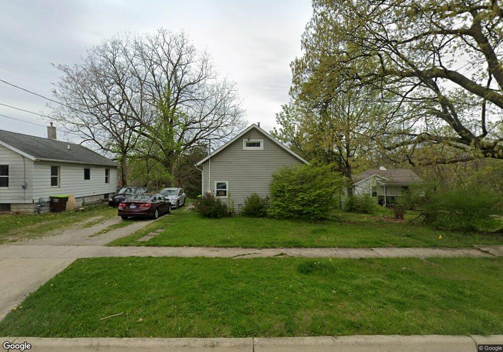
833 Ormsby St Adrian, MI 49221
Estimated Value: $77,000 - $110,000
3
Beds
1
Bath
852
Sq Ft
$109/Sq Ft
Est. Value
About This Home
This home is located at 833 Ormsby St, Adrian, MI 49221 and is currently estimated at $92,673, approximately $108 per square foot. 833 Ormsby St is a home located in Lenawee County with nearby schools including Adrian High School, St. Joseph Academy, and St. Joseph's Academy.
Ownership History
Date
Name
Owned For
Owner Type
Purchase Details
Closed on
Nov 9, 2017
Sold by
Rowe Mark A
Bought by
Rowe Matthew D
Current Estimated Value
Purchase Details
Closed on
May 7, 2015
Sold by
Rowe Matthew D
Bought by
Rowe Matthew D and Rowe Mark A
Purchase Details
Closed on
Feb 13, 2013
Sold by
Rowe David E
Bought by
Rowe David E and Rowe Diane J
Purchase Details
Closed on
Jan 9, 2008
Sold by
The Secretary Of Hud
Bought by
Rowe David E
Purchase Details
Closed on
Nov 30, 2006
Sold by
Chase Home Finance Llc
Bought by
The Secretary Of Hud
Purchase Details
Closed on
Mar 30, 2006
Sold by
Hogsed Richard W and Hogsed Martha E
Bought by
Chase Home Finance Llc
Create a Home Valuation Report for This Property
The Home Valuation Report is an in-depth analysis detailing your home's value as well as a comparison with similar homes in the area
Home Values in the Area
Average Home Value in this Area
Purchase History
| Date | Buyer | Sale Price | Title Company |
|---|---|---|---|
| Rowe Matthew D | -- | None Available | |
| Rowe Matthew D | -- | None Available | |
| Rowe David E | -- | None Available | |
| Rowe David E | $19,800 | None Available | |
| The Secretary Of Hud | -- | None Available | |
| Chase Home Finance Llc | $58,772 | None Available |
Source: Public Records
Tax History
| Year | Tax Paid | Tax Assessment Tax Assessment Total Assessment is a certain percentage of the fair market value that is determined by local assessors to be the total taxable value of land and additions on the property. | Land | Improvement |
|---|---|---|---|---|
| 2025 | $1,260 | $27,700 | $0 | $0 |
| 2024 | $10 | $25,700 | $0 | $0 |
| 2023 | $1,208 | $22,800 | $0 | $0 |
| 2022 | $1,028 | $21,100 | $0 | $0 |
| 2021 | $1,023 | $19,700 | $0 | $0 |
| 2020 | $1,039 | $18,300 | $0 | $0 |
| 2019 | $41,332 | $16,600 | $0 | $0 |
| 2018 | $985 | $19,471 | $0 | $0 |
| 2017 | $849 | $15,170 | $0 | $0 |
| 2016 | $878 | $13,650 | $0 | $0 |
| 2014 | -- | $16,500 | $0 | $0 |
Source: Public Records
Map
Nearby Homes
- 803 Ormsby St
- 717 Bristol St
- 822 Elm St
- 820 Mulberry St
- 417 E Hunt St
- 423 E Butler St
- 612 N Clinton St
- 220 Comstock St
- 229 Clinton St
- 924 Frank St
- 418 E Church St
- 551 French St
- 228 W Church St
- 603 S Center St
- 371 Riverside Ave
- 306 Summer St
- 218 Greenly St
- 333 Greenly St
- 625 Division St
- 227 Greenly St
- 839 Ormsby St
- 903 Ormsby St
- 816 Finch St
- 817 Ormsby St
- 707 Mulberry St
- 836 Ormsby St
- 828 Ormsby St
- 822 Ormsby St
- 516 Seeley St
- 917 Ormsby St
- 917 Ormsby St
- 607 Bristol St
- 910 Comstock St Unit Bldg-Unit
- 910 Comstock St
- 714 Mulberry St
- 523 Bristol St
- 705 Bristol St
- 711 Bristol St
- 517 Bristol St
- 825 Elm St
Your Personal Tour Guide
Ask me questions while you tour the home.