
Seller's Agent in 2025
Justin Marshall
RE/MAX Results
(515) 708-5817
3 in this area
221 Total Sales

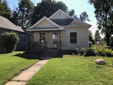
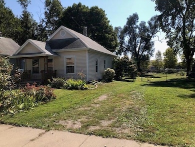
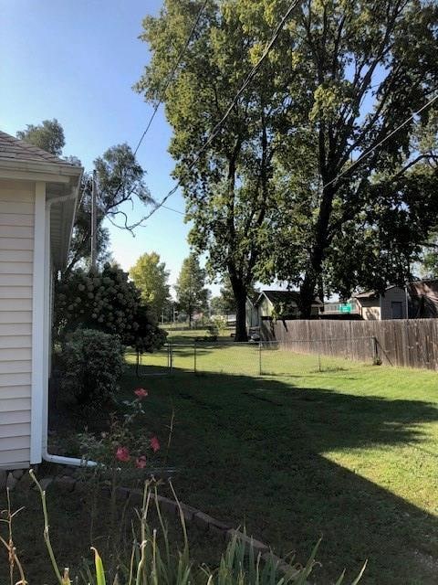
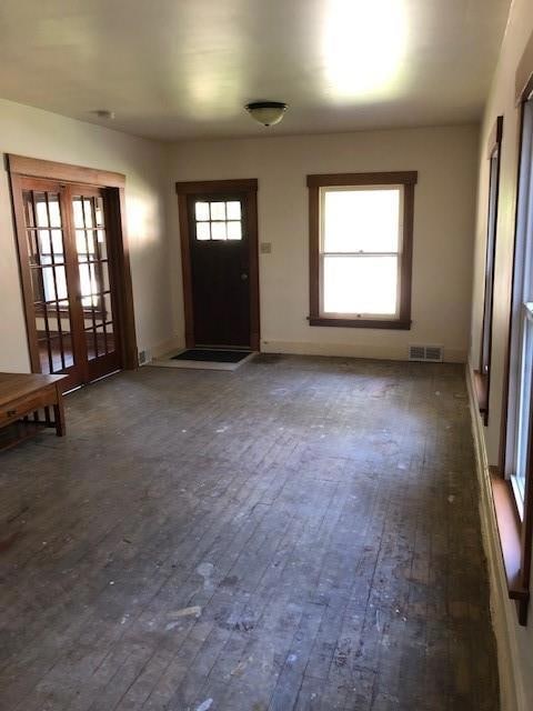
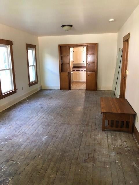
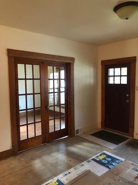
Nicely restored 3 bedroom, 1 full bath home. 1340 square feet of living space on one level, with hardwood floors in the bedrooms. Built in 1885, this home retains much of its old world charm. Set on.366 acres of land, there is plenty of room for a nice sized garden. 3 large out buildings provide ample storage space. Situated just seconds from the Capital, East Village, multiple medical facilities, and freeway access. It even has a solar and wind powered clothes dryer.
| Date | Type | Sale Price | Title Company |
|---|---|---|---|
| Warranty Deed | $175,000 | None Listed On Document | |
| Deed | -- | -- | |
| Interfamily Deed Transfer | -- | None Available | |
| Sheriffs Deed | $70,998 | None Available |
| Date | Status | Loan Amount | Loan Type |
|---|---|---|---|
| Open | $140,000 | New Conventional |
| Date | Event | Price | List to Sale | Price per Sq Ft |
|---|---|---|---|---|
| 11/25/2025 11/25/25 | Sold | $175,000 | 0.0% | $130 / Sq Ft |
| 10/21/2025 10/21/25 | Pending | -- | -- | -- |
| 10/02/2025 10/02/25 | For Sale | $175,000 | -- | $130 / Sq Ft |
| Year | Tax Paid | Tax Assessment Tax Assessment Total Assessment is a certain percentage of the fair market value that is determined by local assessors to be the total taxable value of land and additions on the property. | Land | Improvement |
|---|---|---|---|---|
| 2025 | $1,832 | $108,200 | $23,000 | $85,200 |
| 2024 | $1,832 | $93,100 | $19,800 | $73,300 |
| 2023 | $1,704 | $93,100 | $19,800 | $73,300 |
| 2022 | $1,482 | $72,300 | $15,800 | $56,500 |
| 2021 | $1,360 | $72,300 | $15,800 | $56,500 |
| 2020 | $1,408 | $63,100 | $13,900 | $49,200 |
| 2019 | $1,534 | $63,100 | $13,900 | $49,200 |
| 2018 | $1,514 | $65,600 | $13,100 | $52,500 |
| 2017 | $1,450 | $65,600 | $13,100 | $52,500 |
| 2016 | $1,406 | $62,100 | $12,300 | $49,800 |
| 2015 | $1,406 | $62,100 | $12,300 | $49,800 |
| 2014 | $1,522 | $66,000 | $13,000 | $53,000 |
Seller's Agent in 2025
Justin Marshall
RE/MAX Results
(515) 708-5817
3 in this area
221 Total Sales
Buyer's Agent in 2025
Karla Alaniz
Keller Williams Realty GDM
(515) 897-9027
4 in this area
243 Total Sales
Buyer Co-Listing Agent in 2025
Junior Ibarra
Keller Williams Realty GDM
(515) 417-0624
16 in this area
912 Total Sales
Source: Des Moines Area Association of REALTORS®
MLS Number: 727406
APN: 040-03533001000
Disclaimer: Certain information contained herein is derived from information provided by parties other than Homes.com. All information provided is deemed reliable, but is not guaranteed to be accurate and should be independently verified.
![]() IDX information is provided exclusively for personal, non-commercial use, and may not be used for any purpose other than to identify prospective properties consumers may be interested in purchasing. Information is deemed reliable but not guaranteed.
IDX information is provided exclusively for personal, non-commercial use, and may not be used for any purpose other than to identify prospective properties consumers may be interested in purchasing. Information is deemed reliable but not guaranteed.
Ask me questions while you tour the home.