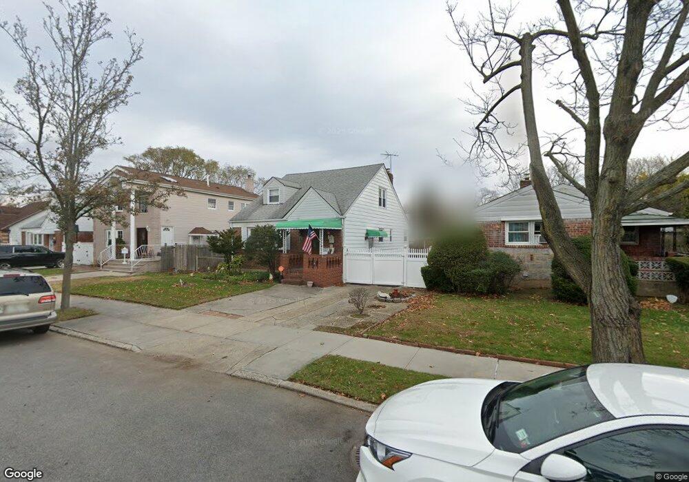
8333 241st St Bellerose, NY 11426
Bellerose NeighborhoodEstimated Value: $736,000 - $968,000
Studio
--
Bath
2,497
Sq Ft
$352/Sq Ft
Est. Value
About This Home
This home is located at 8333 241st St, Bellerose, NY 11426 and is currently estimated at $877,780, approximately $351 per square foot. 8333 241st St is a home located in Queens County with nearby schools including P.S. 18 Q The Winchester School, Irwin Altman Middle School 172, and Martin Van Buren High School.
Ownership History
Date
Name
Owned For
Owner Type
Purchase Details
Closed on
May 15, 2023
Sold by
Carol Turso As Executor and Carol Turso Richard
Bought by
Masnun Samin and Masnun Prachi Ramesha
Current Estimated Value
Home Financials for this Owner
Home Financials are based on the most recent Mortgage that was taken out on this home.
Original Mortgage
$670,500
Outstanding Balance
$649,974
Interest Rate
6.27%
Mortgage Type
Purchase Money Mortgage
Estimated Equity
$227,806
Create a Home Valuation Report for This Property
The Home Valuation Report is an in-depth analysis detailing your home's value as well as a comparison with similar homes in the area
Home Values in the Area
Average Home Value in this Area
Purchase History
| Date | Buyer | Sale Price | Title Company |
|---|---|---|---|
| Masnun Samin | $745,000 | -- | |
| Masnun Samin | $745,000 | -- |
Source: Public Records
Mortgage History
| Date | Status | Borrower | Loan Amount |
|---|---|---|---|
| Open | Masnun Samin | $670,500 | |
| Closed | Masnun Samin | $670,500 |
Source: Public Records
Tax History
| Year | Tax Paid | Tax Assessment Tax Assessment Total Assessment is a certain percentage of the fair market value that is determined by local assessors to be the total taxable value of land and additions on the property. | Land | Improvement |
|---|---|---|---|---|
| 2025 | $7,404 | $39,073 | $13,244 | $25,829 |
| 2024 | $7,404 | $36,864 | $11,039 | $25,825 |
| 2023 | $7,404 | $36,864 | $10,274 | $26,590 |
| 2022 | $5,070 | $42,060 | $13,260 | $28,800 |
| 2021 | $5,448 | $40,020 | $13,260 | $26,760 |
| 2020 | $4,510 | $37,620 | $13,260 | $24,360 |
| 2019 | $4,161 | $39,600 | $13,260 | $26,340 |
| 2018 | $5,603 | $30,720 | $10,591 | $20,129 |
| 2017 | $5,569 | $30,486 | $10,255 | $20,231 |
| 2016 | $5,129 | $30,486 | $10,255 | $20,231 |
| 2015 | $3,030 | $27,134 | $12,338 | $14,796 |
| 2014 | $3,030 | $25,600 | $13,964 | $11,636 |
Source: Public Records
Map
Nearby Homes
- 24120 83rd Ave
- 24125 85th Ave
- 8412 Cross Island Pkwy
- 23913 86th Ave
- 83-27 Commonwealth Blvd
- 8344 247th St
- 24134 87th Ave
- 84-17 247th St
- 83-46 248th St
- 246-04 86th Ave
- 24612 86th Rd
- 246-59 86th Rd
- 84-25 249th St
- 8127 247th St
- 242-27 88th Dr
- 81-24 248th St
- 87-01 Commonwealth Blvd
- 8220 250th St
- 8860 240th St
- 246-62 87th Ave
Your Personal Tour Guide
Ask me questions while you tour the home.