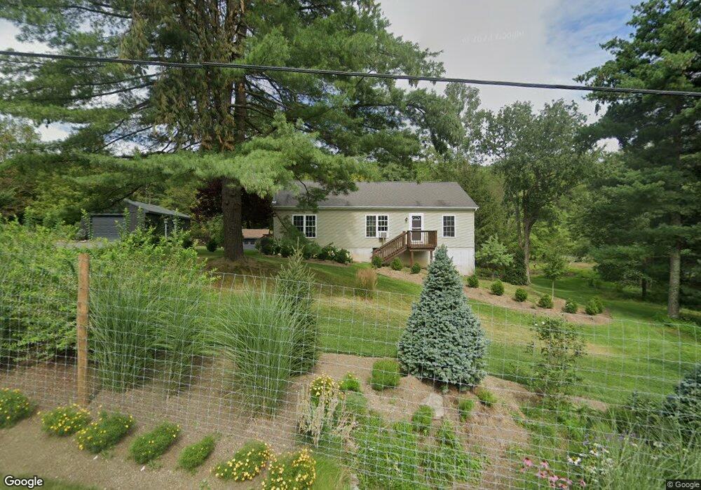
834 County Route 27 Ancram, NY 12502
Estimated Value: $426,711 - $496,000
3
Beds
2
Baths
1,296
Sq Ft
$364/Sq Ft
Est. Value
About This Home
This home is located at 834 County Route 27, Ancram, NY 12502 and is currently estimated at $471,178, approximately $363 per square foot. 834 County Route 27 is a home located in Columbia County with nearby schools including Taconic Hills Elementary School and Taconic Hills Junior/Senior High School.
Ownership History
Date
Name
Owned For
Owner Type
Purchase Details
Closed on
May 7, 2021
Sold by
Grasso Joseph J
Bought by
Campanella Stephen
Current Estimated Value
Purchase Details
Closed on
Dec 13, 2017
Sold by
Schumann Richard P
Bought by
Grasso Joseph
Purchase Details
Closed on
Aug 15, 2007
Sold by
Grasso Joseph
Bought by
Grasso Joseph
Purchase Details
Closed on
Jun 4, 1997
Purchase Details
Closed on
Feb 1, 1996
Sold by
Mele Robert
Bought by
Miller Denise L and Grasso Joseph J
Create a Home Valuation Report for This Property
The Home Valuation Report is an in-depth analysis detailing your home's value as well as a comparison with similar homes in the area
Home Values in the Area
Average Home Value in this Area
Purchase History
| Date | Buyer | Sale Price | Title Company |
|---|---|---|---|
| Campanella Stephen | $323,000 | None Available | |
| Grasso Joseph | $23,000 | -- | |
| Grasso Joseph | -- | -- | |
| -- | -- | -- | |
| Miller Denise L | $46,400 | -- |
Source: Public Records
Tax History Compared to Growth
Tax History
| Year | Tax Paid | Tax Assessment Tax Assessment Total Assessment is a certain percentage of the fair market value that is determined by local assessors to be the total taxable value of land and additions on the property. | Land | Improvement |
|---|---|---|---|---|
| 2024 | $3,945 | $235,000 | $48,000 | $187,000 |
| 2023 | $3,971 | $235,000 | $48,000 | $187,000 |
| 2022 | $4,270 | $235,000 | $48,000 | $187,000 |
| 2021 | $4,270 | $235,000 | $48,000 | $187,000 |
| 2020 | $2,239 | $235,000 | $48,000 | $187,000 |
| 2019 | $1,474 | $165,500 | $44,800 | $120,700 |
| 2018 | $1,474 | $165,500 | $44,800 | $120,700 |
| 2017 | $1,442 | $165,500 | $44,800 | $120,700 |
| 2016 | $2,452 | $165,500 | $44,800 | $120,700 |
| 2015 | -- | $165,500 | $44,800 | $120,700 |
| 2014 | -- | $165,500 | $44,800 | $120,700 |
Source: Public Records
Map
Nearby Homes
- 803 County Route 27
- 1899 County Route 10
- 333 County Route 27
- 0 County Route 10 Unit KEY842732
- Lot 34 County Route 27
- Lot 35 County Route 27
- Lot34&35 County Route 27
- L34 County Route 27
- Lot 34&35 County Route 27
- L34&35 County Route 27
- L35 County Route 27
- 0 County Route 27
- 59 New Forge Road II Unit 1
- 40 Stonewall Ridge Rd
- 472 Doodletown Rd
- 46 Brothers Rd
- Lot 34 Vista Ln
- Lot 34 Route 27
- 63 Cherokee Dr
- 0 Manor Rock Rd Unit KEY824115
- 838 County Route 27
- 842 County Route 27
- 826 County Route 27
- 815 County Route 27
- 839 County Route 27
- 813 County Route 27
- 798 E Cty Rte 27
- 798 County Rte 27
- 798 County Route 27
- 798 - b County Route 27
- 27 County Route 27
- 0 County Route 27
- 797 County Route 27
- 797 County Roue 27
- 778 County Route 27
- 889 County Route 27
- 910 County Route 27
- 595 Pumpkin Hollow Rd
- 723 County Route 27
- 633 Pumpkin Hollow Rd