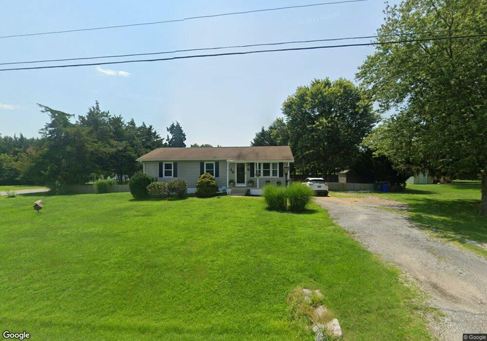
834 Noxontown Rd Townsend, DE 19734
Estimated Value: $266,000 - $359,000
3
Beds
1
Bath
1,056
Sq Ft
$294/Sq Ft
Est. Value
About This Home
This home is located at 834 Noxontown Rd, Townsend, DE 19734 and is currently estimated at $310,796, approximately $294 per square foot. 834 Noxontown Rd is a home located in New Castle County with nearby schools including Townsend Elementary School, Everett Meredith Middle School, and Odessa High School.
Ownership History
Date
Name
Owned For
Owner Type
Purchase Details
Closed on
Sep 12, 2019
Sold by
Buildlex Construction Llc
Bought by
Pederson Kelly
Current Estimated Value
Home Financials for this Owner
Home Financials are based on the most recent Mortgage that was taken out on this home.
Original Mortgage
$210,909
Outstanding Balance
$182,291
Interest Rate
3.7%
Mortgage Type
New Conventional
Estimated Equity
$128,505
Purchase Details
Closed on
Oct 25, 2018
Sold by
Davis Robert H and Legler Nicole Davis
Bought by
Buildlex Construction Llc
Create a Home Valuation Report for This Property
The Home Valuation Report is an in-depth analysis detailing your home's value as well as a comparison with similar homes in the area
Home Values in the Area
Average Home Value in this Area
Purchase History
| Date | Buyer | Sale Price | Title Company |
|---|---|---|---|
| Pederson Kelly | -- | None Available | |
| Buildlex Construction Llc | -- | None Available |
Source: Public Records
Mortgage History
| Date | Status | Borrower | Loan Amount |
|---|---|---|---|
| Open | Pederson Kelly | $210,909 |
Source: Public Records
Tax History
| Year | Tax Paid | Tax Assessment Tax Assessment Total Assessment is a certain percentage of the fair market value that is determined by local assessors to be the total taxable value of land and additions on the property. | Land | Improvement |
|---|---|---|---|---|
| 2025 | $2,198 | $283,200 | $104,400 | $178,800 |
| 2024 | $2,042 | $48,800 | $8,900 | $39,900 |
| 2023 | $1,735 | $48,800 | $8,900 | $39,900 |
| 2022 | $1,748 | $48,800 | $8,900 | $39,900 |
| 2021 | $1,727 | $48,800 | $8,900 | $39,900 |
| 2020 | $1,707 | $48,800 | $8,900 | $39,900 |
| 2019 | $1,580 | $48,800 | $8,900 | $39,900 |
| 2018 | $1,521 | $48,800 | $8,900 | $39,900 |
| 2017 | $303 | $48,800 | $8,900 | $39,900 |
| 2016 | $303 | $48,800 | $8,900 | $39,900 |
| 2015 | $297 | $48,800 | $8,900 | $39,900 |
| 2014 | $296 | $48,800 | $8,900 | $39,900 |
Source: Public Records
Map
Nearby Homes
- 3355 Harris Rd
- 1020 Robinson Rd
- 1019 Robinson Rd
- 1027 Robinson Rd
- 1065 Robinson Rd Unit WHITFIELD RANCH PLAN
- 1063 Robinson Rd Unit WHITFIELD PLAN
- 1067 Robinson Rd Unit LAKELAND PLAN
- 1069 Robinson Rd Unit PEMBROOK PLAN
- 1071 Robinson Rd Unit DELRAY PLAN
- 1105 Kayla Ln
- 929 Robinson Rd
- 413 Janets Way
- 207 Olivine Cir
- 195 Case Rd
- 199 Case Rd
- 203 Case Rd
- 212 Case Rd
- 206 Case Rd
- 208 Case Rd
- 469 Wyatt Dr
- 824 Noxontown Rd
- 4 Minorca Place
- 1 Minorca Place
- 3 Minorca Place
- 5 Minorca Place
- 818 Noxontown Rd
- 6 Minorca Place
- 7 Minorca Place
- 21 Dorking Dr
- 846 Noxontown Rd
- 9 Minorca Place
- 12 Langshaw Ln
- 812 Noxontown Rd
- 16 Langshaw Ln
- 19 Dorking Dr
- 10 Minorca Place
- 11 Minorca Place
- 806 Noxontown Rd
- 18 Dorking Dr
- 20 Langshaw Ln
Your Personal Tour Guide
Ask me questions while you tour the home.