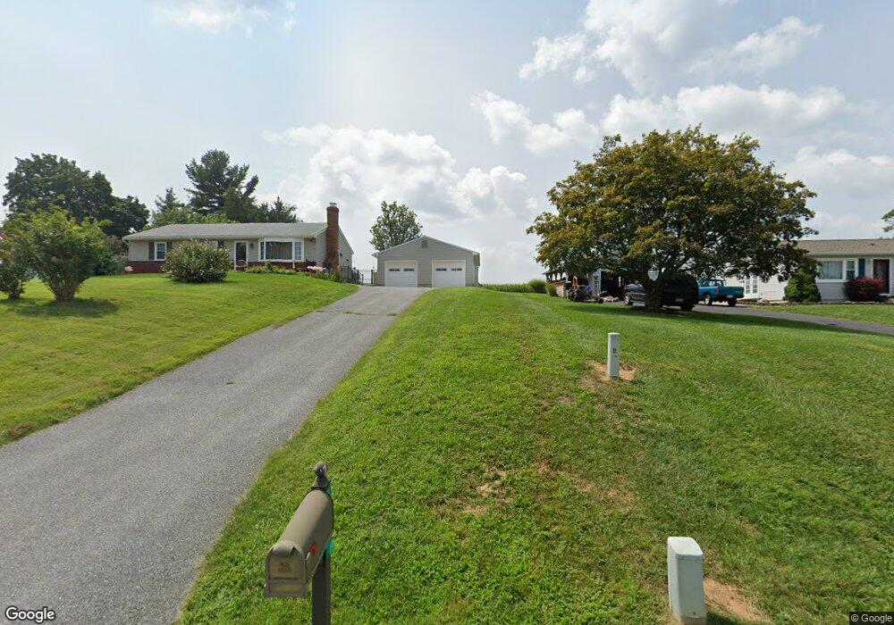
834 Rampart Way Union Bridge, MD 21791
Estimated Value: $302,000 - $352,000
--
Bed
1
Bath
1,092
Sq Ft
$297/Sq Ft
Est. Value
About This Home
This home is located at 834 Rampart Way, Union Bridge, MD 21791 and is currently estimated at $324,715, approximately $297 per square foot. 834 Rampart Way is a home located in Carroll County with nearby schools including Elmer A. Wolfe Elementary School, Northwest Middle School, and Francis Scott Key High School.
Ownership History
Date
Name
Owned For
Owner Type
Purchase Details
Closed on
Nov 4, 1997
Sold by
Howard Earl B
Bought by
Long Brenda I and Harbaugh Bennett M
Current Estimated Value
Purchase Details
Closed on
Mar 15, 1994
Sold by
Warner Arnold C
Bought by
Howard Earl B
Home Financials for this Owner
Home Financials are based on the most recent Mortgage that was taken out on this home.
Original Mortgage
$94,000
Interest Rate
6.93%
Purchase Details
Closed on
Jan 22, 1987
Sold by
Yastrzemsky Charles J
Bought by
Warner Arnold C
Create a Home Valuation Report for This Property
The Home Valuation Report is an in-depth analysis detailing your home's value as well as a comparison with similar homes in the area
Home Values in the Area
Average Home Value in this Area
Purchase History
| Date | Buyer | Sale Price | Title Company |
|---|---|---|---|
| Long Brenda I | $116,000 | -- | |
| Howard Earl B | $117,500 | -- | |
| Warner Arnold C | $89,900 | -- |
Source: Public Records
Mortgage History
| Date | Status | Borrower | Loan Amount |
|---|---|---|---|
| Previous Owner | Howard Earl B | $94,000 |
Source: Public Records
Tax History Compared to Growth
Tax History
| Year | Tax Paid | Tax Assessment Tax Assessment Total Assessment is a certain percentage of the fair market value that is determined by local assessors to be the total taxable value of land and additions on the property. | Land | Improvement |
|---|---|---|---|---|
| 2025 | $2,645 | $249,467 | $0 | $0 |
| 2024 | $2,645 | $220,333 | $0 | $0 |
| 2023 | $2,258 | $191,200 | $86,500 | $104,700 |
| 2022 | $2,237 | $189,267 | $0 | $0 |
| 2021 | $4,657 | $187,333 | $0 | $0 |
| 2020 | $2,232 | $185,400 | $86,500 | $98,900 |
| 2019 | $2,151 | $178,233 | $0 | $0 |
| 2018 | $2,053 | $171,067 | $0 | $0 |
| 2017 | $1,972 | $163,900 | $0 | $0 |
| 2016 | -- | $163,900 | $0 | $0 |
| 2015 | -- | $163,900 | $0 | $0 |
| 2014 | -- | $165,200 | $0 | $0 |
Source: Public Records
Map
Nearby Homes
- 3875 Bark Hill Rd
- 1309 Trevanion Rd
- 4939 Middleburg Rd
- 57B Hoff Rd
- 3459 Uniontown Rd
- 244 Stem Rd
- 285 Stem Rd
- 0 Stem Rd
- 147 Union Bridge Rd
- 11420 Green Valley Rd
- 45 N Main St
- 1624 Baust Church Rd
- 6 N Farquhar St
- 3444 Old Taneytown Rd
- 3824 Old Taneytown Rd
- 430 Bucher John Rd
- 3910 Old Taneytown Rd
- 180 Saddletop Dr
- 172 Saddletop Dr
- 127 Ponytail Ln
- 832 Rampart Way
- 836 Rampart Way
- 838 Rampart Way
- 830 Rampart Way
- 831 Rampart Way
- 833 Rampart Way
- 835 Rampart Way
- 837 Rampart Way
- 840 Rampart Way
- 829 Rampart Way
- 839 Rampart Way
- 828 Rampart Way
- 4166 Middleburg Rd
- 854 Star Ct
- 852 Star Ct
- 856 Star Ct
- 850 Star Ct
- 858 Star Ct
- 860 Star Ct
- 4200 Middleburg Rd