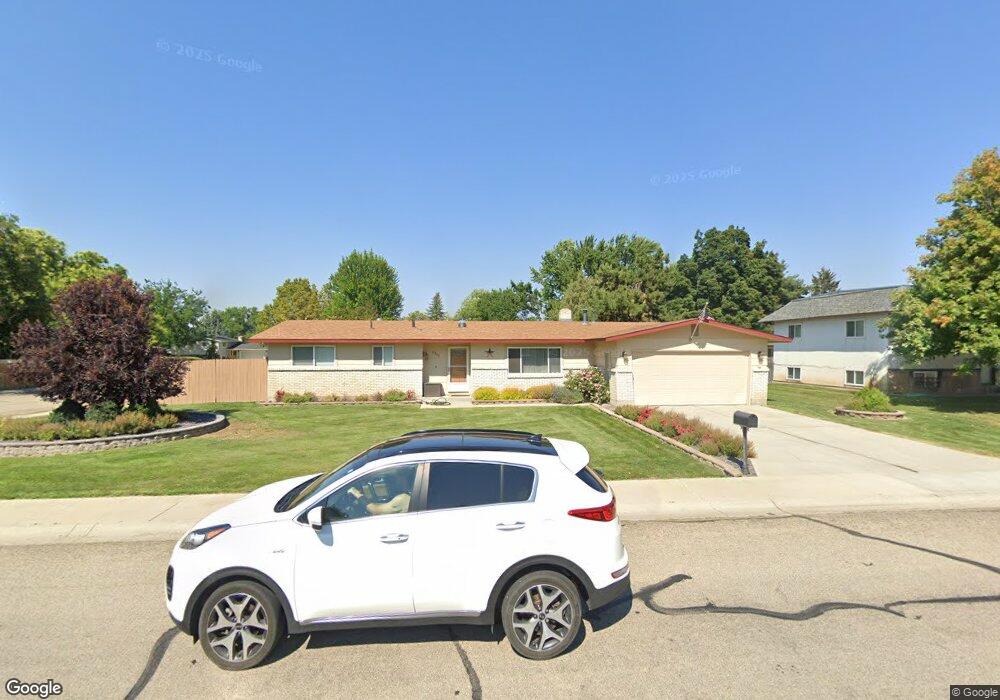
8346 W Pembrook Dr Boise, ID 83704
West Boise NeighborhoodEstimated Value: $420,000 - $488,000
3
Beds
3
Baths
1,554
Sq Ft
$288/Sq Ft
Est. Value
About This Home
This home is located at 8346 W Pembrook Dr, Boise, ID 83704 and is currently estimated at $447,230, approximately $287 per square foot. 8346 W Pembrook Dr is a home located in Ada County with nearby schools including Valley View Elementary School, Fairmont Junior High School, and Capital High School.
Ownership History
Date
Name
Owned For
Owner Type
Purchase Details
Closed on
May 19, 2011
Sold by
Holthaus David C and Holthaus Christine
Bought by
Sparks Sarah R
Current Estimated Value
Home Financials for this Owner
Home Financials are based on the most recent Mortgage that was taken out on this home.
Original Mortgage
$104,500
Outstanding Balance
$72,489
Interest Rate
4.84%
Mortgage Type
New Conventional
Estimated Equity
$374,741
Create a Home Valuation Report for This Property
The Home Valuation Report is an in-depth analysis detailing your home's value as well as a comparison with similar homes in the area
Home Values in the Area
Average Home Value in this Area
Purchase History
| Date | Buyer | Sale Price | Title Company |
|---|---|---|---|
| Sparks Sarah R | -- | Titleone Boise |
Source: Public Records
Mortgage History
| Date | Status | Borrower | Loan Amount |
|---|---|---|---|
| Open | Sparks Sarah R | $104,500 |
Source: Public Records
Tax History Compared to Growth
Tax History
| Year | Tax Paid | Tax Assessment Tax Assessment Total Assessment is a certain percentage of the fair market value that is determined by local assessors to be the total taxable value of land and additions on the property. | Land | Improvement |
|---|---|---|---|---|
| 2025 | $2,042 | $367,200 | -- | -- |
| 2024 | $2,056 | $349,900 | -- | -- |
| 2023 | $2,056 | $340,300 | $0 | $0 |
| 2022 | $2,286 | $388,500 | $0 | $0 |
| 2021 | $1,889 | $297,800 | $0 | $0 |
| 2020 | $1,741 | $246,600 | $0 | $0 |
| 2019 | $1,729 | $227,400 | $0 | $0 |
| 2018 | $1,473 | $193,900 | $0 | $0 |
| 2017 | $1,372 | $171,600 | $0 | $0 |
| 2016 | $1,300 | $158,700 | $0 | $0 |
| 2015 | $1,121 | $145,600 | $0 | $0 |
| 2012 | -- | $108,600 | $0 | $0 |
Source: Public Records
Map
Nearby Homes
- 3841 N Sheringham Dr
- 3731 N Buckingham Dr
- 8466 W Westchester Ave
- 8475 W Westchester Ave
- 3916 N Buckingham Place
- 2952 N Milwaukee
- 3573 N Rugby Dr
- 4216 N Vera St
- 8007 W Scardale Ct
- 8707 W Stynbrook Dr
- 4355 N Christine St
- 8995 W Pembrook Dr
- 7727 W Iron Ct
- 3889 N Maple Grove Rd
- 3084 N Network Ln
- 3760 N Jackie Ln
- 3708 N Jackie Ln
- 8425 W Wyndham Ln
- 3823 N Jackie Ln
- 3019 N Network Ln
- 3820 N Sheringham Dr
- 8330 W Pembrook Dr
- 3721 N Buckingham Dr
- 8408 W Pembrook Dr
- 8347 W Pembrook Dr
- 3830 N Sheringham Dr
- 8403 W Pembrook Dr
- 8333 W Pembrook Dr
- 8413 W Pembrook Dr
- 8323 W Pembrook Dr
- 8422 W Pembrook Dr
- 3710 N Buckingham Dr
- 3710 N Conventry Dr
- 3861 N Sheringham Dr
- 3840 N Sheringham Dr
- 3710 N Coventry Dr
- 3690 N Coventry Dr
- 3720 N Buckingham Dr
- 3730 N Coventry Dr
- 3850 N Sheringham Dr