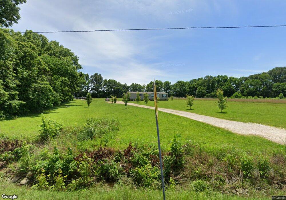
835 Highway 431 Martin, TN 38237
Estimated Value: $173,000 - $311,000
4
Beds
3
Baths
2,176
Sq Ft
$114/Sq Ft
Est. Value
About This Home
This home is located at 835 Highway 431, Martin, TN 38237 and is currently estimated at $249,019, approximately $114 per square foot. 835 Highway 431 is a home with nearby schools including Central Christian Academy and Unity Christian School.
Ownership History
Date
Name
Owned For
Owner Type
Purchase Details
Closed on
Oct 23, 2018
Sold by
Forsythe James
Bought by
Wilson Daniel W and Wilson Rebecca N
Current Estimated Value
Home Financials for this Owner
Home Financials are based on the most recent Mortgage that was taken out on this home.
Original Mortgage
$150,000
Outstanding Balance
$131,087
Interest Rate
4.6%
Mortgage Type
New Conventional
Estimated Equity
$117,932
Purchase Details
Closed on
Dec 1, 2004
Sold by
Kappis Hubanks Efthalia
Bought by
James Forsythe
Purchase Details
Closed on
Jan 25, 2002
Sold by
Theodosis Kappis
Bought by
Hubanks Efthalia K
Create a Home Valuation Report for This Property
The Home Valuation Report is an in-depth analysis detailing your home's value as well as a comparison with similar homes in the area
Home Values in the Area
Average Home Value in this Area
Purchase History
| Date | Buyer | Sale Price | Title Company |
|---|---|---|---|
| Wilson Daniel W | $46,000 | None Available | |
| James Forsythe | $26,000 | -- | |
| Hubanks Efthalia K | $12,000 | -- |
Source: Public Records
Mortgage History
| Date | Status | Borrower | Loan Amount |
|---|---|---|---|
| Open | Wilson Daniel W | $150,000 |
Source: Public Records
Tax History Compared to Growth
Tax History
| Year | Tax Paid | Tax Assessment Tax Assessment Total Assessment is a certain percentage of the fair market value that is determined by local assessors to be the total taxable value of land and additions on the property. | Land | Improvement |
|---|---|---|---|---|
| 2024 | $671 | $48,975 | $14,325 | $34,650 |
| 2023 | $671 | $48,975 | $14,325 | $34,650 |
| 2022 | $639 | $32,400 | $9,775 | $22,625 |
| 2021 | $639 | $32,400 | $9,775 | $22,625 |
| 2020 | $639 | $32,400 | $9,775 | $22,625 |
| 2019 | $193 | $9,775 | $9,775 | $0 |
| 2018 | $193 | $9,775 | $9,775 | $0 |
| 2017 | $181 | $8,500 | $8,500 | $0 |
| 2016 | $181 | $8,500 | $0 | $0 |
| 2015 | $181 | $8,492 | $0 | $0 |
| 2014 | $181 | $8,492 | $0 | $0 |
Source: Public Records
Map
Nearby Homes
- 150 Mimosa Dr
- 492 Cypress Creek Rd
- 1581 Tennessee 431
- 142 Glenwood Dr
- 137 Courtright Rd
- 933 University St
- 206 S Dodd Dr
- 920 University St
- 0 Hawks Rd Unit Brooks
- 157 Mockingbird Ln
- 2051 Tennessee 431
- 0 University St Unit 2504446
- 304 Tyler Austin Rd
- 0 Skyhawk Pkwy Unit Brooks RRA45195
- 102 Cherry Dr
- 126 Lilly Pond Ln
- 110 3 Point Rd
- 0 Kennedy Dr Unit RRA40830
- 0 Kennedy Dr Unit 187533
- 338 Mount Pelia Rd
- 905 Tennessee 431
- 815 Highway 431
- 905 Highway 431
- 815 Tennessee 431
- 820 Highway 431
- 150 Garner Rd
- 951 Highway 431
- 965 Highway 431
- 965 Highway 431
- 171 Garner Rd
- 183 Garner Rd
- 1022 Highway 431
- 1066 Highway 431
- 1068 Highway 431
- 217 Barger Rd
- 330 Barger Rd Unit 360
- 163 Barger Rd
- 255 Garner Rd
- 660 Highway 431
- 153 Mimosa Dr