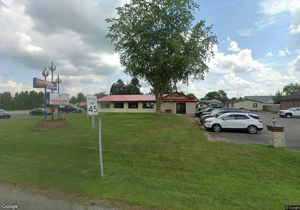
835 N State Road 25 Rochester, IN 46975
Estimated Value: $203,000 - $437,000
--
Bed
--
Bath
1,456
Sq Ft
$220/Sq Ft
Est. Value
About This Home
This home is located at 835 N State Road 25, Rochester, IN 46975 and is currently estimated at $320,516, approximately $220 per square foot. 835 N State Road 25 is a home located in Fulton County with nearby schools including Columbia Elementary School, George M. Riddle Elementary School, and Rochester Community Middle School.
Ownership History
Date
Name
Owned For
Owner Type
Purchase Details
Closed on
May 28, 2021
Sold by
Moonlight Wine & Dine Llc
Bought by
Nejazi Asani
Current Estimated Value
Home Financials for this Owner
Home Financials are based on the most recent Mortgage that was taken out on this home.
Interest Rate
2.95%
Purchase Details
Closed on
May 8, 2013
Sold by
Raymond Beck
Bought by
Holt W Harding
Purchase Details
Closed on
Mar 23, 2010
Sold by
Walker Conley Sheriff
Bought by
Stephen Na
Create a Home Valuation Report for This Property
The Home Valuation Report is an in-depth analysis detailing your home's value as well as a comparison with similar homes in the area
Home Values in the Area
Average Home Value in this Area
Purchase History
| Date | Buyer | Sale Price | Title Company |
|---|---|---|---|
| Nejazi Asani | $195,000 | -- | |
| Holt W Harding | $170,000 | Fretz Abstract | |
| Stephen Na | $213,000 | -- |
Source: Public Records
Mortgage History
| Date | Status | Borrower | Loan Amount |
|---|---|---|---|
| Closed | Nejazi Asani | -- |
Source: Public Records
Tax History Compared to Growth
Tax History
| Year | Tax Paid | Tax Assessment Tax Assessment Total Assessment is a certain percentage of the fair market value that is determined by local assessors to be the total taxable value of land and additions on the property. | Land | Improvement |
|---|---|---|---|---|
| 2024 | $4,271 | $195,800 | $39,300 | $156,500 |
| 2023 | $3,977 | $186,100 | $39,300 | $146,800 |
| 2022 | $3,631 | $170,300 | $39,300 | $131,000 |
| 2021 | $6,024 | $257,900 | $39,300 | $218,600 |
| 2020 | $5,902 | $245,300 | $39,300 | $206,000 |
| 2019 | $5,708 | $245,300 | $39,300 | $206,000 |
| 2018 | $6,665 | $280,500 | $39,300 | $241,200 |
| 2017 | $6,336 | $275,900 | $39,300 | $236,600 |
| 2016 | $6,512 | $276,500 | $39,300 | $237,200 |
| 2014 | $5,606 | $271,700 | $39,300 | $232,400 |
| 2013 | $5,606 | $267,400 | $39,300 | $228,100 |
Source: Public Records
Map
Nearby Homes
- 1620 Colonial Dr
- 2124 Boulevard St
- 2215 E State Road 14
- 2415 Barrett Rd
- 908 Arthur St
- 1150 Hill St
- 1349 Mitchell Dr
- Integrity 2060 Plan at Old Orchard Estates - Integrity
- 4555 Indiana 25
- 2807 Barrett Rd
- 640 E 12th St
- 1529 College Ave
- Island 2
- 1040 E 4th St
- 2122 Wolfs Point Dr
- 605 Man-Chester Dr
- 3213 Barrett Rd
- 3215 Barrett Rd
- 1316 Franklin St
- 467 Man-Chester Dr
- 3018 Wabash Ave
- 825 N State Road 25
- 0 N S R 25 Unit 814509
- 0 N S R 25 Unit 814626
- 0 N S R 25 Unit 814583
- 1716 E State Road 14
- 1703 E 9th St
- 1735 Colonial Dr
- 1610 Northshore Dr
- tbd Indiana 14
- 1612 Northshore Dr
- 1535 E 9th St
- 1535 E 9th St Unit Lot 7
- 1535 E 9th St Unit 28
- 1535 E 9th St Unit Lot 1
- 1535 E 9th St Unit 2
- 720 N State Road 25
- 1700 Colonial Dr
- 1707 Colonial Dr
- 1601 Vfw Dr
