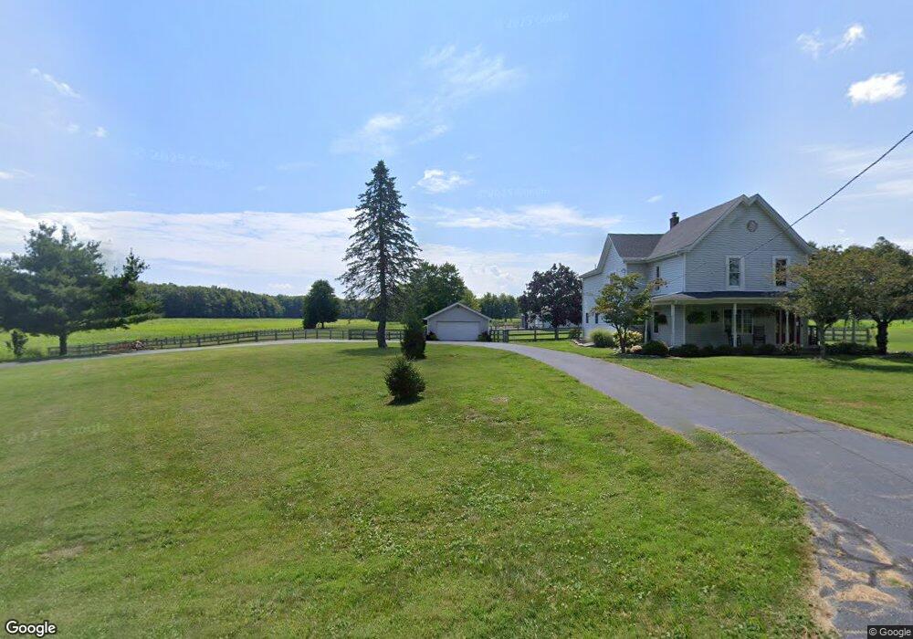
8353 State Route 730 Clarksville, OH 45113
Estimated Value: $440,000 - $511,000
4
Beds
2
Baths
2,752
Sq Ft
$172/Sq Ft
Est. Value
About This Home
This home is located at 8353 State Route 730, Clarksville, OH 45113 and is currently estimated at $474,464, approximately $172 per square foot. 8353 State Route 730 is a home located in Clinton County with nearby schools including Clinton-Massie Elementary School, Clinton-Massie Middle School, and Clinton-Massie High School.
Ownership History
Date
Name
Owned For
Owner Type
Purchase Details
Closed on
Nov 6, 2014
Sold by
Flint Ronald D and Flint Arlene F
Bought by
King Kellen
Current Estimated Value
Home Financials for this Owner
Home Financials are based on the most recent Mortgage that was taken out on this home.
Original Mortgage
$100,000
Outstanding Balance
$77,137
Interest Rate
4.19%
Mortgage Type
New Conventional
Estimated Equity
$397,327
Purchase Details
Closed on
Jan 1, 1990
Bought by
Flint Ronald D and Flint Arlene F
Create a Home Valuation Report for This Property
The Home Valuation Report is an in-depth analysis detailing your home's value as well as a comparison with similar homes in the area
Home Values in the Area
Average Home Value in this Area
Purchase History
| Date | Buyer | Sale Price | Title Company |
|---|---|---|---|
| King Kellen | $240,000 | Attorney | |
| Flint Ronald D | -- | -- |
Source: Public Records
Mortgage History
| Date | Status | Borrower | Loan Amount |
|---|---|---|---|
| Open | King Kellen | $100,000 |
Source: Public Records
Tax History Compared to Growth
Tax History
| Year | Tax Paid | Tax Assessment Tax Assessment Total Assessment is a certain percentage of the fair market value that is determined by local assessors to be the total taxable value of land and additions on the property. | Land | Improvement |
|---|---|---|---|---|
| 2024 | $3,757 | $110,460 | $30,800 | $79,660 |
| 2023 | $3,757 | $110,460 | $30,800 | $79,660 |
| 2022 | $5,381 | $67,490 | $13,300 | $54,190 |
| 2021 | $5,303 | $67,490 | $13,300 | $54,190 |
| 2020 | $4,834 | $67,490 | $13,300 | $54,190 |
| 2019 | $3,226 | $58,320 | $15,380 | $42,940 |
| 2018 | $3,219 | $58,320 | $15,380 | $42,940 |
| 2017 | $1,021 | $58,320 | $15,380 | $42,940 |
| 2016 | $2,084 | $59,340 | $17,370 | $41,970 |
| 2015 | $2,187 | $59,340 | $17,370 | $41,970 |
| 2013 | $1,829 | $58,740 | $17,370 | $41,370 |
Source: Public Records
Map
Nearby Homes
- 6182 Ohio 730
- 4347 Ohio 350
- 9132 St Rt 730
- 9132 State Route 730
- 0 Old State Rd Unit 1849352
- 279 Frances Dr
- 6182 State Route 730
- 450 Pansy Rd
- 216 Pansy Rd
- 1623 Reeder Rd
- 9356 Ohio 350
- 1896 Reeder Rd
- 582 Nauvoo Rd
- 1211 Pratt Rd
- 21 Kimlor Ln
- 1056 Halpin Rd
- 963 Pratt Rd
- 2211 Reeder Rd
- 104 Linton Ave
- 420 Kensington Dr
- 8353 State Route 730
- 8374 State Route 730
- 9189 Ohio 730
- 346 Baker Rd
- 201 Baker Rd
- 10 Baker Rd
- 260 Baker Rd
- 8176 State Route 730
- 8100 State Route 730
- 4421 Ohio 350
- 4421 State Route 350
- 4391 State Route 350
- 4285 State Route 350
- 8044 State Route 730
- 8689 State Route 730
- 7992 Ohio 730
- 4507 State Route 350
- 4507 State Route 350
- 350 Sr
- 7992 State Route 730