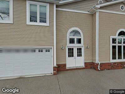
8358 Colony Dr Clay, MI 48001
Pearl Beach NeighborhoodEstimated Value: $616,000 - $913,000
3
Beds
3
Baths
2,100
Sq Ft
$377/Sq Ft
Est. Value
About This Home
This home is located at 8358 Colony Dr, Clay, MI 48001 and is currently estimated at $791,961, approximately $377 per square foot. 8358 Colony Dr is a home located in St. Clair County with nearby schools including Algonac Junior/Senior High School.
Ownership History
Date
Name
Owned For
Owner Type
Purchase Details
Closed on
Dec 16, 2013
Sold by
Sucharski Robert and Robinson Ronda
Bought by
Robert A Sucharski & Ronda R Robinson Re
Current Estimated Value
Purchase Details
Closed on
May 19, 2010
Sold by
Miller Erika B and Dabringhaus Erika B
Bought by
Robinson Ronda and Sucharski Robert
Home Financials for this Owner
Home Financials are based on the most recent Mortgage that was taken out on this home.
Original Mortgage
$216,000
Interest Rate
5.14%
Mortgage Type
New Conventional
Create a Home Valuation Report for This Property
The Home Valuation Report is an in-depth analysis detailing your home's value as well as a comparison with similar homes in the area
Home Values in the Area
Average Home Value in this Area
Purchase History
| Date | Buyer | Sale Price | Title Company |
|---|---|---|---|
| Robert A Sucharski & Ronda R Robinson Re | -- | None Available | |
| Robinson Ronda | $270,000 | Title One Inc |
Source: Public Records
Mortgage History
| Date | Status | Borrower | Loan Amount |
|---|---|---|---|
| Open | Robinson Ronda | $219,000 | |
| Closed | Robinson Ronda | $216,000 |
Source: Public Records
Tax History Compared to Growth
Tax History
| Year | Tax Paid | Tax Assessment Tax Assessment Total Assessment is a certain percentage of the fair market value that is determined by local assessors to be the total taxable value of land and additions on the property. | Land | Improvement |
|---|---|---|---|---|
| 2024 | $4,768 | $406,200 | $0 | $0 |
| 2023 | $4,593 | $334,900 | $0 | $0 |
| 2022 | $7,561 | $312,100 | $0 | $0 |
| 2021 | $7,146 | $294,000 | $0 | $0 |
| 2020 | $7,071 | $270,000 | $270,000 | $0 |
| 2019 | $6,959 | $255,900 | $0 | $0 |
| 2018 | $6,838 | $153,000 | $0 | $0 |
| 2017 | $3,915 | $142,300 | $0 | $0 |
| 2016 | $2,327 | $142,300 | $0 | $0 |
| 2015 | -- | $132,600 | $132,600 | $0 |
| 2014 | -- | $125,500 | $125,500 | $0 |
| 2013 | -- | $118,100 | $0 | $0 |
Source: Public Records
Map
Nearby Homes
- 7303 Audubon St
- 7249 Bluebill St
- 7213 Cardinal Rd
- 7208 Bluebill St
- 7275 Riverside Dr
- 6507 Dyke Rd
- 6435 Marina Dr
- 6560 Dickinson Island
- 8180 Anchor Bay Dr
- 10368 Saint John Dr
- 10215 Saint John Dr
- 10139 Saint John Dr
- 10125 Saint John Dr
- 9996 Tashmoo Ln
- 9994 Tashmoo Ln Unit 3
- 7931 Anchor Bay Dr
- 5536 Pointe Tremble Rd
- 7434 Dyke Rd
- 5218 Pointe Tremble Rd
- 9532 Anchor Dr Unit 125
- 8358 Colony Dr
- 8363 Colony Dr
- 8359 Colony Dr
- 8357 Colony Dr
- 8364 Colony Dr
- 8353 Colony Dr
- 8360 Colony Dr
- 8351 Colony Dr
- 8362 Colony Dr
- 8361 Colony Dr
- 8345 Colony Dr
- 7287 Flamingo St
- 7289 Flamingo St
- 7301 Cardinal St
- 7291 Flamingo St
- 7285 Flamingo St
- 7298 Cardinal St
- 7293 Flamingo St
- 8366 Colony Dr
- 7283 Flamingo St