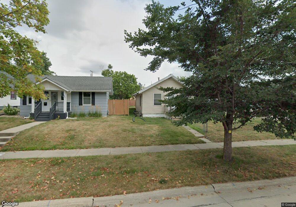
836 12th St NE Cedar Rapids, IA 52402
Mound View NeighborhoodEstimated Value: $103,098 - $121,000
2
Beds
1
Bath
696
Sq Ft
$161/Sq Ft
Est. Value
About This Home
This home is located at 836 12th St NE, Cedar Rapids, IA 52402 and is currently estimated at $112,025, approximately $160 per square foot. 836 12th St NE is a home located in Linn County with nearby schools including Garfield Elementary School, Franklin Middle School, and George Washington High School.
Ownership History
Date
Name
Owned For
Owner Type
Purchase Details
Closed on
Aug 23, 2013
Sold by
Barnhart Michael David and Barnhart Jessica
Bought by
Barnhart Jessica
Current Estimated Value
Purchase Details
Closed on
May 28, 2004
Sold by
Mango Investments Llc
Bought by
Long Jessica
Home Financials for this Owner
Home Financials are based on the most recent Mortgage that was taken out on this home.
Original Mortgage
$77,250
Outstanding Balance
$37,364
Interest Rate
6.06%
Mortgage Type
New Conventional
Estimated Equity
$74,661
Create a Home Valuation Report for This Property
The Home Valuation Report is an in-depth analysis detailing your home's value as well as a comparison with similar homes in the area
Home Values in the Area
Average Home Value in this Area
Purchase History
| Date | Buyer | Sale Price | Title Company |
|---|---|---|---|
| Barnhart Jessica | -- | None Available | |
| Long Jessica | $78,500 | -- |
Source: Public Records
Mortgage History
| Date | Status | Borrower | Loan Amount |
|---|---|---|---|
| Open | Long Jessica | $77,250 |
Source: Public Records
Tax History Compared to Growth
Tax History
| Year | Tax Paid | Tax Assessment Tax Assessment Total Assessment is a certain percentage of the fair market value that is determined by local assessors to be the total taxable value of land and additions on the property. | Land | Improvement |
|---|---|---|---|---|
| 2025 | $1,320 | $91,200 | $23,000 | $68,200 |
| 2024 | $1,386 | $85,100 | $20,700 | $64,400 |
| 2023 | $1,386 | $85,100 | $20,700 | $64,400 |
| 2022 | $1,194 | $74,600 | $19,600 | $55,000 |
| 2021 | $1,266 | $66,600 | $16,100 | $50,500 |
| 2020 | $1,266 | $66,000 | $16,100 | $49,900 |
| 2019 | $1,204 | $64,400 | $16,100 | $48,300 |
| 2018 | $1,168 | $64,400 | $16,100 | $48,300 |
| 2017 | $1,106 | $59,300 | $16,100 | $43,200 |
| 2016 | $1,303 | $61,300 | $16,100 | $45,200 |
| 2015 | $1,383 | $65,038 | $16,100 | $48,938 |
| 2014 | $1,198 | $68,375 | $16,100 | $52,275 |
| 2013 | $1,238 | $68,375 | $16,100 | $52,275 |
Source: Public Records
Map
Nearby Homes
- 832 Daniels St NE
- 826 Daniels St NE
- 1046 12th St NE
- 910 Maplewood Dr NE
- 2011 Sierra Cir NE
- 2015 Sierra Cir NE
- 2019 Sierra Cir NE
- 2000 Sierra Cir NE
- 2006 Sierra Cir NE
- 2023 Sierra Cir NE
- 2012 Sierra Cir NE
- 2103 Sierra Cir NE
- 2018 Sierra Cir NE
- 2109 Sierra Cir NE
- 2115 Sierra Cir NE
- 2102 Sierra Cir NE
- 2110 Sierra Cir NE
- 2121 Sierra Cir NE
- 2127 Sierra Cir NE
- 2116 Sierra Cir NE
- 840 12th St NE
- 1210 Lincoln Ave NE
- 844 12th St NE
- 828 12th St NE
- 848 12th St NE
- 822 12th St NE
- 839 Center Point Rd NE
- 835 12th St NE
- 845 Center Point Rd NE
- 839 12th St NE
- 818 12th St NE
- 856 12th St NE
- 843 12th St NE
- 829 12th St NE
- 847 12th St NE
- 851 Center Point Rd NE
- 816 12th St NE
- 823 12th St NE
- 860 12th St NE
- 855 Center Point Rd NE