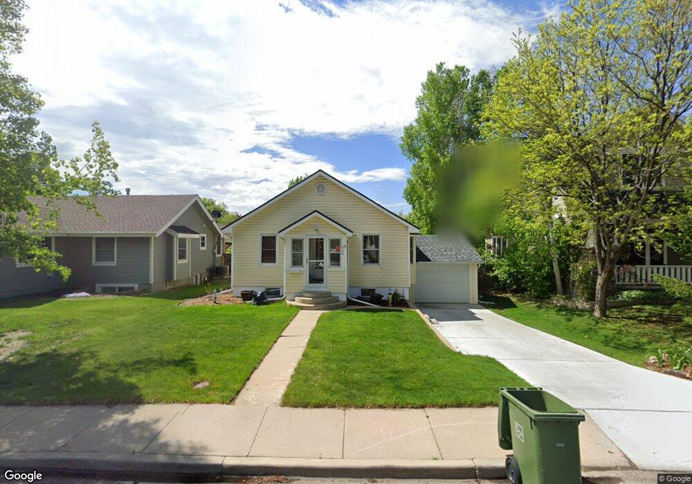
836 W 6th St Loveland, CO 80537
Estimated Value: $450,952 - $552,000
3
Beds
2
Baths
952
Sq Ft
$520/Sq Ft
Est. Value
About This Home
This home is located at 836 W 6th St, Loveland, CO 80537 and is currently estimated at $495,488, approximately $520 per square foot. 836 W 6th St is a home located in Larimer County with nearby schools including Garfield Elementary School, Bill Reed Middle School, and Loveland High School.
Ownership History
Date
Name
Owned For
Owner Type
Purchase Details
Closed on
Oct 14, 2021
Sold by
Briles Kristi J and Terry G Quist Trust
Bought by
Quint Residence Trust
Current Estimated Value
Home Financials for this Owner
Home Financials are based on the most recent Mortgage that was taken out on this home.
Original Mortgage
$222,000
Outstanding Balance
$202,443
Interest Rate
2.8%
Mortgage Type
New Conventional
Estimated Equity
$293,045
Purchase Details
Closed on
Jan 1, 1988
Bought by
Krening James M and Krening Larke A
Create a Home Valuation Report for This Property
The Home Valuation Report is an in-depth analysis detailing your home's value as well as a comparison with similar homes in the area
Home Values in the Area
Average Home Value in this Area
Purchase History
| Date | Buyer | Sale Price | Title Company |
|---|---|---|---|
| Quint Residence Trust | -- | None Available | |
| Krening James M | $53,500 | -- |
Source: Public Records
Mortgage History
| Date | Status | Borrower | Loan Amount |
|---|---|---|---|
| Open | Quint Residence Trust | $222,000 |
Source: Public Records
Tax History Compared to Growth
Tax History
| Year | Tax Paid | Tax Assessment Tax Assessment Total Assessment is a certain percentage of the fair market value that is determined by local assessors to be the total taxable value of land and additions on the property. | Land | Improvement |
|---|---|---|---|---|
| 2025 | $2,354 | $33,178 | $3,417 | $29,761 |
| 2024 | $2,270 | $33,178 | $3,417 | $29,761 |
| 2022 | $2,053 | $25,799 | $3,545 | $22,254 |
| 2021 | $2,109 | $26,541 | $3,647 | $22,894 |
| 2020 | $1,810 | $22,759 | $3,647 | $19,112 |
| 2019 | $1,779 | $22,759 | $3,647 | $19,112 |
| 2018 | $1,583 | $19,238 | $3,672 | $15,566 |
| 2017 | $1,363 | $19,238 | $3,672 | $15,566 |
| 2016 | $1,289 | $17,568 | $4,060 | $13,508 |
| 2015 | $1,278 | $17,570 | $4,060 | $13,510 |
| 2014 | $1,202 | $15,980 | $4,060 | $11,920 |
Source: Public Records
Map
Nearby Homes
- 914 W 6th St
- 610 California Ave
- 680 Colorado Ave
- 610 W 5th St
- 633 W 6th St
- 721 Sheridan Ave
- 604 W 9th St
- 720 Roosevelt Ave
- 1330 W 6th St
- 625 Harrison Ave
- 643 W 10th St
- 905 Harrison Ave
- 1016 Winona Cir
- 1100 N Taft Ave Unit 27
- 143 W 2nd St
- 1667 Taft Gardens Cir
- 1658 Taft Gardens Cir
- 416 W 12th St
- 1100 Taft Ave
- 1100 Taft Ave Unit 46