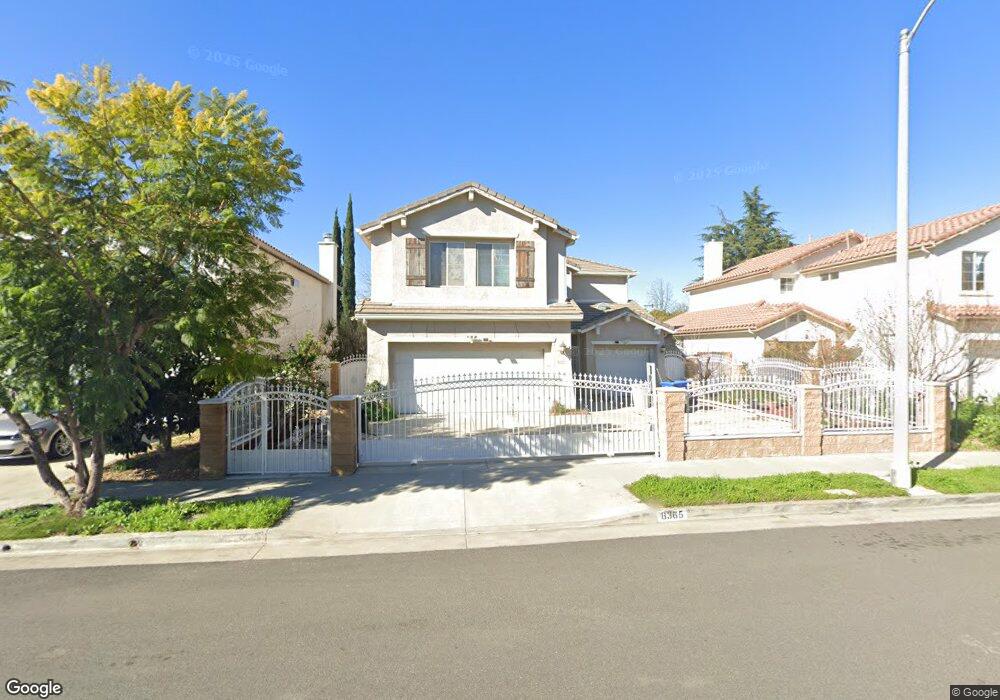
8365 Independence Ave Canoga Park, CA 91304
Canoga Park NeighborhoodEstimated Value: $919,000 - $1,036,000
3
Beds
3
Baths
2,285
Sq Ft
$420/Sq Ft
Est. Value
About This Home
This home is located at 8365 Independence Ave, Canoga Park, CA 91304 and is currently estimated at $959,946, approximately $420 per square foot. 8365 Independence Ave is a home located in Los Angeles County with nearby schools including Limerick Avenue Elementary School, Christopher Columbus Middle School, and Ernest Lawrence Middle School.
Ownership History
Date
Name
Owned For
Owner Type
Purchase Details
Closed on
Nov 15, 2005
Sold by
Giang Hoa Lap and Phung Jeannie
Bought by
Giang Hoa Lap
Current Estimated Value
Purchase Details
Closed on
Oct 30, 2003
Sold by
Giang Hoa Lap
Bought by
Giang Hoa Lap
Purchase Details
Closed on
Apr 10, 2003
Sold by
Canoga 15 Llc
Bought by
Giang Hoa Lap
Home Financials for this Owner
Home Financials are based on the most recent Mortgage that was taken out on this home.
Original Mortgage
$100,000
Interest Rate
5.84%
Create a Home Valuation Report for This Property
The Home Valuation Report is an in-depth analysis detailing your home's value as well as a comparison with similar homes in the area
Home Values in the Area
Average Home Value in this Area
Purchase History
| Date | Buyer | Sale Price | Title Company |
|---|---|---|---|
| Giang Hoa Lap | -- | -- | |
| Giang Hoa Lap | -- | -- | |
| Giang Hoa Lap | $369,000 | Lawyers Title |
Source: Public Records
Mortgage History
| Date | Status | Borrower | Loan Amount |
|---|---|---|---|
| Closed | Giang Hoa Lap | $100,000 |
Source: Public Records
Tax History Compared to Growth
Tax History
| Year | Tax Paid | Tax Assessment Tax Assessment Total Assessment is a certain percentage of the fair market value that is determined by local assessors to be the total taxable value of land and additions on the property. | Land | Improvement |
|---|---|---|---|---|
| 2025 | $6,570 | $534,410 | $306,020 | $228,390 |
| 2024 | $6,570 | $523,932 | $300,020 | $223,912 |
| 2023 | $6,443 | $513,660 | $294,138 | $219,522 |
| 2022 | $6,142 | $503,589 | $288,371 | $215,218 |
| 2021 | $6,054 | $493,716 | $282,717 | $210,999 |
| 2019 | $5,871 | $479,075 | $274,333 | $204,742 |
| 2018 | $5,801 | $469,682 | $268,954 | $200,728 |
| 2016 | $5,524 | $451,446 | $258,511 | $192,935 |
| 2015 | $5,443 | $444,665 | $254,628 | $190,037 |
| 2014 | $5,464 | $435,956 | $249,641 | $186,315 |
Source: Public Records
Map
Nearby Homes
- 21050 Community St
- 20920 Community St Unit 7
- 20951 Roscoe Blvd
- 8341 De Soto Ave Unit 10
- 20921 Community St Unit 12
- 20851 Community St Unit 10
- 21219 Roscoe Blvd Unit 211
- 8328 N Cooper Place
- 20807 Roscoe Blvd Unit 1
- 21315 Community St
- 8540 De Soto Ave Unit 49
- 8558 De Soto Ave Unit 41
- 8575 Independence Ave Unit 11
- 20737 Roscoe Blvd Unit 301
- 8565 Independence Ave Unit 7
- 21305 Chase St
- 8359 Deering Ave
- 21032 Baltar St
- 21126 Bryant St
- 20838 Bryant St
- 8371 Independence Ave
- 8359 Independence Ave
- 8377 Independence Ave
- 8353 Independence Ave
- 21018 Community St
- 8364 Independence Ave
- 8358 Independence Ave
- 8370 Independence Ave
- 8376 Independence Ave
- 8352 Independence Ave
- 21023 Schoenborn St
- 21024 Community St
- 8401 Independence Ave
- 21012 Schoenborn St
- 21006 Schoenborn St
- 21029 Schoenborn St
- 21028 Community St
- 20944 Community St
- 20949 Schoenborn St
- 21000 Schoenborn St