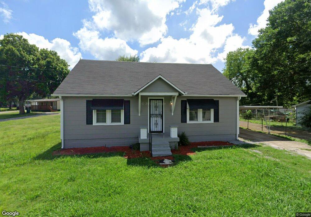
837 Martin Ln Pulaski, TN 38478
Estimated Value: $132,000 - $175,000
--
Bed
--
Bath
1,189
Sq Ft
$132/Sq Ft
Est. Value
About This Home
This home is located at 837 Martin Ln, Pulaski, TN 38478 and is currently estimated at $156,422, approximately $131 per square foot. 837 Martin Ln is a home with nearby schools including Pulaski Elementary School, Southside Elementary School, and Bridgeforth Middle School.
Ownership History
Date
Name
Owned For
Owner Type
Purchase Details
Closed on
Dec 24, 2019
Sold by
Bugg Kimberly N
Bought by
Franklin Hardin and Franklin Fordie
Current Estimated Value
Purchase Details
Closed on
Jan 31, 2019
Sold by
Bugg Kimberly N
Bought by
Pranklin Hardin C and Pranklin Fordie
Purchase Details
Closed on
May 5, 2014
Sold by
Martin Darrell Glen
Bought by
Bugg Kimberly N
Purchase Details
Closed on
Aug 8, 2013
Sold by
Bugg Joseph Monroe
Bought by
Martin Darrell Glen
Purchase Details
Closed on
Nov 17, 1997
Sold by
Martin Fred and Martin Florence
Bought by
Bugg Joseph M and Bugg Lucille
Purchase Details
Closed on
Jun 26, 1986
Bought by
Martin Fred and Florence Alberta
Purchase Details
Closed on
Jan 1, 1948
Create a Home Valuation Report for This Property
The Home Valuation Report is an in-depth analysis detailing your home's value as well as a comparison with similar homes in the area
Home Values in the Area
Average Home Value in this Area
Purchase History
| Date | Buyer | Sale Price | Title Company |
|---|---|---|---|
| Franklin Hardin | $8,000 | None Available | |
| Pranklin Hardin C | $4,000 | -- | |
| Pranklin Hardin C | $4,000 | None Listed On Document | |
| Bugg Kimberly N | -- | -- | |
| Martin Darrell Glen | -- | -- | |
| Bugg Joseph M | $22,500 | -- | |
| Martin Fred | -- | -- | |
| -- | -- | -- |
Source: Public Records
Tax History Compared to Growth
Tax History
| Year | Tax Paid | Tax Assessment Tax Assessment Total Assessment is a certain percentage of the fair market value that is determined by local assessors to be the total taxable value of land and additions on the property. | Land | Improvement |
|---|---|---|---|---|
| 2024 | $608 | $25,250 | $4,125 | $21,125 |
| 2023 | $608 | $25,250 | $4,125 | $21,125 |
| 2022 | $301 | $12,500 | $4,125 | $8,375 |
| 2021 | $215 | $6,350 | $1,375 | $4,975 |
| 2020 | $215 | $6,350 | $1,375 | $4,975 |
| 2019 | $290 | $10,250 | $1,375 | $8,875 |
| 2018 | $348 | $10,250 | $1,375 | $8,875 |
| 2017 | $348 | $10,250 | $1,375 | $8,875 |
| 2016 | $358 | $10,100 | $1,375 | $8,725 |
| 2015 | $337 | $10,100 | $1,375 | $8,725 |
| 2014 | $337 | $10,097 | $0 | $0 |
Source: Public Records
Map
Nearby Homes
- 0 Maple St
- 525 Culpepper St Extended
- 630 Marietta St
- 808 N 1st St
- 320 Park St
- 617 Childers St
- 600 Childers St
- 140 Phillips St
- 528 Maple St
- 124 Chestnut St
- 0 Marietta St
- 418 Jones St
- 403 Victoria St
- 958 Dollar Hollow Rd
- 613 Mcgrew St
- 116 E Woodring St
- 1400 Ragsdale Ln
- 0 Sumpter St
- 0 N 3rd St
- 207 N Cedar Ln
- 831 Martin Ln
- 830 Ragsdale Ln
- 840 Martin Ln
- 838 Ragsdale Ln
- 844 Martin Ln
- 826 Ragsdale Ln
- 855 Martin Ln
- 840 Ragsdale Ln
- 520 Mitchell St
- 515 Mitchell St
- 818 Branch Ln
- 140 Lane Cir
- 150 Lane Cir
- 43 Lookout Ln
- 843 Ragsdale Ln
- 837 Ragsdale Ln
- 820 Branch Ln
- 0 Ragsdale Ln Unit 1721584
- 209 Lane Cir
- 514 Mitchell St