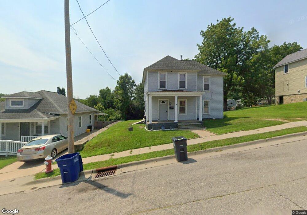
838 Mount Loretta Ave Dubuque, IA 52003
Estimated Value: $138,000 - $209,000
2
Beds
2
Baths
1,344
Sq Ft
$131/Sq Ft
Est. Value
About This Home
This home is located at 838 Mount Loretta Ave, Dubuque, IA 52003 and is currently estimated at $175,997, approximately $130 per square foot. 838 Mount Loretta Ave is a home located in Dubuque County with nearby schools including Bryant Elementary School, George Washington Middle School, and Dubuque Senior High School.
Ownership History
Date
Name
Owned For
Owner Type
Purchase Details
Closed on
Dec 1, 2025
Sold by
Basten Cheryl A and Kintzle Cheryl A
Bought by
Two Of Seven Properties Llc
Current Estimated Value
Home Financials for this Owner
Home Financials are based on the most recent Mortgage that was taken out on this home.
Original Mortgage
$160,000
Outstanding Balance
$159,697
Interest Rate
6.27%
Mortgage Type
Construction
Estimated Equity
$16,300
Purchase Details
Closed on
May 20, 2005
Sold by
Nauman Herman J and Nauman Marjorie M
Bought by
Kintzle Jeffery F and Kintzle Cheryl Ann
Create a Home Valuation Report for This Property
The Home Valuation Report is an in-depth analysis detailing your home's value as well as a comparison with similar homes in the area
Purchase History
| Date | Buyer | Sale Price | Title Company |
|---|---|---|---|
| Two Of Seven Properties Llc | $137,000 | None Listed On Document | |
| Kintzle Jeffery F | $26,000 | None Available |
Source: Public Records
Mortgage History
| Date | Status | Borrower | Loan Amount |
|---|---|---|---|
| Open | Two Of Seven Properties Llc | $160,000 |
Source: Public Records
Tax History
| Year | Tax Paid | Tax Assessment Tax Assessment Total Assessment is a certain percentage of the fair market value that is determined by local assessors to be the total taxable value of land and additions on the property. | Land | Improvement |
|---|---|---|---|---|
| 2025 | $1,874 | $157,700 | $37,000 | $120,700 |
| 2024 | $1,874 | $140,600 | $33,600 | $107,000 |
| 2023 | $1,816 | $140,600 | $33,600 | $107,000 |
| 2022 | $1,882 | $122,710 | $30,240 | $92,470 |
| 2021 | $1,882 | $122,710 | $30,240 | $92,470 |
| 2020 | $1,776 | $108,680 | $26,880 | $81,800 |
| 2019 | $1,796 | $108,680 | $26,880 | $81,800 |
| 2018 | $1,764 | $105,120 | $26,880 | $78,240 |
| 2017 | $1,748 | $105,120 | $26,880 | $78,240 |
| 2016 | $1,722 | $99,050 | $26,880 | $72,170 |
| 2015 | $1,722 | $99,760 | $26,880 | $72,880 |
| 2014 | $1,612 | $96,290 | $26,880 | $69,410 |
Source: Public Records
Map
Nearby Homes
- 1280 S Grandview Ave
- 10 Main St
- 1047 Shady Oaks Dr
- 935 Indian Ridge
- 626 Bradley St
- 966 Victoria St
- 1725 Plymouth Ct
- 0 Jones St Unit SWC of Water St
- 1025 Carmel Dr
- 170 S Hill St
- 189 Saint Marys St
- 890 W 3rd St
- 135 Hill St
- 71 Lois St
- 595 Cooper Place
- 139 Nevada St
- 651 Caledonia Place Unit 653 Caledonia Place
- 1365 Solon St
- 757 Roberts St
- 638 W 8th St
- 846 Mount Loretta Ave
- 830 Mount Loretta Ave
- 820 Mount Loretta Ave
- 843 Mt Loretta Ave
- 866 Mount Loretta Ave
- 843 Mt Loretta
- 843 Mount Loretta Ave
- 847 Mt Loretta Ave
- 847 Mount Loretta Ave
- 841 Tressa St
- 841 Tressa St
- 845 Tressa St
- 874 Mount Loretta Ave
- 490 River Ridge St
- 390 Mississippi View Dr
- 495 River Ridge St
- 395 River Ridge St
- 837 Tressa St
- 375 Mississippi View Dr
- 350 River Ridge St
Your Personal Tour Guide
Ask me questions while you tour the home.