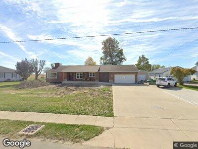
8388 State Route 119 Maria Stein, OH 45860
Estimated Value: $222,083 - $366,000
3
Beds
2
Baths
1,222
Sq Ft
$243/Sq Ft
Est. Value
About This Home
This home is located at 8388 State Route 119, Maria Stein, OH 45860 and is currently estimated at $297,521, approximately $243 per square foot. 8388 State Route 119 is a home located in Mercer County with nearby schools including Marion Local Elementary School and Marion Local High School.
Ownership History
Date
Name
Owned For
Owner Type
Purchase Details
Closed on
Nov 2, 2021
Sold by
Berning David
Bought by
Berning David U and Berning Mona M
Current Estimated Value
Purchase Details
Closed on
Apr 13, 2021
Sold by
Berning Chris and Berning John
Bought by
Berning David
Home Financials for this Owner
Home Financials are based on the most recent Mortgage that was taken out on this home.
Original Mortgage
$75,000
Interest Rate
2.1%
Mortgage Type
New Conventional
Purchase Details
Closed on
Jan 16, 2008
Sold by
Berning Urban L and Berning Lucille M
Bought by
Berning David and Berning Chris
Purchase Details
Closed on
Dec 28, 2007
Sold by
Berning Urban L and Berning Lucille M
Bought by
Berning Urban L and Berning Lucille M
Create a Home Valuation Report for This Property
The Home Valuation Report is an in-depth analysis detailing your home's value as well as a comparison with similar homes in the area
Home Values in the Area
Average Home Value in this Area
Purchase History
| Date | Buyer | Sale Price | Title Company |
|---|---|---|---|
| Berning David U | -- | None Available | |
| Berning David | $100,000 | None Available | |
| Berning David | -- | None Available | |
| Berning Urban L | -- | None Available |
Source: Public Records
Mortgage History
| Date | Status | Borrower | Loan Amount |
|---|---|---|---|
| Open | Berning David U | $60,000 | |
| Previous Owner | Berning David | $75,000 |
Source: Public Records
Tax History Compared to Growth
Tax History
| Year | Tax Paid | Tax Assessment Tax Assessment Total Assessment is a certain percentage of the fair market value that is determined by local assessors to be the total taxable value of land and additions on the property. | Land | Improvement |
|---|---|---|---|---|
| 2024 | $3,140 | $79,660 | $11,410 | $68,250 |
| 2023 | $3,140 | $79,660 | $11,410 | $68,250 |
| 2022 | $2,242 | $53,340 | $6,160 | $47,180 |
| 2021 | $2,278 | $53,340 | $6,160 | $47,180 |
| 2020 | $2,273 | $53,340 | $6,160 | $47,180 |
| 2019 | $2,023 | $45,820 | $5,500 | $40,320 |
| 2018 | $2,074 | $45,820 | $5,500 | $40,320 |
| 2017 | $2,074 | $45,820 | $5,500 | $40,320 |
| 2016 | $2,050 | $45,750 | $5,180 | $40,570 |
| 2015 | $2,006 | $45,750 | $5,180 | $40,570 |
| 2014 | $1,965 | $44,730 | $5,180 | $39,550 |
| 2013 | $2,124 | $43,020 | $5,010 | $38,010 |
Source: Public Records
Map
Nearby Homes
- 8388 State Route 119
- 8400 State Route 119
- 8376 State Route 119
- 8405 State Route 119
- 8371 State Route 119
- 8427 State Route 119
- 8361 State Route 119
- 8351 State Route 119
- 8343 State Route 119
- 8449 State Route 119
- 8329 State Route 119
- 8459 State Route 119
- 8315 State Route 119
- 8473 State Route 119
- 8297 State Route 119
- 2029 Saint Johns Rd
- 2041 Saint Johns Rd
- 2057 Saint Johns Rd
- 1986 Rolfes Rd
- 8265 State Route 119