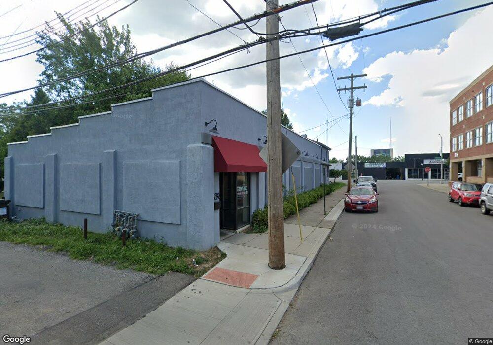
839 W Broad St Columbus, OH 43222
Franklinton Neighborhood
3
Beds
2
Baths
6,359
Sq Ft
7,405
Sq Ft Lot
About This Home
This home is located at 839 W Broad St, Columbus, OH 43222. 839 W Broad St is a home located in Franklin County with nearby schools including Avondale Elementary School, Starling PK-8, and West High School.
Ownership History
Date
Name
Owned For
Owner Type
Purchase Details
Closed on
Jan 22, 2018
Sold by
Mechenbier James A
Bought by
Main Street America Ltd
Home Financials for this Owner
Home Financials are based on the most recent Mortgage that was taken out on this home.
Original Mortgage
$280,205
Outstanding Balance
$236,399
Interest Rate
3.93%
Mortgage Type
Future Advance Clause Open End Mortgage
Purchase Details
Closed on
Apr 11, 1983
Bought by
Mechenbier James A
Create a Home Valuation Report for This Property
The Home Valuation Report is an in-depth analysis detailing your home's value as well as a comparison with similar homes in the area
Home Values in the Area
Average Home Value in this Area
Purchase History
| Date | Buyer | Sale Price | Title Company |
|---|---|---|---|
| Main Street America Ltd | $280,000 | Chicago Title | |
| Mechenbier James A | -- | -- |
Source: Public Records
Mortgage History
| Date | Status | Borrower | Loan Amount |
|---|---|---|---|
| Open | Main Street America Ltd | $280,205 |
Source: Public Records
Tax History Compared to Growth
Tax History
| Year | Tax Paid | Tax Assessment Tax Assessment Total Assessment is a certain percentage of the fair market value that is determined by local assessors to be the total taxable value of land and additions on the property. | Land | Improvement |
|---|---|---|---|---|
| 2024 | $10,001 | $126,490 | $20,370 | $106,120 |
| 2023 | $9,923 | $126,490 | $20,370 | $106,120 |
| 2022 | $7,805 | $98,000 | $22,400 | $75,600 |
| 2021 | $9,852 | $123,200 | $22,400 | $100,800 |
| 2020 | $9,736 | $123,200 | $22,400 | $100,800 |
| 2019 | $9,224 | $112,000 | $20,370 | $91,630 |
| 2018 | $8,573 | $110,950 | $20,370 | $90,580 |
| 2017 | $8,892 | $110,950 | $20,370 | $90,580 |
| 2016 | $8,656 | $99,470 | $20,370 | $79,100 |
| 2015 | $8,037 | $99,470 | $20,370 | $79,100 |
| 2014 | $8,033 | $99,470 | $20,370 | $79,100 |
| 2013 | $3,980 | $99,470 | $20,370 | $79,100 |
Source: Public Records
Map
Nearby Homes
- The Summit Plan at Homes on Hartford - Single Family
- 45 S Hartford Ave
- 49 S Hartford Ave
- 45 N Hartford Ave
- 33 N Hartford Ave
- 40 N Jones Ave
- 50 Hawkes Ave
- 42 Rodgers Ave
- 69 Rodgers Ave
- 61 Dakota Ave
- 642 W State St
- 34 S Cypress Ave
- 839 W Rich St
- 112 S Cypress Ave
- 763 W Rich St
- 41 S Cypress Ave
- 1073 Cable Ave
- 870-872 Sullivant Ave
- 772 Sullivant Ave Unit 772
- 185 S Cypress Ave
- 847 W Broad St
- 33 S Souder Ave
- 844 W Broad St
- 35 S Souder Ave
- 33 S Hartford Ave
- 866 W Broad St
- 37 S Hartford Ave
- 820 W Broad St
- 891 W Broad St
- 30 Martin Ave
- 30 Martin Ave Unit B
- 34 Martin Ave Columbus
- 34 Martin Ave
- 30 N Hartford Ave
- 36 Martin Ave
- 34 N Hartford Ave
- 894 W Broad St
- 44 Martin Ave
- 40 Martin Ave
- 36 N Hartford Ave