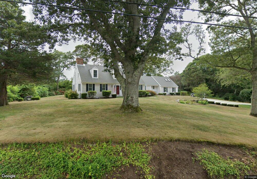
84 Briar Spring Rd Orleans, MA 02653
Estimated Value: $1,161,000 - $1,928,000
3
Beds
4
Baths
3,253
Sq Ft
$520/Sq Ft
Est. Value
About This Home
This home is located at 84 Briar Spring Rd, Orleans, MA 02653 and is currently estimated at $1,691,958, approximately $520 per square foot. 84 Briar Spring Rd is a home located in Barnstable County with nearby schools including Orleans Elementary School, Nauset Regional Middle School, and Nauset Regional High School.
Ownership History
Date
Name
Owned For
Owner Type
Purchase Details
Closed on
May 20, 2005
Sold by
Reuland Geoffrey V and Reuland Mary S
Bought by
Mary S Reuland Ret
Current Estimated Value
Home Financials for this Owner
Home Financials are based on the most recent Mortgage that was taken out on this home.
Original Mortgage
$195,000
Interest Rate
5.56%
Purchase Details
Closed on
Mar 23, 2005
Sold by
Mary S Reuland Ret
Bought by
Reuland Geoffrey and Reuland Mary S
Home Financials for this Owner
Home Financials are based on the most recent Mortgage that was taken out on this home.
Original Mortgage
$195,000
Interest Rate
5.56%
Purchase Details
Closed on
Jul 20, 2004
Sold by
Reuland Geoffrey V and Reuland Mary S
Bought by
Mary S Reuland Rt
Purchase Details
Closed on
Nov 20, 1986
Bought by
Mary S Reuland Ret
Create a Home Valuation Report for This Property
The Home Valuation Report is an in-depth analysis detailing your home's value as well as a comparison with similar homes in the area
Home Values in the Area
Average Home Value in this Area
Purchase History
| Date | Buyer | Sale Price | Title Company |
|---|---|---|---|
| Mary S Reuland Ret | -- | -- | |
| Reuland Geoffrey | -- | -- | |
| Mary S Reuland Rt | -- | -- | |
| Mary S Reuland Ret | -- | -- |
Source: Public Records
Mortgage History
| Date | Status | Borrower | Loan Amount |
|---|---|---|---|
| Previous Owner | Reuland Geoffrey | $195,000 | |
| Previous Owner | Mary S Reuland Rt | $300,000 |
Source: Public Records
Tax History
| Year | Tax Paid | Tax Assessment Tax Assessment Total Assessment is a certain percentage of the fair market value that is determined by local assessors to be the total taxable value of land and additions on the property. | Land | Improvement |
|---|---|---|---|---|
| 2025 | $8,808 | $1,411,600 | $593,700 | $817,900 |
| 2024 | $8,502 | $1,326,300 | $582,000 | $744,300 |
| 2023 | $7,918 | $1,271,000 | $582,700 | $688,300 |
| 2022 | $6,813 | $946,200 | $423,800 | $522,400 |
| 2021 | $6,689 | $853,200 | $417,000 | $436,200 |
| 2020 | $6,476 | $856,600 | $428,900 | $427,700 |
| 2019 | $6,231 | $842,000 | $417,000 | $425,000 |
| 2018 | $5,271 | $795,000 | $409,000 | $386,000 |
| 2017 | $4,894 | $773,200 | $409,000 | $364,200 |
| 2016 | $4,491 | $695,200 | $338,000 | $357,200 |
| 2015 | $4,386 | $683,200 | $331,400 | $351,800 |
Source: Public Records
Map
Nearby Homes
- 80 Briar Spring Rd
- 15 Dale Ann Dr
- 25 Pleasant View Dr
- 63 Briar Spring Rd
- 7 Brick Hill Rd
- 7 Brick Hill Ext Rd
- 43 Old Duck Hole Rd
- 110 Beach Rd
- 22 Nauset Farms Private Way
- 216 Main St
- 64 Pershing Ln
- 63 Kescayogansett Rd
- 19 Monument Rd
- 142 Monument Rd
- 15 Morgan's Way
- 15 Morgans Way
- 44 Tonset Rd
- 7 Lockwood Ln
- 47 Daley Terrace
- 32 Areys Ln
- 19 Dale Ann Dr
- 79 Briar Spring Rd
- 83 Briar Spring Rd
- 21 Dale Ann Dr
- 27 Uncle Harveys Way
- 89 Briar Spring Rd
- 76 Briar Spring Rd
- 25 Dale Ann Dr
- 25 Uncle Harveys Way
- 77 Briar Spring Rd
- 9 Dale Ann Dr
- 20 Dale Ann Dr
- 25 Uncle Harvey's Way
- 7 Dale Ann Dr
- 29 Dale Ann Dr
- 6 Shore View Rd
- 70 Briar Spring Rd
- 6 Fox Ridge Dr
- 96 Briar Spring Rd
- 0 Briar Spring Rd
Your Personal Tour Guide
Ask me questions while you tour the home.