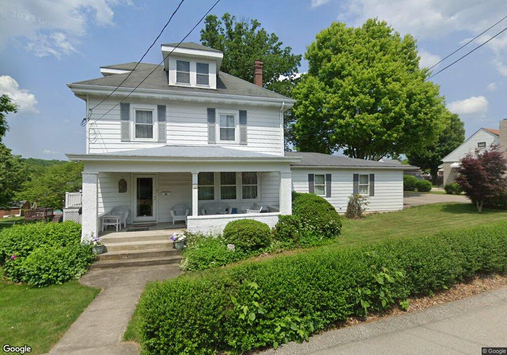
84 Connor St Uniontown, PA 15401
Estimated Value: $237,000 - $298,000
3
Beds
2
Baths
1,792
Sq Ft
$142/Sq Ft
Est. Value
About This Home
This home is located at 84 Connor St, Uniontown, PA 15401 and is currently estimated at $255,292, approximately $142 per square foot. 84 Connor St is a home located in Fayette County with nearby schools including Laurel Highlands Senior High School, St. John the Evangelist School, and Chestnut Ridge Christian Academy.
Ownership History
Date
Name
Owned For
Owner Type
Purchase Details
Closed on
May 4, 2022
Sold by
Prante Amy E
Bought by
Cook Nicholas J
Current Estimated Value
Purchase Details
Closed on
Mar 1, 2022
Sold by
Cook Nicholas J and Cook Susan M
Bought by
Frante Amy E
Purchase Details
Closed on
Jan 1, 1968
Bought by
Cook Nicholas J and Cook Susan M
Create a Home Valuation Report for This Property
The Home Valuation Report is an in-depth analysis detailing your home's value as well as a comparison with similar homes in the area
Home Values in the Area
Average Home Value in this Area
Purchase History
| Date | Buyer | Sale Price | Title Company |
|---|---|---|---|
| Cook Nicholas J | -- | None Listed On Document | |
| Frante Amy E | -- | None Listed On Document | |
| Cook Nicholas J | -- | -- |
Source: Public Records
Tax History Compared to Growth
Tax History
| Year | Tax Paid | Tax Assessment Tax Assessment Total Assessment is a certain percentage of the fair market value that is determined by local assessors to be the total taxable value of land and additions on the property. | Land | Improvement |
|---|---|---|---|---|
| 2025 | $1,682 | $58,940 | $11,880 | $47,060 |
| 2024 | $1,634 | $58,940 | $11,880 | $47,060 |
| 2023 | $3,144 | $58,940 | $11,880 | $47,060 |
| 2022 | $3,114 | $58,940 | $11,880 | $47,060 |
| 2021 | $3,028 | $58,940 | $11,880 | $47,060 |
| 2020 | $3,028 | $58,940 | $11,880 | $47,060 |
| 2019 | $2,780 | $58,940 | $11,880 | $47,060 |
| 2018 | $2,696 | $58,940 | $11,880 | $47,060 |
| 2017 | $2,696 | $58,940 | $11,880 | $47,060 |
| 2016 | -- | $58,940 | $11,880 | $47,060 |
| 2015 | -- | $58,940 | $11,880 | $47,060 |
| 2014 | -- | $117,880 | $23,760 | $94,120 |
Source: Public Records
Map
Nearby Homes
- 74 Mullen St
- 58 Mullen St
- 101 Connor St
- 26 Wilmac St
- 50 Vernon St
- 520 Royalty Dr
- 20 Rosemont Dr
- 92 2nd St
- 56 Ruble Dr
- 7 Lydia Dr
- 220 Clarendon Ave
- 102 Easy St
- 71 Lebanon Ave
- 113 Washington Ave
- 348 1st St
- 0 Foreman Ave Derrick Ave Unit 1730532
- 0 Coal Lick Hollow Rd Unit 1686380
- 158 Clarendon Ave
- 323 Dixon Blvd
- 100 Molly St