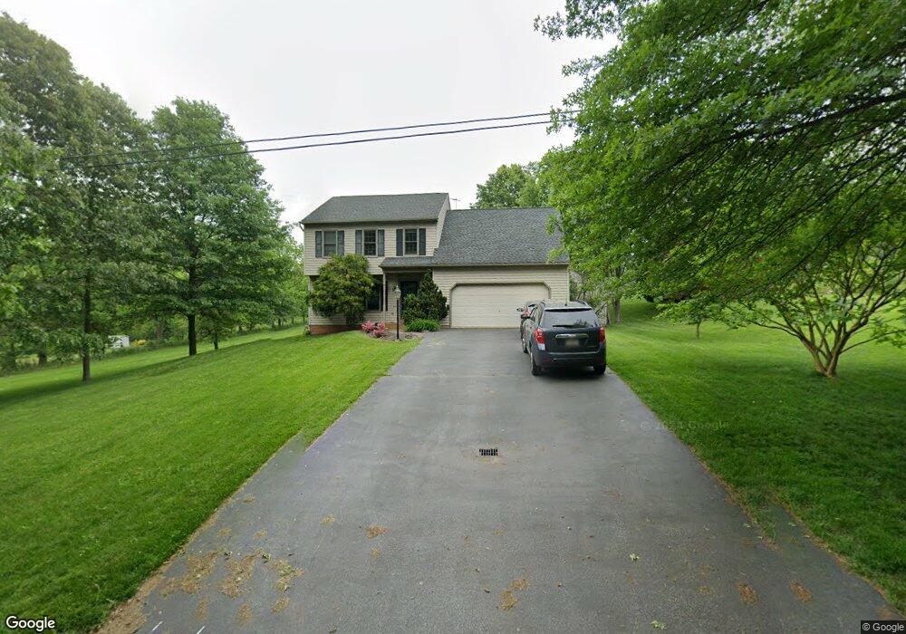
84 Mcdowell Dr Dallastown, PA 17313
Estimated Value: $322,000 - $392,000
4
Beds
3
Baths
1,943
Sq Ft
$187/Sq Ft
Est. Value
About This Home
This home is located at 84 Mcdowell Dr, Dallastown, PA 17313 and is currently estimated at $363,489, approximately $187 per square foot. 84 Mcdowell Dr is a home located in York County with nearby schools including Ore Valley Elementary School, Dallastown Area Middle School, and Dallastown Area High School.
Ownership History
Date
Name
Owned For
Owner Type
Purchase Details
Closed on
Aug 10, 1998
Sold by
Sanger James K and Sanger Lori K
Bought by
Nowak Blair J and Nowak Kristen M
Current Estimated Value
Home Financials for this Owner
Home Financials are based on the most recent Mortgage that was taken out on this home.
Original Mortgage
$152,500
Outstanding Balance
$31,814
Interest Rate
6.92%
Estimated Equity
$331,675
Purchase Details
Closed on
Oct 25, 1990
Bought by
Sanger James K and Sanger Lori K
Create a Home Valuation Report for This Property
The Home Valuation Report is an in-depth analysis detailing your home's value as well as a comparison with similar homes in the area
Home Values in the Area
Average Home Value in this Area
Purchase History
| Date | Buyer | Sale Price | Title Company |
|---|---|---|---|
| Nowak Blair J | $160,550 | -- | |
| Sanger James K | $25,500 | -- |
Source: Public Records
Mortgage History
| Date | Status | Borrower | Loan Amount |
|---|---|---|---|
| Open | Nowak Blair J | $152,500 |
Source: Public Records
Tax History Compared to Growth
Tax History
| Year | Tax Paid | Tax Assessment Tax Assessment Total Assessment is a certain percentage of the fair market value that is determined by local assessors to be the total taxable value of land and additions on the property. | Land | Improvement |
|---|---|---|---|---|
| 2025 | $7,060 | $205,680 | $42,020 | $163,660 |
| 2024 | $6,957 | $205,680 | $42,020 | $163,660 |
| 2023 | $6,957 | $205,680 | $42,020 | $163,660 |
| 2022 | $6,730 | $205,680 | $42,020 | $163,660 |
| 2021 | $6,411 | $205,680 | $42,020 | $163,660 |
| 2020 | $6,411 | $205,680 | $42,020 | $163,660 |
| 2019 | $6,390 | $205,680 | $42,020 | $163,660 |
| 2018 | $6,347 | $205,680 | $42,020 | $163,660 |
| 2017 | $6,094 | $205,680 | $42,020 | $163,660 |
| 2016 | $0 | $205,680 | $42,020 | $163,660 |
| 2015 | -- | $205,680 | $42,020 | $163,660 |
| 2014 | -- | $205,680 | $42,020 | $163,660 |
Source: Public Records
Map
Nearby Homes
- 2981 Sunset Dr
- 55 Belmar Dr
- 195 Coventry Rd
- 680 Hampstead Ct
- 79 S Franklin St
- 263 W Main St
- 53 S Franklin St
- 519 Middleview Dr
- 2960 Starfire Dr
- 0 Lot 15 Gary Dr
- 141 W Water St
- 2723 S Queen St Unit 96
- 18 E Howard St
- 59 E Crestlyn Dr
- 74 S Main St
- 374 Avon Dr Unit 282
- 443 Bradford Dr Unit 183
- 439 Bradford Dr Unit 185
- 437 Bradford Dr Unit 186
- 435 Bradford Dr Unit 187
- 76 Mcdowell Dr
- 100 Mcdowell Dr
- 68 Mcdowell Dr
- 129 Fruitlyn Dr
- 135 Fruitlyn Dr
- 163 Fruitlyn Dr
- 141 Fruitlyn Dr
- 147 Fruitlyn Dr
- 153 Fruitlyn Dr
- 123 Fruitlyn Dr
- 159 Fruitlyn Dr
- 390 Oak Rd
- 150 Mcdowell Dr
- 396 Oak Rd
- 165 Fruitlyn Dr
- 171 Fruitlyn Dr
- 128 Fruitlyn Dr
- 126 Fruitlyn Dr
- 110 Locust Hill Rd
- 124 Fruitlyn Dr