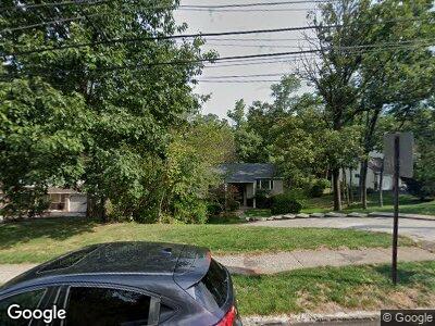
84 Skyline Dr Norristown, PA 19403
Estimated Value: $495,255 - $528,000
4
Beds
3
Baths
2,038
Sq Ft
$254/Sq Ft
Est. Value
About This Home
This home is located at 84 Skyline Dr, Norristown, PA 19403 and is currently estimated at $518,064, approximately $254 per square foot. 84 Skyline Dr is a home located in Montgomery County with nearby schools including Skyview Upper Elementary School, Arrowhead Elementary School, and Arcola Intermediate School.
Ownership History
Date
Name
Owned For
Owner Type
Purchase Details
Closed on
Mar 17, 2003
Sold by
Kirshenbaum Steven L
Bought by
Kirshenbaum Steven L and Marjorie Mogul
Current Estimated Value
Create a Home Valuation Report for This Property
The Home Valuation Report is an in-depth analysis detailing your home's value as well as a comparison with similar homes in the area
Home Values in the Area
Average Home Value in this Area
Purchase History
| Date | Buyer | Sale Price | Title Company |
|---|---|---|---|
| Kirshenbaum Steven L | -- | -- | |
| Kirshenbaum Steven L | -- | -- | |
| Kirshenbaum Steven L | -- | -- |
Source: Public Records
Mortgage History
| Date | Status | Borrower | Loan Amount |
|---|---|---|---|
| Open | Kirshenbaum Steven L | $147,500 | |
| Closed | Kirshenbaum Steven L | $100,183 | |
| Closed | Kirshernbaum Steven L | $158,644 | |
| Closed | Kirshernbaum Steven L | $93,480 | |
| Closed | Not Provided | $0 | |
| Closed | Kirshenbaum Steven L | $100,000 |
Source: Public Records
Tax History Compared to Growth
Tax History
| Year | Tax Paid | Tax Assessment Tax Assessment Total Assessment is a certain percentage of the fair market value that is determined by local assessors to be the total taxable value of land and additions on the property. | Land | Improvement |
|---|---|---|---|---|
| 2024 | $5,979 | $146,600 | $51,520 | $95,080 |
| 2023 | $5,752 | $146,600 | $51,520 | $95,080 |
| 2022 | $5,595 | $146,600 | $51,520 | $95,080 |
| 2021 | $5,451 | $146,600 | $51,520 | $95,080 |
| 2020 | $5,324 | $146,600 | $51,520 | $95,080 |
| 2019 | $5,275 | $146,600 | $51,520 | $95,080 |
| 2018 | $5,274 | $146,600 | $51,520 | $95,080 |
| 2017 | $5,037 | $146,600 | $51,520 | $95,080 |
| 2016 | $4,979 | $146,600 | $51,520 | $95,080 |
| 2015 | $4,856 | $146,600 | $51,520 | $95,080 |
| 2014 | $4,785 | $146,600 | $51,520 | $95,080 |
Source: Public Records
Map
Nearby Homes
- 2508 Condor Dr
- 1601 Broadwing Ct
- 14 Featherbed Ln
- 8 Featherbed Ln
- Laney Craftsman
- 143 Tyson Mill Rd
- 19 Casselberry Dr
- 79 Hunt Club Dr
- 217 Von Steuben Dr
- 712 Mourning Dove Rd
- 9 Culp Rd
- 2790 Egypt Rd
- 315 Minuteman Dr
- 1022 Sparrow Rd
- 715 Raynham Rd
- 1229 Egypt Rd
- 3604 Arcola Rd
- 13 Dorchester Rd
- 1202 Egypt Rd
- 2751 Lantern Ln
