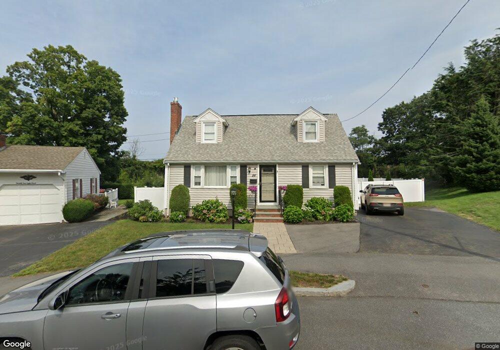
84 Unity St Quincy, MA 02169
Estimated Value: $721,646 - $805,000
3
Beds
2
Baths
1,622
Sq Ft
$472/Sq Ft
Est. Value
About This Home
This home is located at 84 Unity St, Quincy, MA 02169 and is currently estimated at $764,912, approximately $471 per square foot. 84 Unity St is a home located in Norfolk County with nearby schools including Montclair Elementary School, Atlantic Middle School, and North Quincy High School.
Ownership History
Date
Name
Owned For
Owner Type
Purchase Details
Closed on
Nov 24, 1993
Sold by
Yee Gene Y and Yee Monna B
Bought by
Deluca Joseph P
Current Estimated Value
Home Financials for this Owner
Home Financials are based on the most recent Mortgage that was taken out on this home.
Original Mortgage
$132,000
Interest Rate
6.72%
Mortgage Type
Purchase Money Mortgage
Purchase Details
Closed on
Jul 21, 1988
Sold by
Bartosiak Michael
Bought by
Yee Gene Y
Home Financials for this Owner
Home Financials are based on the most recent Mortgage that was taken out on this home.
Original Mortgage
$245,000
Interest Rate
10.49%
Mortgage Type
Purchase Money Mortgage
Create a Home Valuation Report for This Property
The Home Valuation Report is an in-depth analysis detailing your home's value as well as a comparison with similar homes in the area
Purchase History
| Date | Buyer | Sale Price | Title Company |
|---|---|---|---|
| Deluca Joseph P | $165,000 | -- | |
| Yee Gene Y | $180,000 | -- |
Source: Public Records
Mortgage History
| Date | Status | Borrower | Loan Amount |
|---|---|---|---|
| Closed | Yee Gene Y | $132,000 | |
| Previous Owner | Yee Gene Y | $154,400 | |
| Previous Owner | Yee Gene Y | $245,000 |
Source: Public Records
Tax History
| Year | Tax Paid | Tax Assessment Tax Assessment Total Assessment is a certain percentage of the fair market value that is determined by local assessors to be the total taxable value of land and additions on the property. | Land | Improvement |
|---|---|---|---|---|
| 2025 | $7,172 | $622,000 | $310,200 | $311,800 |
| 2024 | $6,814 | $604,600 | $295,500 | $309,100 |
| 2023 | $6,349 | $570,400 | $281,400 | $289,000 |
| 2022 | $6,062 | $506,000 | $225,100 | $280,900 |
| 2021 | $6,017 | $495,600 | $225,100 | $270,500 |
| 2020 | $6,103 | $491,000 | $225,100 | $265,900 |
| 2019 | $5,668 | $451,600 | $218,500 | $233,100 |
| 2018 | $5,688 | $426,400 | $202,400 | $224,000 |
| 2017 | $5,576 | $393,500 | $192,700 | $200,800 |
| 2016 | $5,198 | $362,000 | $175,200 | $186,800 |
| 2015 | $4,919 | $336,900 | $165,300 | $171,600 |
| 2014 | $4,623 | $311,100 | $165,300 | $145,800 |
Source: Public Records
Map
Nearby Homes
- 580 Quarry St Unit 13
- 41 Wallace Rd
- 230 Willard St Unit 102
- 230 Willard St Unit 207
- 440 Granite Ave Unit 201
- 475 Beale St
- 17 Bunton St
- 149 Reservoir Rd
- 46 Century Ln
- 1185 Brook Rd
- 0 Franklin St
- 39 Cross St
- 17 Albany St
- 40 Cross St Unit 1
- 281 Elmwood Ave
- 30 Elmwood Park
- 211 Copeland St
- 169 Pine St
- 52 Hurlcroft Rd
- 510 Willard St
Your Personal Tour Guide
Ask me questions while you tour the home.