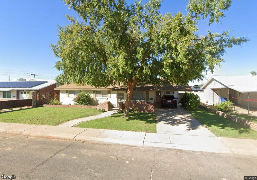
840 W 10th St Tempe, AZ 85281
Mitchell Park West NeighborhoodEstimated Value: $392,050 - $502,000
--
Bed
2
Baths
1,260
Sq Ft
$364/Sq Ft
Est. Value
About This Home
This home is located at 840 W 10th St, Tempe, AZ 85281 and is currently estimated at $459,013, approximately $364 per square foot. 840 W 10th St is a home located in Maricopa County with nearby schools including Geneva Epps Mosley Middle School, Tempe High School, and New School for the Arts & Academics.
Ownership History
Date
Name
Owned For
Owner Type
Purchase Details
Closed on
Feb 14, 2012
Sold by
Baxley Ronald Phillip and Baxley Charlotte E
Bought by
Baxley Ronald Phillip and Baxley Charlotte L
Current Estimated Value
Purchase Details
Closed on
Apr 27, 1998
Sold by
Baxley Ronald Phillip and Baxley Charlotte L
Bought by
Baxley Ronald Phillip and Baxley Charlotte L
Home Financials for this Owner
Home Financials are based on the most recent Mortgage that was taken out on this home.
Original Mortgage
$28,828
Interest Rate
7.06%
Create a Home Valuation Report for This Property
The Home Valuation Report is an in-depth analysis detailing your home's value as well as a comparison with similar homes in the area
Home Values in the Area
Average Home Value in this Area
Purchase History
| Date | Buyer | Sale Price | Title Company |
|---|---|---|---|
| Baxley Ronald Phillip | -- | None Available | |
| Baxley Ronald Phillip | -- | Security Title Agency |
Source: Public Records
Mortgage History
| Date | Status | Borrower | Loan Amount |
|---|---|---|---|
| Closed | Baxley Ronald Phillip | $28,828 |
Source: Public Records
Tax History Compared to Growth
Tax History
| Year | Tax Paid | Tax Assessment Tax Assessment Total Assessment is a certain percentage of the fair market value that is determined by local assessors to be the total taxable value of land and additions on the property. | Land | Improvement |
|---|---|---|---|---|
| 2025 | $1,858 | $17,822 | -- | -- |
| 2024 | $1,705 | $16,973 | -- | -- |
| 2023 | $1,705 | $35,230 | $7,040 | $28,190 |
| 2022 | $1,628 | $26,060 | $5,210 | $20,850 |
| 2021 | $1,660 | $24,200 | $4,840 | $19,360 |
| 2020 | $1,605 | $21,660 | $4,330 | $17,330 |
| 2019 | $1,574 | $20,020 | $4,000 | $16,020 |
| 2018 | $1,532 | $17,720 | $3,540 | $14,180 |
| 2017 | $1,484 | $16,260 | $3,250 | $13,010 |
| 2016 | $1,477 | $14,800 | $2,960 | $11,840 |
| 2015 | $1,429 | $13,310 | $2,660 | $10,650 |
Source: Public Records
Map
Nearby Homes
- 620 W Howe St
- 700 W University Dr Unit 122
- 700 W University Dr Unit 253
- 522 W Howe St
- 1111 W University Dr Unit 3012
- 1111 W University Dr Unit 2026
- 538 W 13th St
- 538 W 13th St Unit A
- 919 W Parkway Blvd
- 531 W 14th St
- 626 S Wilson St
- 754 S Beck Ave
- 901 W 16th St
- 734 S Beck Ave
- 1101 S Farmer Ave
- 1061 W 5th St Unit 3
- 1310 W Romo Jones St
- 702 S Beck Ave
- 1218 S Farmer Ave
- 1323 W 10th Place
- 834 W 10th St
- 846 W 10th St
- 837 W Elna Rae St
- 828 W 10th St
- 852 W 10th St
- 829 W Elna Rae St
- 843 W Elna Rae St
- 841 W 10th St
- 835 W 10th St
- 847 W 10th St
- 825 W Elna Rae St
- 849 W Elna Rae St
- 829 W 10th St
- 822 W 10th St
- 853 W 10th St
- 819 W Elna Rae St
- 823 W 10th St
- 816 W 10th St
- 836 W Elna Rae St
- 1001 W 10th St