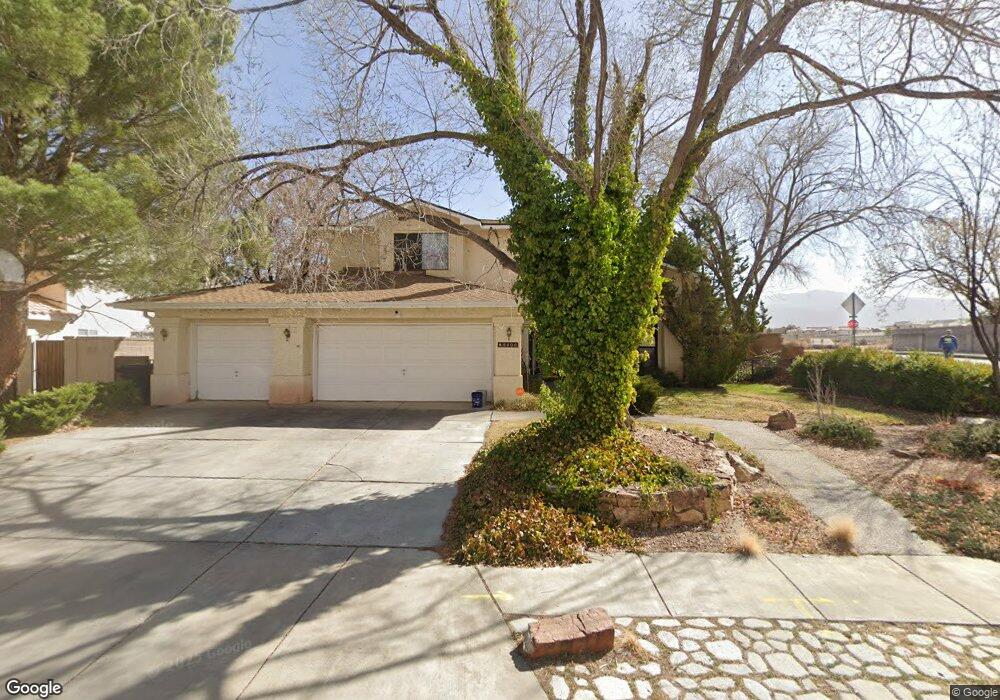
8400 Joseph Sharp St NE Albuquerque, NM 87122
Albuquerque Acres West NeighborhoodEstimated Value: $586,000 - $657,000
4
Beds
3
Baths
2,600
Sq Ft
$239/Sq Ft
Est. Value
About This Home
This home is located at 8400 Joseph Sharp St NE, Albuquerque, NM 87122 and is currently estimated at $622,453, approximately $239 per square foot. 8400 Joseph Sharp St NE is a home located in Bernalillo County with nearby schools including Dennis Chavez Elementary School, Desert Ridge Middle School, and La Cueva High School.
Ownership History
Date
Name
Owned For
Owner Type
Purchase Details
Closed on
Jun 22, 2004
Sold by
Mahn Jeffrey A and Mahn Eileen A
Bought by
Thornton Kyle L and Thornton Carol B
Current Estimated Value
Home Financials for this Owner
Home Financials are based on the most recent Mortgage that was taken out on this home.
Original Mortgage
$232,000
Outstanding Balance
$115,837
Interest Rate
6.32%
Mortgage Type
Purchase Money Mortgage
Estimated Equity
$506,616
Create a Home Valuation Report for This Property
The Home Valuation Report is an in-depth analysis detailing your home's value as well as a comparison with similar homes in the area
Home Values in the Area
Average Home Value in this Area
Purchase History
| Date | Buyer | Sale Price | Title Company |
|---|---|---|---|
| Thornton Kyle L | -- | First American Title Ins Co |
Source: Public Records
Mortgage History
| Date | Status | Borrower | Loan Amount |
|---|---|---|---|
| Open | Thornton Kyle L | $232,000 | |
| Closed | Thornton Kyle L | $58,000 |
Source: Public Records
Tax History Compared to Growth
Tax History
| Year | Tax Paid | Tax Assessment Tax Assessment Total Assessment is a certain percentage of the fair market value that is determined by local assessors to be the total taxable value of land and additions on the property. | Land | Improvement |
|---|---|---|---|---|
| 2024 | $5,158 | $124,247 | $33,106 | $91,141 |
| 2023 | $5,069 | $120,628 | $32,142 | $88,486 |
| 2022 | $4,896 | $117,115 | $31,206 | $85,909 |
| 2021 | $4,729 | $113,704 | $30,297 | $83,407 |
| 2020 | $4,649 | $110,393 | $29,415 | $80,978 |
| 2019 | $4,510 | $107,178 | $28,558 | $78,620 |
| 2018 | $4,347 | $107,178 | $28,558 | $78,620 |
| 2017 | $4,211 | $104,057 | $27,727 | $76,330 |
| 2016 | $4,088 | $98,083 | $26,135 | $71,948 |
| 2015 | $95,227 | $95,227 | $25,374 | $69,853 |
| 2014 | $3,841 | $92,455 | $24,636 | $67,819 |
| 2013 | -- | $89,761 | $23,918 | $65,843 |
Source: Public Records
Map
Nearby Homes
- 8200 Corona Ave NE
- 8401 S Sandoval St NE
- 8719 Desert Fox Way NE
- 8424 Gordon Snidow Ct NE
- 8615 Tierra Alegre Dr NE
- 8705 Tierra Alegre Dr NE
- 8504 Sonoma Valley Dr NE
- 8708 Ashton Place NE
- 8219 Signal Ave NE
- 8819 Greenarbor Rd NE
- 11250 Corona Ave NE
- 8509 Alameda Blvd NE
- 8927 Desert Fox Way NE
- 11620 Wilshire Ave NE
- 7901 William Moyers Ave NE
- 8718 Liberty Dr NE
- 7809 Oakland Ave NE
- 8214 Krim Dr NE
- 9124 Signal Ave NE
- 8300 Visalia Way NE
- 0 Anaheim Ave NE Unit 85170
- 0 Anaheim Ave NE Unit 161448
- 0 Anaheim Ave NE Unit 221465
- 0 Anaheim Ave NE Unit 204017
- 0 Anaheim Ave NE Unit 150302
- 0 Anaheim Ave NE Unit 432301
- 0 Anaheim Ave NE Unit 432303
- 0 Anaheim Ave NE Unit 207536
- 0 Anaheim Ave NE Unit 17205
- 0 Anaheim Ave NE Unit 51606
- 0 Anaheim Ave NE Unit 14941
- 0 Anaheim Ave NE Unit 79078
- 0 Anaheim Ave NE Unit 131093
- 0 Anaheim Ave NE Unit 34880
- 0 Anaheim Ave NE Unit 1014057
- 0 Anaheim Ave NE Unit 976724
- 0 Anaheim Ave NE Unit 650009
- 0 Anaheim Ave NE Unit 711676
- 0 Anaheim Ave NE Unit 729389